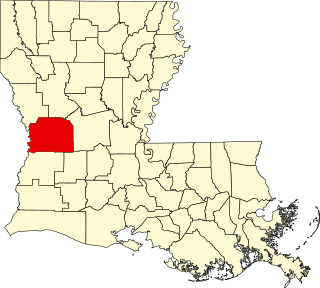
Vernon Parish is a parish located in the U.S. state of Louisiana. As of the 2020 census, the population was 48,750. The parish seat is Leesville. Bordered on the west by the Sabine River, the parish was founded in 1871 during the Reconstruction era.

Sabine Parish is a parish located in the U.S. state of Louisiana. As of the 2020 census, the population was 22,155. The seat of the parish is Many.

Rapides Parish is a parish located in the U.S. state of Louisiana. As of the 2020 census, the population was 130,023. The parish seat is Alexandria, which developed along the Red River of the South. Rapides is the French word for "rapids". The parish was created in 1807 after the United States acquired this territory in the Louisiana Purchase.

Beauregard Parish is a parish located in the U.S. state of Louisiana. As of the 2020 census, the population was 36,549. The parish seat is DeRidder. The parish was formed on January 1, 1913.

Allen Parish is a parish located in the U.S. state of Louisiana. As of the 2020 census, the population was 22,750. The parish seat is Oberlin and the largest city is Oakdale. Allen Parish is in southwestern Louisiana, southwest of Alexandria.

Hornbeck is a town in Vernon Parish, Louisiana, United States. The population was 480 at the 2010 census, up from 435 in 2000. It is part of the Fort Polk South Micropolitan Statistical Area.

Leesville is a city in, and the parish seat of, Vernon Parish, Louisiana, United States. The population was 5,649 at the 2020 census. It is part of the Fort Polk South micropolitan area and is additionally served by the Leesville Airport. The city is home to the Fort Johnson U.S. Army installation.

DeRidder is a city in, and the parish seat of, Beauregard Parish, Louisiana, United States. A small portion of the city extends into Vernon Parish. As of the 2010 census DeRidder had a population of 10,578. It is the smaller principal city of the Fort Polk South-DeRidder CSA, a Combined Statistical Area that includes the Fort Polk South and DeRidder micropolitan areas, which had a combined population of 87,988 at the 2010 census.

Kisatchie National Forest, the only National forest in Louisiana, United States, is located in the forested piney hills and hardwood bottoms of seven central and northern parishes. It is part of the Cenozoic uplands and has large areas of longleaf pine forests. It is one of the largest pieces of natural landscape in Louisiana, with some 604,000 acres (2,440 km2) of public land, more than half of which is vital longleaf pine and flatwoods vegetation. These support many rare plant and animal species. There are also rare habitats, such as hillside seepage bogs and calcareous prairies. The forest also contains and provides a buffer for the Kisatchie Hills Wilderness, a nationally designated wilderness area that contributes to protecting biodiversity of the coastal plain region of the United States.

Louisiana Highway 8 is a state highway in Louisiana. It spans 156 miles (251 km) beginning at the Louisiana/Texas state line west of Leesville and ending at an intersection with U.S. Route 425 and LA 15 in Sicily Island.

Louisiana Highway 28 (LA 28) is a state highway located in central Louisiana. It runs 86.97 miles (139.96 km) in an east–west direction from the junction of U.S. Highway 171 (US 171) and LA 8 in Leesville to US 84 west of Jonesville.

This is a list of the National Register of Historic Places listings in Vernon Parish, Louisiana.

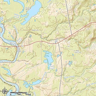
Burr Ferry is an unincorporated community at the junction of LA 8 and LA 111 south, in Vernon Parish, Louisiana, United States. The community is two miles from the site of the old Burr's Ferry on the Sabine River, at the Texas line. The Sabine River, at this location, is the site of two listings on the National Register of Historic Places; Burr's Ferry Bridge, and Burr's Ferry Earthworks.

The 1992 United States presidential election in Louisiana took place on November 3, 1992, as part of the 1992 United States presidential election. Voters chose nine representatives, or electors to the Electoral College, who voted for president and vice president.

Louisiana Highway 111 (LA 111) is a state highway located in western Louisiana. It runs 45.72 miles (73.58 km) in a general north–south direction from U.S. Highway 190 (US 190) in Junction to LA 117 northeast of Leesville.

The 1996 United States presidential election in Louisiana took place on November 5, 1996. Voters chose nine representatives, or electors to the Electoral College, who voted for president and vice president.
The Leesville Daily Leader is a daily newspaper published three days per week in Leesville, Louisiana, United States. It is owned by Boone Newspapers.

Pitkin is a census-designated place (CDP) in Vernon Parish, Louisiana, United States.
Slagle is an unincorporated community in Vernon Parish, Louisiana, United States. Its ZIP code is 71475.
Leander is an unincorporated community in Vernon Parish, Louisiana, United States. Its ZIP code is 71438.


