Related Research Articles

The Northwest Territories is a federal territory of Canada. At a land area of approximately 1,144,000 km2 (442,000 sq mi) and a 2016 census population of 41,786, it is the second-largest and the most populous of the three territories in Northern Canada. Its estimated population as of 2019 is 44,895. Yellowknife became the territorial capital in 1967, following recommendations by the Carrothers Commission.

The Saskatchewan River is a major river in Canada, about 550 kilometres (340 mi) long, flowing roughly eastward across Saskatchewan and Manitoba to empty into Lake Winnipeg. Through its tributaries the North Saskatchewan and South Saskatchewan, its watershed encompasses much of the prairie regions of central Canada, stretching westward to the Rocky Mountains in Alberta and northwestern Montana in the United States. It reaches 1,939 kilometres (1,205 mi) to its farthest headwaters on the Bow River, a tributary of the South Saskatchewan in Alberta.

Lake Athabasca is located in the northwest corner of Saskatchewan and the northeast corner of Alberta between 58° and 60° N. The lake is 26% in Alberta and 74% in Saskatchewan.

The Chipewyan are an aboriginal Dene ethnolinguistic group of the Athabaskan language family, whose ancestors are identified with the Taltheilei Shale archaeological tradition. They are part of the Northern Athabascan group of peoples, and come from what is now Western Canada.

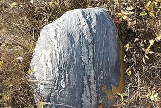
Prospecting is the first stage of the geological analysis of a territory. It is the physical search for minerals, fossils, precious metals or mineral specimens, and is also known as fossicking.

The District of Saskatchewan was a regional administrative district of Canada's Northwest Territories. It was formed in 1882 was later enlarged then abolished with the creation of the provinces of Saskatchewan and Alberta in 1905.

The Athabasca Basin is a region in the Canadian Shield of northern Saskatchewan and Alberta Canada. It is best known as the world's leading source of high-grade uranium and currently supplies about 20% of the world's uranium.
Fort de la Corne was one of the two French forts established on the Saskatchewan River in the 20 years between the end of La Vérendrye's push west from Lake Superior in 1731–1743 and the fall of New France in 1763.

Beaver River is a large river in east-central Alberta and central Saskatchewan, Canada. It flows east through Alberta and Saskatchewan and then turns sharply north to flow into Lac Île-à-la-Crosse on the Churchill River which flows into Hudson Bay. The Alberta part is in the Cold Lake oil sands.

The Fort McKay First Nation (FMFN) is a First Nations government in northeast Alberta comprising five Indian reserves – Fort McKay 174, Fort McKay 174C, Fort McKay 174D, Namur Lake 174B and Namur River 174A. The FMFN, signed to Treaty 8, is affiliated with the Athabasca Tribal Council and its members are of Cree, Metis and Dene heritage. The FMFN's traditional lands include portions of the Athabasca oil sands.
The James Smith First Nation is a Cree First Nation band government whose reserve is in Melfort, Saskatchewan, Canada. James Smith has two reserves, James Smith 100 located north of Kinistino near Fort de la Corne on the Saskatchewan River, and Cumberland 100A. This reserve is shared between three first nations, the other two being the Peter Chapman First Nation and Chakastaypasin First Nation. James Smith has a present population of 2,412, with the on-reserve population estimated to be at 1,592 members. James Smith is part of the Prince Albert Grand Council. Bordering the reserve are the rural municipalities of Kinistino No. 459 and Torch River No. 488.
The geology of Canada is a subject of regional geology and covers the country of Canada, which is the second-largest country in the world. Geologic units and processes are investigated on a large scale to reach a synthesized picture of the geological development of the country.
The Fort à la Corne Provincial Forest is a mixed-wood forest conservation area in Saskatchewan, Canada. It is east of the city of Prince Albert and just north of the James Smith First Nation. The fort takes its name for a historic Hudson's Bay Company post in the area. Recently the area has been subject to diamond exploration by various companies including Shane Resources, United Uranium, and Shore Gold.

Mining is the biggest contributor to Namibia's economy in terms of revenue. It accounts for 25% of the country's income. Its contribution to the gross domestic product is also very important and makes it one of the largest economic sectors of the country. The majority of revenue comes from diamond mining.
The geology of Saskatchewan can be divided into two main geological regions, the Precambrian Canadian Shield and the Phanerozoic Western Canadian Sedimentary Basin. Within the Precambrian shield exists the Athabasca sedimentary basin. Meteorite impacts have altered the natural geological formation processes. The prairies were most recently affected by glacial events in the Quaternary period.
For many years, North America was the largest exporter of uranium ore in the world and has been a major world producer since demand for uranium developed. In 2009 Kazakhstan took over top spot, relegating Canada to second. 20% of the world's primary uranium production came from mines in Canada in 2009. 14.5% of the world production came from one mine, McArthur River. Currently the only producing area in Canada is northern Saskatchewan, although other areas have had active mines in the past.

Ross Stanfield was a self-styled mining promoter based in Calgary, Alberta, Canada. Mr. Stanfield had been active in the industry at least since the mid-1970s.1 In 1964, he and his business partner at the time, John Hilton, optioned property near Williams Lake, British Columbia to a penny stock company called Gibraltar Mines Ltd. Together with senior partner Placer Developments Ltd., Gibraltar Mines Ltd. eventually brought the Gibraltar Mine, a current holding of Taseko Mines Limited and the second largest copper mine in Canada, into production in 1972.2

Saskatchewan River fur trade The Saskatchewan River was one of the two main axes of Canadian expansion west of Lake Winnipeg. The other and more important one was northwest to the Athabasca Country. For background see Canadian canoe routes (early). The main trade route followed the North Saskatchewan River and Saskatchewan River, which were just south of the forested beaver country. The South Saskatchewan River was a prairie river with few furs.
The Beaver Lake Cree Nation is a First Nations band government located 105 kilometres (65 mi) northeast of Edmonton, Alberta, representing people of the Cree ethno-linguistic group in the area around Lac La Biche, Alberta, where the band office is currently located. Their treaty area is Treaty 6. The Intergovernmental Affairs office consults with persons on the Government treaty contacts list. There are two parcels of land reserved for the band by the Canadian Crown, Beaver Lake Indian Reserve No. 131 and Blue Quills First Nation Indian Reserve. The latter reserve is shared by six bands; Beaver Lake Cree Nations, Cold Lake First Nations, Frog Lake First Nation, Heart Lake First Nation, Kehewin Cree Nation, Saddle Lake Cree Nation.
References
- ↑ "Company Profile for Star Uranium Corp (CA;SUV)" . Retrieved 2008-10-16.
| This article about a mining-related corporation or company is a stub. You can help Wikipedia by expanding it. |