Breathitt County is a county located in the eastern Appalachian portion of the U.S. state of Kentucky. As of the 2010 census, the population was 13,878. Its county seat is Jackson, Kentucky. The county was formed in 1839 and was named for John Breathitt, who was Governor of Kentucky from 1832 to 1834. Breathitt County was a prohibition or dry county, until a public vote in July 2016 that allowed alcohol sales.

Barren County is a county located in the U.S. state of Kentucky. As of the 2010 census, the population was 42,173. Its county seat is Glasgow. The county was founded on December 20, 1798, from parts of Warren and Green Counties. It was named for the Barrens, meadow lands that cover the northern third, though actually the soil is fertile.

U.S. Route 45 is a major north–south United States highway and a border-to-border route, from Lake Superior to the Gulf of Mexico. A sign at the highway's northern terminus notes the total distance as 1,300 miles (2,100 km).

U.S. Route 231 is a parallel route of U.S. Route 31. It runs for 912 miles (1,467 km) from St. John, Indiana, at U.S. Route 41 to south of U.S. Route 98 in downtown Panama City, Florida.

The Louisville and Nashville Railroad, commonly called the L&N, was a Class I railroad that operated freight and passenger services in the southeast United States.

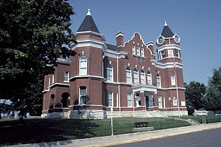
The National Register of Historic Places in the United States is a register including buildings, sites, structures, districts, and objects. The Register automatically includes all National Historic Landmarks as well as all historic areas administered by the U.S. National Park Service. Since its introduction in 1966, more than 90,000 separate listings have been added to the register.

The Kentucky House of Representatives is the lower house of the Kentucky General Assembly. It is composed of 100 Representatives elected from single-member districts throughout the Commonwealth. Not more than two counties can be joined to form a House district, except when necessary to preserve the principle of equal representation. Representatives are elected to two-year terms with no term limits. The Kentucky House of Representatives convenes at the State Capitol in Frankfort.

John LaRue Helm was the 18th and 24th governor of the U.S. Commonwealth of Kentucky, although his service in that office totaled less than fourteen months. He also represented Hardin County in both houses of the Kentucky General Assembly and was chosen to be the Speaker of the Kentucky House of Representatives four times. In 1838 his sole bid for federal office ended in defeat when his opponent, Willis Green, was elected to the U.S. House of Representatives.

Kentucky's 3rd congressional district is a congressional district in the U.S. state of Kentucky. It encompasses almost all of Louisville Metro, which, since the merger of 2003, is consolidated with Jefferson County, though other incorporated cities exist within the county, such as Shively and St. Matthews. The far southeast reaches of Louisville Metro are part of the 4th Congressional District.

Kentucky's 6th congressional district is a congressional district in the U.S. state of Kentucky. Based in Central Kentucky, the district contains the cities of Lexington, Richmond, and Frankfort, the state capital.

Kentucky was a border state of key importance in the American Civil War. President Abraham Lincoln recognized the importance of the Commonwealth when, in a September 1861 letter to Orville Browning, he wrote:
I think to lose Kentucky is nearly the same as to lose the whole game. Kentucky gone, we cannot hold Missouri, nor Maryland. These all against us, and the job on our hands is too large for us. We would as well consent to separation at once, including the surrender of this capitol.
U.S. Route 27 (US 27) in Kentucky runs 190.785 miles (307.039 km) from the Tennessee border to the Ohio border at Cincinnati. It crosses into the state in the Lake Cumberland area, passing near or through many small towns, including Somerset, Stanford, and Nicholasville. The road then passes straight through the heart of Lexington, including past the University of Kentucky (UK) and Transylvania University. North of Lexington it passes through Cynthiana and Falmouth before entering Campbell County and passing through many Northern Kentucky suburbs before ending at the Ohio state line on the Taylor Southgate Bridge in Cincinnati.
U.S. Route 421 (US 421) in the U.S. state of Kentucky is a 250.536-mile-long (403.199 km) north–south United States highway that traverses twelve counties in the central and eastern parts of the state. It travels in a southeast-to-northwest path from the Virginia state line near Pennington Gap to the Indiana state line, on the Ohio River at Milton, Kentucky and Madison, Indiana.

The Dawkins Line Rail Trail is an 18-mile (29.0 km) rail trail in Johnson and Magoffin Counties in Kentucky. The multi-use trail, suitable for biking, walking, and horseback riding, occupies an abandoned rail corridor that was constructed in the early 20th century for the Dawkins Lumber Company. It is the longest rail trail in Kentucky.

The Kentucky–Vanderbilt football rivalry is an American college football rivalry between the Kentucky Wildcats football team of the University of Kentucky and Vanderbilt Commodores football team of Vanderbilt University. The rivalry between these two schools, located about 181 miles (291 km) apart, dates to their first meeting in 1896. They are founding members of the Southeastern Conference (SEC), and are currently members of the SEC's Eastern Division with a total of 91 meetings. This rivalry is Kentucky's second longest behind Tennessee and Vanderbilt's third behind Ole Miss and Tennessee. Kentucky leads the series 45–42–4.