Storm King Dam

Last updated

Map all coordinates using: OpenStreetMap  
Download coordinates as: KML
Storm King Dam
Storm King Dam, 2015 01.JPG
Storm King Dam, 2015
Australia Queensland relief location map.jpg
Red pog.svg
Storm King Dam
Location9 km (5.6 mi) South-East of Stanthorpe, Queensland
Coordinates 28°42′47″S151°59′40″E / 28.7130°S 151.9944°E / -28.7130; 151.9944 (Storm King Dam (reservoir)) Coordinates: 28°42′47″S151°59′40″E / 28.7130°S 151.9944°E / -28.7130; 151.9944 (Storm King Dam (reservoir))
Type reservoir
Primary inflows Quart Pot Creek
Primary outflows Quart Pot Creek
Basin  countriesAustralia
Managing agency Southern Downs Regional Council
Built1954
Water volume2,180 ML (77×10^6 cu ft)

Storm King Dam is a reservoir created by the dam of the same name in the locality of Storm King in the Southern Downs Region, Queensland, Australia. [1] It provides water for the town of Stanthorpe. [2]

Contents

Geography

Storm King Dam was created from Quart Pot Creek which is the only inflow ( 28°44′33″S151°59′32″E / 28.7425°S 151.9923°E / -28.7425; 151.9923 (Storm King Dam (inflow)) ) and outflow of the dam ( 28°42′33″S151°59′35″E / 28.7091°S 151.9931°E / -28.7091; 151.9931 (Storm King Dam (wall and outflow)) ). [3]

History

The dam takes its name from the Storm King Mining Company which was established by John Yaldwyn and James Ross, who built an earlier dam for mining purposes. The company, in turn, took its name from the sailing ship Storm King, on which they migrated to Australia, arriving 9 February 1872. [1]

The present dam was first proposed in 1928 but was not built until 1954 by the Stanthorpe Shire Council. [4] It had filled by February 1954. [5] Following local government area amalgamations in 2008, the dam is currently operated by the Southern Downs Regional Council. It supplies water both to residents of Stanthorpe and to irrigators. [2]

In the 1980s, the Memorial School of Arts was relocated from Amiens to the dam to expand the recreation centre in the youth camp. [6] [7] It opened in Amiens in 1926. [8]

During drought periods, the dam has proved inadequate to meet the needs of the community it serves. In 2007, Storm King Dam was carrying as little as two months supply. [2] In August 2019, the dam was almost dry and plans were being made to bring drinking water to the community by truck. [9] The shire council delivered water by truck from approximately January 2020 to March 2021. Following heavy rain on the eastern seaboard in mid-late March 2021, the dam filled and started to spill. [10]

Amenities

Storm King Dam is available for recreational use, including fishing, water sports, bird watching and picnics. Fish in the dam include Murray cod, yellowbelly and silver perch. The lake attracts many water birds including pelicans. Barbeques and other picnic facilities are available. Boating is permitted on the lake, but motor boats require a permit. [11]

There is a boat ramp and jetty off Eukey Road ( 28°42′55″S151°59′32″E / 28.7154°S 151.9923°E / -28.7154; 151.9923 (Storm King Dam boat ramp) ). It is managed by the Southern Downs Regional Council. [12]

Related Research Articles

Stanthorpe, Queensland Town in Queensland, Australia

Stanthorpe is a rural town and locality in the Southern Downs Region, Queensland, Australia. In the 2016 census, Stanthorpe had a population of 5,406 people.

John Bradfield (engineer) Australian engineer

John Job Crew Bradfield was an Australian engineer best known as the chief proponent of the Sydney Harbour Bridge, of which he oversaw both the design and construction. He worked for the New South Wales Department of Public Works from 1891 to 1933. He was the first recipient of an engineering doctorate from the University of Sydney, in 1924. Other notable projects with which he was associated include the Cataract Dam, the Burrinjuck Dam, and Brisbane's Story Bridge. The Harbour Bridge formed only one component of the City Circle, Bradfield's grand scheme for the railways of central Sydney, a modified version of which was completed after his death. He was also the designer of an unbuilt irrigation project known as the Bradfield Scheme, which proposed that remote areas of western Queensland and north-eastern South Australia could be made fertile by the diversion of rivers from North Queensland.

Wallangarra, Queensland Town in Queensland, Australia

Wallangarra is a rural town and locality in the Southern Downs Region, Queensland, Australia. In the 2016 census the locality of Wallangarra had a population of 468 people.

Darling Downs Region in Queensland, Australia

The Darling Downs is a farming region on the western slopes of the Great Dividing Range in southern Queensland, Australia. The Downs are to the west of South East Queensland and are one of the major regions of Queensland. The name was generally applied to an area approximating to that of the Condamine River catchment upstream of Condamine township but is now applied to a wider region comprising the Southern Downs, Western Downs, Toowoomba and Goondiwindi local authority areas. The name Darling Downs was given in 1827 by Allan Cunningham, the first European explorer to reach the area and recognises the then Governor of New South Wales, Ralph Darling.

Granite Belt Region in Queensland, Australia

The Granite Belt is an area of the Great Dividing Range in the Darling Downs region of Queensland and the New England region of New South Wales, Australia. The Granite Belt is centred on the town of Stanthorpe. The cool, high country of the granite belt is located on Queensland's southern border. It is the northernmost part of the New England Tablelands.

Glenlyon Dam

Glenlyon Dam, also known as Pike Creek Reservoir, is an earth and rockfill dam in Queensland near the border with New South Wales, roughly between Stanthorpe and Texas to the west. In 1976, the dam wall was built on Pike Creek, a tributary of the Dumaresq River, 5 km (3.1 mi) upstream from the confluence of the Mole River and Severn River branching from the Dumaresq.

Southern Downs Region Local government area in Queensland, Australia

The Southern Downs Region is a local government area in the Darling Downs region of Queensland, Australia, along the state's boundary with New South Wales. It was created in 2008 from a merger of the Shire of Warwick and the Shire of Stanthorpe.

Amiens railway line Branch railway line in the Granite Belt region of Queensland, Australia

The Amiens railway line was a branch railway in the Granite Belt region of Queensland, Australia, branching from the Southern Line at Cottonvale between Warwick and Stanthorpe. The Amiens line was the highest in southern Queensland, with the railway reaching an elevation of 946 metres above sea level at Pozieres.

Southern railway line

The Southern railway line serves the Darling Downs region of Queensland, Australia. The 197-kilometre (122 mi) long line branches from the Western line at Toowoomba, 161 kilometres (100 mi) west of Brisbane, and proceeds south through Warwick and Stanthorpe to the New South Wales/Queensland state border at Wallangarra.

Applethorpe, Queensland Town in Queensland, Australia

Applethorpe is a rural town and locality in the Southern Downs Region, Queensland, Australia. In the 2016 census the locality of Applethorpe had a population of 511 people.

Amiens, Queensland Town in Queensland, Australia

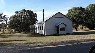
Amiens is a rural locality in the Southern Downs Region, Queensland, Australia. In the 2016 census, Amiens had a population of 293 people.

Ballandean, Queensland Town in Queensland, Australia

Ballandean is a rural town and locality in the Southern Downs Region, Queensland, Australia. In the 2016 census the locality of Ballandean had a population of 338 people.

Dalveen, Queensland Town in Queensland, Australia

Dalveen is a town and a locality in the Southern Downs Region, Queensland, Australia. It borders New South Wales. In the 2016 census, Dalveen had a population of 335 people.

The Summit, Queensland Town in Queensland, Australia

The Summit is a rural town and locality in the Southern Downs Region, Queensland, Australia. In the 2016 census, the locality of The Summit had a population of 409 people.

Eukey Suburb of Southern Downs Region, Queensland, Australia

Eukey is a rural locality in the Southern Downs Region, Queensland, Australia. It is on the border with New South Wales. In the 2016 census Eukey had a population of 134 people.

Severnlea, Queensland Suburb of Southern Downs Region, Queensland, Australia

Severnlea is a locality in the Southern Downs Region, Queensland, Australia. In the 2016 census, Severnlea had a population of 350 people.

Glen Aplin, Queensland Suburb of Southern Downs Region, Queensland, Australia

Glen Aplin is a rural locality in the Southern Downs Region, Queensland, Australia. In the 2016 census, Glen Aplin had a population of 503 people.

Dalcouth, Queensland Suburb of Southern Downs Region, Queensland, Australia

Dalcouth is a locality in the Southern Downs Region, Queensland, Australia. It is on the border with New South Wales. In the 2016 census, Dalcouth had a population of 165 people.

Sugarloaf, Queensland (Southern Downs Region) Suburb of Southern Downs Region, Queensland, Australia

Sugarloaf is a rural locality in the Southern Downs Region, Queensland, Australia. In the 2016 census, Sugarloaf had a population of 113 people.

Stanthorpe–Texas–Inglewood Road is a continuous 152.8 kilometres (94.9 mi) road route in the Southern Downs and Goondiwindi regions of Queensland, Australia. It has two official names, Stanthorpe–Texas Road and Inglewood–Texas Road. The entire route is signed as State Route 89. Tourist Drives 5 (Amiens) and 8 and the Shearer’s Way all start in Stanthorpe and run concurrent with this road for part of its length.

References

  1. 1 2 "Storm King Dam (entry 32613)". Queensland Place Names. Queensland Government . Retrieved 14 June 2015.
  2. 1 2 3 "Granite Belt Water Planning". Southern Downs Regional Council. Archived from the original on 10 June 2015. Retrieved 14 June 2015.
  3. "Queensland Globe". State of Queensland . Retrieved 27 January 2022.
  4. "COUNCIL MEETINGS". The Brisbane Courier . 14 September 1928. p. 11. Retrieved 14 June 2015 via National Library of Australia.
  5. "Dam is full". The Courier-Mail . Brisbane. 23 February 1954. p. 12. Retrieved 14 June 2015 via National Library of Australia.
  6. "Social". Amiens History Association. Archived from the original on 25 January 2022. Retrieved 25 January 2022.
  7. "Amiens Memorial Hall, ca. 1955". State Library of Queensland . Archived from the original on 26 January 2022. Retrieved 26 January 2022.
  8. "AMIENS". The Brisbane Courier . No. 21, 356. Queensland, Australia. 7 July 1926. p. 20. Archived from the original on 26 January 2022. Retrieved 27 January 2022 via National Library of Australia.
  9. Bradfield, Elly (5 August 2019). "Day zero approaches for Stanthorpe as locals face prospect of levy to cover cost of trucked-in water". weatherzone.com.au. Archived from the original on 5 August 2019. Retrieved 26 January 2022.
  10. Bradfield, Elly; Robinson, Lucy; Daly, Jon (25 March 2021). "'Good for the soul': This town trucked in water for 15 months — now the dam is overflowing". ABC News. Archived from the original on 25 March 2021. Retrieved 27 January 2022.
  11. "Storm King Dam". Queensland Government. Archived from the original on 24 September 2015. Retrieved 14 June 2015.
  12. "Recreational Boating Facilities Queensland". Queensland Open Data. Queensland Government. 12 November 2020. Archived from the original on 22 November 2020. Retrieved 22 November 2020.

Commons-logo.svg Media related to Storm King Dam at Wikimedia Commons