Related Research Articles

Rayburn Township is a township that is located in Armstrong County, Pennsylvania, United States. The population was 1,766 at the time of the 2020 census, a decrease from the figure of 1,907 that was tabulated in 2010.

Valley Township is a township that is located in Armstrong County, Pennsylvania, United States. The population was 654 at the time of the 2020 census, a decrease from the figure of 656 that was tabulated in 2010.

The Kiskiminetas River is a tributary of the Allegheny River, approximately 27 miles (43 km) long, in Western Pennsylvania in the United States. The region stretching from the northern side of Harmar Township, Pennsylvania to the Kiskiminetas towns is often referred to by the locals as the Alle-Kiski Valley after the rivers.

The Feather River is the principal tributary of the Sacramento River, in the Sacramento Valley of Northern California. The river's main stem is about 73 miles (117 km) long. Its length to its most distant headwater tributary is just over 210 miles (340 km). The main stem Feather River begins in Lake Oroville, where its four long tributary forks join—the South Fork, Middle Fork, North Fork, and West Branch Feather Rivers. These and other tributaries drain part of the northern Sierra Nevada, and the extreme southern Cascades, as well as a small portion of the Sacramento Valley. The total drainage basin is about 6,200 square miles (16,000 km2), with approximately 3,604 square miles (9,330 km2) above Lake Oroville.

Bishop Creek is a 10.1-mile-long (16.3 km) stream in Inyo County, California. It is the largest tributary of the Owens River. It has five hydroelectric plants owned by Southern California Edison, Bishop Creek #2–6. Bishop Creek #1 was never completed. Parts of the creek run through pipelines, or penstocks, to increase output at the power plants.

Cherry Creek is a large, swift-flowing stream in the Sierra Nevada mountain range, and is the largest tributary of the Tuolumne River. The creek is 40 miles (64 km) long measured to its farthest headwaters; the main stem itself is 26 miles (42 km) long, draining a watershed of 234 square miles (610 km2) in the Stanislaus National Forest. Part of the drainage also extends into the northwest corner of Yosemite National Park.

Redbank Creek is a tributary of the Allegheny River in Clarion, Armstrong, and Jefferson counties, Pennsylvania in the United States.

Mahoning Creek is a tributary of the Allegheny River in Pennsylvania in the United States.
Buffalo Creek is a tributary of the Allegheny River in Armstrong and Butler counties, Pennsylvania in the United States.
North Fork Creek is a tributary of Redbank Creek in northwest Pennsylvania in the United States. It is formed by the confluence of Muddy Run and Williams Run in Polk Township, Jefferson County.
Little Sandy Creek is a tributary of Redbank Creek, approximately 32.7 mi (52.6 km) long, in northwest Pennsylvania in the United States.

Crooked Creek is a tributary of the Allegheny River in both Armstrong and Indiana counties in the U.S. state of Pennsylvania.
Cowanshannock Creek is a tributary of the Allegheny River in Armstrong and Indiana counties, Pennsylvania in the United States.

The Pine River is a 103-mile-long (166 km) river in the Lower Peninsula of the U.S. state of Michigan. The Pine River is a tributary of the Chippewa River and is thus part of the Saginaw River drainage basin.

Arnold Creek is a tributary of Middle Island Creek, 10.9 miles (17.5 km) long, in West Virginia in the United States. Via Middle Island Creek and the Ohio River, it is part of the watershed of the Mississippi River, draining an area of 34.7 square miles (90 km2) in a rural region on the unglaciated portion of the Allegheny Plateau.
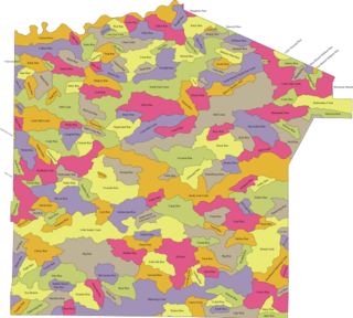
The following table lists all the named streams that flow in Jefferson County. For each stream, the name, coordinate of the source, name of the stream it flows into, coordinate of the confluence, and political subdivision in which the confluence is located are given.
The Tributaries of Redbank Creek drain parts of Jefferson, Clarion, and Armstrong counties, Pennsylvania. The following table lists all the named tributaries of Redbank Creek (Pennsylvania), a tributary of the Allegheny River. For each stream, the name, tributary number, coordinate and political subdivision of the confluence, and coordinate of the source are given.
References
- 1 2 3 4 5 6 7 8 9 10 11 12 13 14 15 16 17 18 19 20 21 22 23 24 25 26 "Allegheny River". Geographic Names Information System . United States Geological Survey, United States Department of the Interior.
- ↑ "Armstrong Run". Geographic Names Information System . United States Geological Survey, United States Department of the Interior.
- ↑ "Beers Run". Geographic Names Information System . United States Geological Survey, United States Department of the Interior.
- 1 2 3 4 5 6 7 8 9 10 11 12 13 14 "Crooked Creek". Geographic Names Information System . United States Geological Survey, United States Department of the Interior.
- ↑ "Big Run". Geographic Names Information System . United States Geological Survey, United States Department of the Interior.
- ↑ "Birch Run". Geographic Names Information System . United States Geological Survey, United States Department of the Interior.
- ↑ "Brady Run". Geographic Names Information System . United States Geological Survey, United States Department of the Interior.
- 1 2 3 4 5 6 7 8 "Kiskiminetas River". Geographic Names Information System . United States Geological Survey, United States Department of the Interior.
- 1 2 3 4 5 6 7 "Buffalo Creek". Geographic Names Information System . United States Geological Survey, United States Department of the Interior.
- ↑ "Bullock Run". Geographic Names Information System . United States Geological Survey, United States Department of the Interior.
- 1 2 "North Fork Pine Creek". Geographic Names Information System . United States Geological Survey, United States Department of the Interior.
- ↑ "Camp Run". Geographic Names Information System . United States Geological Survey, United States Department of the Interior.
- 1 2 3 4 5 6 7 8 9 10 "Mahoning Creek". Geographic Names Information System . United States Geological Survey, United States Department of the Interior.
- ↑ "Campbell Run". Geographic Names Information System . United States Geological Survey, United States Department of the Interior.
- ↑ "Carnahan Run". Geographic Names Information System . United States Geological Survey, United States Department of the Interior.
- ↑ "Cathcart Run". Geographic Names Information System . United States Geological Survey, United States Department of the Interior.
- ↑ "Cave Run". Geographic Names Information System . United States Geological Survey, United States Department of the Interior.
- ↑ "Cessna Run". Geographic Names Information System . United States Geological Survey, United States Department of the Interior.
- 1 2 "South Branch Plum Creek". Geographic Names Information System . United States Geological Survey, United States Department of the Interior.
- 1 2 "Cherry Run". Geographic Names Information System . United States Geological Survey, United States Department of the Interior.
- ↑ "Coal Bank Run". Geographic Names Information System . United States Geological Survey, United States Department of the Interior.
- ↑ "Cornplanter Run". Geographic Names Information System . United States Geological Survey, United States Department of the Interior.
- ↑ "Cove Run". Geographic Names Information System . United States Geological Survey, United States Department of the Interior.
- 1 2 3 4 5 6 7 "Sugar Creek". Geographic Names Information System . United States Geological Survey, United States Department of the Interior.
- 1 2 3 4 5 6 7 8 "Cowanshannock Creek". Geographic Names Information System . United States Geological Survey, United States Department of the Interior.
- ↑ "Craig Run". Geographic Names Information System . United States Geological Survey, United States Department of the Interior.
- ↑ "Craigs Run". Geographic Names Information System . United States Geological Survey, United States Department of the Interior.
- ↑ "Deaver Run". Geographic Names Information System . United States Geological Survey, United States Department of the Interior.
- 1 2 3 4 5 "South Fork Pine Creek". Geographic Names Information System . United States Geological Survey, United States Department of the Interior.
- ↑ "Dutch Run". Geographic Names Information System . United States Geological Survey, United States Department of the Interior.
- 1 2 3 "Plum Creek". Geographic Names Information System . United States Geological Survey, United States Department of the Interior.
- ↑ "Elbow Run". Geographic Names Information System . United States Geological Survey, United States Department of the Interior.
- ↑ "Elder Run". Geographic Names Information System . United States Geological Survey, United States Department of the Interior.
- 1 2 "Fagley Run". Geographic Names Information System . United States Geological Survey, United States Department of the Interior.
- ↑ "Flat Run". Geographic Names Information System . United States Geological Survey, United States Department of the Interior.
- ↑ "Foundry Run". Geographic Names Information System . United States Geological Survey, United States Department of the Interior.
- 1 2 "Garretts Run". Geographic Names Information System . United States Geological Survey, United States Department of the Interior.
- ↑ "Glade Run". Geographic Names Information System . United States Geological Survey, United States Department of the Interior.
- ↑ "Glade Run". Geographic Names Information System . United States Geological Survey, United States Department of the Interior.
- ↑ "Gobblers Run". Geographic Names Information System . United States Geological Survey, United States Department of the Interior.
- ↑ "Guffy Run". Geographic Names Information System . United States Geological Survey, United States Department of the Interior.
- ↑ "Hamilton Run". Geographic Names Information System . United States Geological Survey, United States Department of the Interior.
- ↑ "Hart Run". Geographic Names Information System . United States Geological Survey, United States Department of the Interior.
- ↑ "Hays Run". Geographic Names Information System . United States Geological Survey, United States Department of the Interior.
- ↑ "Hill Run". Geographic Names Information System . United States Geological Survey, United States Department of the Interior.
- ↑ "Holder Run". Geographic Names Information System . United States Geological Survey, United States Department of the Interior.
- ↑ "Horney Camp Run". Geographic Names Information System . United States Geological Survey, United States Department of the Interior.
- ↑ "Huling Run". Geographic Names Information System . United States Geological Survey, United States Department of the Interior.
- ↑ "Huskins Run". Geographic Names Information System . United States Geological Survey, United States Department of the Interior.
- ↑ "Knapp Run". Geographic Names Information System . United States Geological Survey, United States Department of the Interior.
- ↑ "Laurel Run". Geographic Names Information System . United States Geological Survey, United States Department of the Interior.
- ↑ "Limestone Run". Geographic Names Information System . United States Geological Survey, United States Department of the Interior.
- ↑ "Lindsay Run". Geographic Names Information System . United States Geological Survey, United States Department of the Interior.
- ↑ "Little Mudlick Creek". Geographic Names Information System . United States Geological Survey, United States Department of the Interior.
- 1 2 "Little Sandy Creek". Geographic Names Information System . United States Geological Survey, United States Department of the Interior.
- 1 2 "Redbank Creek". Geographic Names Information System . United States Geological Survey, United States Department of the Interior.
- ↑ "Long Run". Geographic Names Information System . United States Geological Survey, United States Department of the Interior.
- ↑ "Long Run". Geographic Names Information System . United States Geological Survey, United States Department of the Interior.
- ↑ "Long Run". Geographic Names Information System . United States Geological Survey, United States Department of the Interior.
- 1 2 "Patterson Creek". Geographic Names Information System . United States Geological Survey, United States Department of the Interior.
- ↑ "Long Run". Geographic Names Information System . United States Geological Survey, United States Department of the Interior.
- ↑ "Long Run". Geographic Names Information System . United States Geological Survey, United States Department of the Interior.
- ↑ "Marrowbone Run". Geographic Names Information System . United States Geological Survey, United States Department of the Interior.
- ↑ "Mast Run". Geographic Names Information System . United States Geological Survey, United States Department of the Interior.
- ↑ "Mill Run". Geographic Names Information System . United States Geological Survey, United States Department of the Interior.
- 1 2 "Mudlick Creek". Geographic Names Information System . United States Geological Survey, United States Department of the Interior.
- 1 2 "Pine Run". Geographic Names Information System . United States Geological Survey, United States Department of the Interior.
- ↑ "Nicholson Run". Geographic Names Information System . United States Geological Survey, United States Department of the Interior.
- ↑ "Nolf Run". Geographic Names Information System . United States Geological Survey, United States Department of the Interior.
- ↑ "North Branch Cherry Run". Geographic Names Information System . United States Geological Survey, United States Department of the Interior.
- ↑ "North Branch Plum Creek". Geographic Names Information System . United States Geological Survey, United States Department of the Interior.
- ↑ "North Branch South Fork Pine Creek". Geographic Names Information System . United States Geological Survey, United States Department of the Interior.
- 1 2 3 "Pine Creek". Geographic Names Information System . United States Geological Survey, United States Department of the Interior.
- ↑ "Nye Branch". Geographic Names Information System . United States Geological Survey, United States Department of the Interior.
- 1 2 "Sugarcamp Run". Geographic Names Information System . United States Geological Survey, United States Department of the Interior.
- ↑ "Pine Run". Geographic Names Information System . United States Geological Survey, United States Department of the Interior.
- ↑ "Pine Run". Geographic Names Information System . United States Geological Survey, United States Department of the Interior.
- ↑ "Pine Run". Geographic Names Information System . United States Geological Survey, United States Department of the Interior.
- ↑ "Rattling Run". Geographic Names Information System . United States Geological Survey, United States Department of the Interior.
- 1 2 "Roaring Run". Geographic Names Information System . United States Geological Survey, United States Department of the Interior.
- ↑ "Rough Run". Geographic Names Information System . United States Geological Survey, United States Department of the Interior.
- ↑ "Rupp Run". Geographic Names Information System . United States Geological Survey, United States Department of the Interior.
- ↑ "Scrubgrass Creek". Geographic Names Information System . United States Geological Survey, United States Department of the Interior.
- ↑ "Sipes Run". Geographic Names Information System . United States Geological Survey, United States Department of the Interior.
- ↑ "Snyders Run". Geographic Names Information System . United States Geological Survey, United States Department of the Interior.
- ↑ "South Branch Cowanshannock Creek". Geographic Names Information System . United States Geological Survey, United States Department of the Interior.
- ↑ "South Branch South Fork Pine Creek". Geographic Names Information System . United States Geological Survey, United States Department of the Interior.
- ↑ "Spra Run". Geographic Names Information System . United States Geological Survey, United States Department of the Interior.
- ↑ "Spruce Run". Geographic Names Information System . United States Geological Survey, United States Department of the Interior.
- ↑ "Spur Run". Geographic Names Information System . United States Geological Survey, United States Department of the Interior.
- 1 2 "Taylor Run". Geographic Names Information System . United States Geological Survey, United States Department of the Interior.
- ↑ "Sugar Run". Geographic Names Information System . United States Geological Survey, United States Department of the Interior.
- ↑ "Tub Mill Run". Geographic Names Information System . United States Geological Survey, United States Department of the Interior.
- ↑ "Watson Run". Geographic Names Information System . United States Geological Survey, United States Department of the Interior.
- ↑ "Whiskey Run". Geographic Names Information System . United States Geological Survey, United States Department of the Interior.
- ↑ "Wiskey Creek". Geographic Names Information System . United States Geological Survey, United States Department of the Interior.