Kiskiminetas Township, Armstrong County, Pennsylvania

Last updated

Kiskiminetas Township, Pennsylvania
Florida Avenue, Orchard Hills.jpg
Florida Avenue in Orchard Hills
Map of Kiskiminetas Township, Armstrong County, Pennsylvania Highlighted.png
Map of Armstrong County, Pennsylvania, highlighting Kiskiminetas Township
Map of Pennsylvania highlighting Armstrong County.svg
Map of Armstrong County, Pennsylvania
Country United States
State Pennsylvania
County Armstrong
Settled1773
Incorporated1831
Area
[1]
  Total41.04 sq mi (106.29 km2)
  Land40.67 sq mi (105.32 km2)
  Water0.38 sq mi (0.97 km2)
Population
 (2020)
  Total4,604
  Estimate 
(2021) [2]
4,583
  Density113.04/sq mi (43.65/km2)
Time zone UTC-5 (Eastern (EST))
  Summer (DST) UTC-4 (EDT)
FIPS code42-005-39968

Kiskiminetas Township is a township in Armstrong County, Pennsylvania, United States. The population was 4,604 at the 2020 census, [2] a decrease from the figure of 4,800 tabulated in 2010, [3] making it the most populous township or borough in the county. [4]

Contents

Kiskiminetas is derived from a Native American language meaning "make daylight". [5]

Geography

The township is located at the southern tip of Armstrong County, bounded to the southwest by the Kiskiminetas River, a tributary of the Allegheny River. It is bordered by the boroughs of Apollo and North Apollo to the west and the village of Spring Church to the east.

The Roaring Run hiking trail lies within the boundaries of the township, adjacent to the Kiskiminetas River and what was once the Main Line Canal. [6] [7]

According to the United States Census Bureau, the township has a total area of 41.0 square miles (106.3 km2), of which 40.7 square miles (105.3 km2) is land and 0.35 square miles (0.9 km2), or 0.89%, is water. [3]

Demographics

Historical population
CensusPop.Note
2010 4,800
2020 4,604−4.1%
2021 (est.)4,583 [2] −0.5%
U.S. Decennial Census [8]

As of the 2000 census, [9] there were 4,950 people, 1,931 households, and 1,457 families residing in the township. The population density was 121.5 inhabitants per square mile (46.9/km2). There were 2,074 housing units at an average density of 50.9 per square mile (19.7/km2). The racial makeup of the township was 98.28% White, 0.48% African American, 0.12% Native American, 0.22% Asian, 0.28% from other races, and 0.61% from two or more races. Hispanic or Latino of any race were 0.51% of the population.

There were 1,931 households, out of which 30.8% had children under the age of 18 living with them, 64.0% were married couples living together, 7.8% had a female householder with no husband present, and 24.5% were non-families. 20.9% of all households were made up of individuals, and 10.1% had someone living alone who was 65 years of age or older. The average household size was 2.55, and the average family size was 2.95.

The township median age of 40 years was the same as the county median age of 40 years. The distribution by age group was 23.0% under the age of 18, 6.9% from 18 to 24, 28.6% from 25 to 44, 26.0% from 45 to 64, and 15.5% who were 65 years of age or older. The median age was 40 years. For every 100 females, there were 96.7 males. For every 100 females age 18 and over, there were 96.1 males.

The median income for a household in the township was $38,487, and the median income for a family was $44,000. Males had a median income of $35,136 versus $23,529 for females. The per capita income was $16,291. About 13.4% of families and 14.9% of the population were below the poverty line, including 20.5% of those under age 18 and 7.7% of those age 65 or over.

History

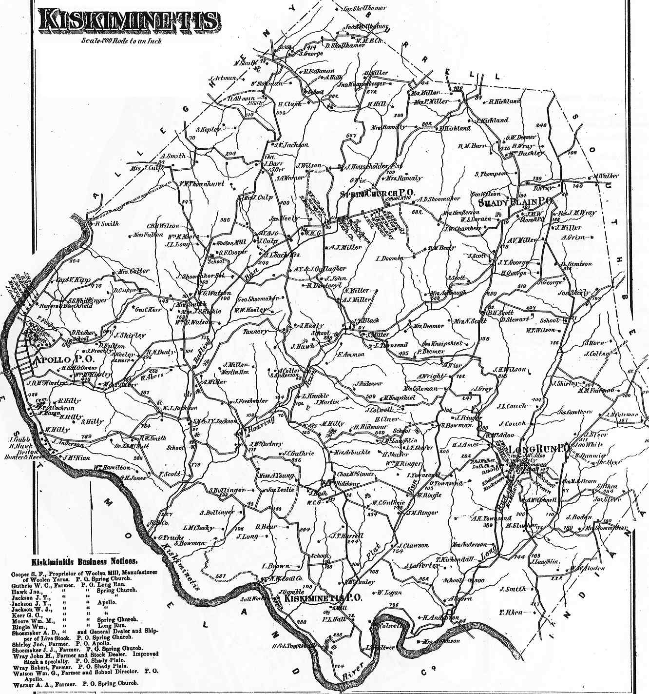
Kiskiminetis Township appears in the 1876 Atlas of Armstrong County, Pennsylvania. [10] Its early history is detailed in Robert Walter Smith's 1883 History of Armstrong County. [11]

Coal mines were once located in the township, including a mine operated by the Leechburg Mining Co. which ceased operations at some time prior to 1977. [12]

Cemeteries

Related Research Articles

<span class="mw-page-title-main">Apollo, Pennsylvania</span> Borough in Pennsylvania, United States

Apollo is a borough in Armstrong County, Pennsylvania, United States, 35 miles (56 km) northeast of Pittsburgh in a former coal-mining region. Apollo was settled in 1790, laid out in 1816, and incorporated as a borough in 1848. The population was 1,615 at the 2020 United States Census

<span class="mw-page-title-main">Bethel Township, Armstrong County, Pennsylvania</span> Township in Pennsylvania, United States

Bethel Township is a township in Armstrong County, Pennsylvania, United States. The population was 1,096 at the 2020 census, a decrease from the figure of 1,183 tabulated in 2010.

<span class="mw-page-title-main">Burrell Township, Armstrong County, Pennsylvania</span> Township in Pennsylvania, United States

Burrell Township is a township in Armstrong County, Pennsylvania, United States, and is part of the Pittsburgh metropolitan area. The population was 659 at the 2020 census, a decrease from the figure of 689 tabulated in 2010.

<span class="mw-page-title-main">Cowanshannock Township, Armstrong County, Pennsylvania</span> Township in Pennsylvania, United States

Cowanshannock Township is a township in Armstrong County, Pennsylvania, United States. The population was 2,742 at the 2020 census, a decrease from the figure of 2,899 tabulated in 2010.

<span class="mw-page-title-main">East Franklin Township, Armstrong County, Pennsylvania</span> Township in Pennsylvania, United States

East Franklin Township is a township in Armstrong County, Pennsylvania, United States. The population was 3,821 at the 2020 census, a decrease from the figure of 4,082 tabulated in 2010.

<span class="mw-page-title-main">Gilpin Township, Armstrong County, Pennsylvania</span> Township in Pennsylvania, United States

Gilpin Township is a Second class Township in Armstrong County, Pennsylvania, United States. At the 2010 census it had a population of 2,496. As of the 2020 census, its population had decreased to 2,411, a 3.4% decrease.

<span class="mw-page-title-main">Kittanning Township, Armstrong County, Pennsylvania</span> Township in Pennsylvania, United States

Kittanning Township is a township in Armstrong County, Pennsylvania, United States. The population was 2,019 at the 2020 census, a decrease from the figure of 2,265 tabulated in 2010.

<span class="mw-page-title-main">Madison Township, Armstrong County, Pennsylvania</span> Township in Pennsylvania, United States

Madison Township is a township in Armstrong County, Pennsylvania, United States. The population was 826 at the 2020 census, an increase over the figure of 820 tabulated in 2010.

<span class="mw-page-title-main">Mahoning Township, Armstrong County, Pennsylvania</span> Township in Pennsylvania, United States

Mahoning Township is a township in Armstrong County, Pennsylvania, United States. The population was 1,406 at the 2020 census, a decrease from 1,425 at the 2010 census.

<span class="mw-page-title-main">Manor Township, Armstrong County, Pennsylvania</span> Township in Pennsylvania, United States

Manor Township is a township in Armstrong County, Pennsylvania, United States. The population was 4,190 at the 2020 census, a decrease from the figure of 4,227 tabulated in 2010.

<span class="mw-page-title-main">North Buffalo Township, Armstrong County, Pennsylvania</span> Township in Pennsylvania, United States

North Buffalo Township is a township in Armstrong County, Pennsylvania, United States. The population was 2,698 at the 2020 census, a decrease from the figure of 3,011 tabulated in 2010.

<span class="mw-page-title-main">Parks Township, Armstrong County, Pennsylvania</span> Township in Pennsylvania, United States

Parks Township is a township in Armstrong County in the U.S. state of Pennsylvania. The population was 2,471 at the 2020 census, a decrease from 2,744 at the 2010 census.

<span class="mw-page-title-main">Plumcreek Township, Armstrong County, Pennsylvania</span> Township in Pennsylvania, United States

Plumcreek Township is a township that is located in Armstrong County, Pennsylvania, United States. The population was 2,106 at the time of the 2020 census, a decrease from the figure of 2,375 that was tabulated in 2010.

<span class="mw-page-title-main">Rayburn Township, Armstrong County, Pennsylvania</span> Township in Pennsylvania, United States

Rayburn Township is a township that is located in Armstrong County, Pennsylvania, United States. The population was 1,766 at the time of the 2020 census, a decrease from the figure of 1,907 that was tabulated in 2010.

<span class="mw-page-title-main">Redbank Township, Armstrong County, Pennsylvania</span> Township in Pennsylvania, United States

Redbank Township is a township in Armstrong County, Pennsylvania, United States. The population was 975 at the 2020 census, a decrease from the figure of 1,064 tabulated in 2010.

<span class="mw-page-title-main">South Buffalo Township, Armstrong County, Pennsylvania</span> Township in Pennsylvania, United States

South Buffalo Township is a township in Armstrong County, Pennsylvania, United States. The population was 2,713 at the 2020 census, an increase from the figure of 2,636 tabulated in 2010.

<span class="mw-page-title-main">Sugarcreek Township, Armstrong County, Pennsylvania</span> Township in Pennsylvania, United States

Sugarcreek Township is a township in Armstrong County, Pennsylvania, United States. The population was 1,336 at the 2020 census, a decrease from the figure of 1,539 tabulated in 2010.

<span class="mw-page-title-main">Washington Township, Armstrong County, Pennsylvania</span> Township in Pennsylvania, United States

Washington Township is a township in Armstrong County, Pennsylvania, United States. The population was 898 at the 2020 census, a decrease from 923 at the 2010 census.

<span class="mw-page-title-main">Wayne Township, Armstrong County, Pennsylvania</span> Township in Pennsylvania, United States

Wayne Township is a township that is located in Armstrong County, Pennsylvania, United States.

<span class="mw-page-title-main">Conemaugh Township, Indiana County, Pennsylvania</span> Township in Pennsylvania, United States

Conemaugh Township is a township in Indiana County, Pennsylvania, United States. The population was 2,080 at the 2020 census. The township includes the communities of Clarksburg, Foster, Lewisville, McKeeverville, Nowrytown, Tunnelton, and White.

References

  1. "2016 U.S. Gazetteer Files". United States Census Bureau. Retrieved August 13, 2017.
  2. 1 2 3 Bureau, US Census. "City and Town Population Totals: 2020-2021". Census.gov. US Census Bureau. Retrieved June 28, 2022.
  3. 1 2 "Geographic Identifiers: 2010 Demographic Profile Data (G001): Kiskiminetas township, Armstrong County, Pennsylvania". U.S. Census Bureau, American Factfinder. Archived from the original on February 12, 2020. Retrieved July 31, 2013.
  4. "Geographic Identifiers: 2010 Demographic Profile Data (G001): All County Subdivisions within Armstrong County, Pennsylvania". U.S. Census Bureau, American Factfinder. Archived from the original on February 10, 2020. Retrieved August 1, 2013.
  5. Gannett, Henry (1905). The Origin of Certain Place Names in the United States. Govt. Print. Off. p. 176.
  6. "Roaring Run Trail". Trans Allegheny Trails.
  7. "Pennsylvania Main Line Canal". National Park Service. Retrieved April 18, 2022.
  8. "Census of Population and Housing". Census.gov. Retrieved June 4, 2016.
  9. "U.S. Census website". United States Census Bureau . Retrieved January 31, 2008.
  10. "Atlas of Armstrong County Pennsylvania, page 43". Pomeroy, Whitman & Co. 1876. Retrieved November 9, 2018.
  11. Robert Walter Smith (1883). "History of Armstrong County Pennsylvania, Chapter 10, page 232". Chicago: Waterman, Watkins. Retrieved November 7, 2018.
  12. Thomas, Mary Ann. "Finding Closure: DEP to seat mine openings, demolish old fan building at Roaring Run Trail". Tribune-Review. Retrieved April 18, 2022.
  13. "Apollo - Riverview Cemetery". Geographic Names Information System . United States Geological Survey, United States Department of the Interior.
  14. "Beulah Church Cemetery". Geographic Names Information System . United States Geological Survey, United States Department of the Interior.
  15. "Fairview Cemetery". Geographic Names Information System . United States Geological Survey, United States Department of the Interior.
  16. "Maysville Evangelical Lutheran Church Cemetery". Geographic Names Information System . United States Geological Survey, United States Department of the Interior.
  17. "Spring Church Joint Cemetery". Geographic Names Information System . United States Geological Survey, United States Department of the Interior.
  18. "Spring Church Lutheran Church Cemetery". Geographic Names Information System . United States Geological Survey, United States Department of the Interior.
  19. "Townsend Cemetery". Geographic Names Information System . United States Geological Survey, United States Department of the Interior.

40°37′00″N79°27′29″W / 40.61667°N 79.45806°W / 40.61667; -79.45806