McCrea Furnace, Pennsylvania

Last updated
McCrea Furnace, Pennsylvania
Unincorporated community
USA Pennsylvania location map.svg
Red pog.svg
McCrea Furnace
Coordinates: 40°55′34″N79°17′27″W / 40.92611°N 79.29083°W / 40.92611; -79.29083 Coordinates: 40°55′34″N79°17′27″W / 40.92611°N 79.29083°W / 40.92611; -79.29083
Country United States
State Pennsylvania
County Armstrong
Township Wayne
Elevation
1,407 ft (429 m)
Time zone UTC-5 (Eastern (EST))
  Summer (DST) UTC-4 (EDT)
ZIP code
16222
GNIS feature ID1204130 [1]

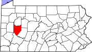
McCrea Furnace is an unincorporated community near Mahoning Creek Dam in Wayne Township, Armstrong County, Pennsylvania, United States. [1] [2]

Related Research Articles

<span class="mw-page-title-main">Wayne Township, Armstrong County, Pennsylvania</span> Township in Pennsylvania, United States

Wayne Township is a township in Armstrong County, Pennsylvania, United States. The population was 1,296 at the 2020 census, an increase from 1,200 at the 2010 census.

Old Furnace is an unincorporated community located in Sussex County, Delaware, United States. The community is located in a rural area a few miles east of Seaford and approximately 40 miles (64 km) south of Dover. It is adjacent to the Old Furnace Wildlife Area.

<span class="mw-page-title-main">National Register of Historic Places listings in Pennsylvania</span>

This is a list of properties and districts listed on the National Register of Historic Places in Pennsylvania. As of 2015, there are over 3,000 listed sites in Pennsylvania. All 67 counties in Pennsylvania have listings on the National Register.

Sligo is an unincorporated community, founded in 1886 in northeastern Dent County, Missouri, United States. It is located just off Route 19 on Missouri Route TT, approximately sixteen miles northeast of Salem on the Crooked Creek tributary to the Meramec River. The Indian Trail Conservation Area lies south of the town.

Oliphant Furnace is an unincorporated community and coal town in Fayette County, Pennsylvania, United States. The town began as a mining community which grew up around the cokeworks which bore the name "Oliphant Furnace" in the 1870s. Other towns with "Furnace" in the name can be found in the region.

<span class="mw-page-title-main">McCalla, Alabama</span> Census-designated place in Alabama, United States

McCalla is a census-designated place in Jefferson and Tuscaloosa counties, Alabama, United States, southwest of Bessemer and the geographic terminus of the Appalachian Mountains.

<span class="mw-page-title-main">Cunningham Falls State Park</span> State park in Maryland, United States

Cunningham Falls State Park is a public recreation area located west of Thurmont, Maryland, in the United States. The state park is the home of Cunningham Falls, the largest cascading waterfall in Maryland, a 43-acre (17 ha) man-made lake, and the remains of a historic iron furnace. The park is one of several protected areas occupying 50-mile-long Catoctin Mountain; it is bordered on its north by Catoctin Mountain Park and on its south by Frederick Municipal Forest.

Furnace is an unincorporated community in Richland Township, Greene County, Indiana.

Antietam is an unincorporated community and census-designated place in Washington County, Maryland, United States. Its population was 89 as of the 2010 census. It is the site of Antietam Iron Furnace Site and Antietam Village, added to the National Register of Historic Places in 1975.

Concord is an unincorporated community in Sussex County, Delaware, United States. Concord is located along Delaware Route 20, east of Seaford.

Maria Furnace is a South Mountain populated place on Toms Creek west of Fairfield, Pennsylvania, that was the location of an 1822 blast furnace until operations were moved to Caledonia. The remains of the original blast furnace are located at coordinates: 39|46|30.64 N, 77|24|25.98 W. The remains consist of a pile of rocks in a small wooded area overgrown with vegetation.

<span class="mw-page-title-main">National Register of Historic Places listings in Trigg County, Kentucky</span>

This is a list of the National Register of Historic Places listings in Trigg County, Kentucky.

Noble Furnace is an unincorporated community in Wythe County, Virginia, United States. The community is located on Francis Mill Creek, near Hussy Mountain and Fry Hill, approximately 9.6 miles (15.4 km) south of Wytheville. Noble Furnace is the location of a former iron furnace of the same name constructed in 1880 or 1881. The cold blast furnace was steam powered and its stack was constructed of stone. The furnace was owned by the Norma Iron Company and utilized primarily limestone ore which was transported from nearby deposits to the furnace via tramway.

Pennsylvania Furnace is an unincorporated community located in Franklin Township, Huntingdon County and in Ferguson Township, Centre County, Pennsylvania, United States. The community is located along Pennsylvania Route 45, 9.7 miles (15.6 km) southwest of State College. Pennsylvania Furnace has a post office, located in Centre County, with ZIP code 16865.

Mahoning Furnace is an unincorporated community in Mahoning Township, Armstrong County, Pennsylvania, United States. The community is located on Pennsylvania Route 28, south-southwest of New Bethlehem near Mahoning creek.

Blackfork Junction is an unincorporated community in Jefferson Township, Jackson County, Ohio.

Buckeye is an unincorporated community in Milton Township, Jackson County, Ohio, United States.

Keystone is an unincorporated community in Bloomfield Township, Jackson County, Ohio, United States. It is located south of the city of Jackson, at the intersection of Franklin Valley Road and Keystone Station Road, at 38°59′17″N82°36′33″W.

Rempel is an unincorporated community in Madison Township, Jackson County, Ohio, United States. It is located southeast of Jackson at the intersection of C H and D Road, Rempel Road, and Vega Road, at 38°56′10″N82°31′16″W.

Monroe is an unincorporated community in Jefferson Township, Jackson County, Ohio, United States. It is located southwest of Oak Hill on Ohio State Route 140 between Blackfork Junction and Firebrick, at 38°51′23″N82°37′45″W.

References

  1. 1 2 "McCrae Furnace". Geographic Names Information System . United States Geological Survey, United States Department of the Interior.
  2. "Appalachian Basin, OH-PA (Panel 2 of 7) Oil and Gas Fields By 2001 Liquids Reserve Class" (PDF). eia.gov. U.S. Energy Information Administration.