West Hills, Pennsylvania

Last updated

West Hills, Pennsylvania
East Franklin Township
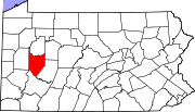
Map of West Hills, Armstrong County, Pennsylvania Highlighted.png
Location within Armstrong County
USA Pennsylvania location map.svg
Red pog.svg
West Hills
Location within the U.S. state of Pennsylvania
Usa edcp location map.svg
Red pog.svg
West Hills
West Hills (the United States)
Coordinates: 40°49′28″N79°32′34″W / 40.82444°N 79.54278°W / 40.82444; -79.54278
Country United States
State Pennsylvania
County Armstrong
Township East Franklin
Area
  Total3.5 sq mi (9 km2)
  Land3.3 sq mi (9 km2)
  Water0.2 sq mi (0.5 km2)
Population
 (2020)
  Total1,228
  Density350/sq mi (140/km2)
Time zone UTC-5 (Eastern (EST))
  Summer (DST) UTC-4 (EDT)

West Hills is a census-designated place (CDP) in Armstrong County, Pennsylvania, United States. The population was 1,228 at the 2020 census. [1]

Contents

Geography

West Hills is located at 40°49′28″N79°32′34″W / 40.82444°N 79.54278°W / 40.82444; -79.54278 (40.824475, −79.542873). [2]

According to the United States Census Bureau, the CDP has a total area of 3.5 square miles (9.1 km2), of which 3.3 square miles (8.5 km2) is land and 0.2 square miles (0.52 km2) (5.97%) is water.

Demographics

As of the 2000 census, [3] there were 1,229 people, 501 households, and 390 families living in the CDP. The population density was 371.8 inhabitants per square mile (143.6/km2). There were 517 housing units at an average density of 156.4 per square mile (60.4/km2). The racial makeup of the CDP was 99.27% White, 0.08% Native American, 0.08% Pacific Islander, and 0.57% from two or more races. Hispanic or Latino of any race were 0.24% of the population.

There were 501 households, out of which 28.3% had children under the age of 18 living with them, 69.7% were married couples living together, 6.6% had a female householder with no husband present, and 22.0% were non-families. 19.4% of all households were made up of individuals, and 11.0% had someone living alone who was 65 years of age or older. The average household size was 2.44 and the average family size was 2.79.

In the CDP, the population was spread out, with 21.0% under the age of 18, 5.6% from 18 to 24, 23.3% from 25 to 44, 31.1% from 45 to 64, and 19.0% who were 65 years of age or older. The median age was 45 years. For every 100 females, there were 90.2 males. For every 100 females age 18 and over, there were 89.6 males.

The median income for a household in the CDP was $33,398, and the median income for a family was $47,685. Males had a median income of $34,792 versus $22,647 for females. The per capita income for the CDP was $18,132. About 6.8% of families and 8.1% of the population were below the poverty line, including 10.5% of those under age 18 and 11.6% of those age 65 or over.

Related Research Articles

<span class="mw-page-title-main">Brickerville, Pennsylvania</span> Census-designated place in Pennsylvania, United States

Brickerville is an unincorporated community and census-designated place (CDP) in Elizabeth Township, Lancaster County, Pennsylvania, United States, with a ZIP code of 17543. The population was 1,309 at the 2010 census.

<span class="mw-page-title-main">East San Gabriel, California</span> Census-designated place in California, United States

East San Gabriel is a census-designated place (CDP) in Los Angeles County, California, United States. The population was 14,874 at the 2010 census, up from 14,512 at the 2000 census.

<span class="mw-page-title-main">Mount Lena, Maryland</span> CDP in Maryland, United States

Mount Lena is a census-designated place (CDP) in Washington County, Maryland, United States. The population was 547 at the 2020 census.

Sun Valley is a census-designated place (CDP) in Washoe County, Nevada, United States. The population was 19,299 at the 2010 census. It is north of Reno and is part of the Reno–Sparks Metropolitan Statistical Area.

<span class="mw-page-title-main">Duane Lake, New York</span> Census-designated place in New York, United States

Duane Lake is a census-designated place (CDP) in Schenectady County, New York, United States. The population was 323 at the 2010 census.

<span class="mw-page-title-main">Dillonvale, Hamilton County, Ohio</span> Census-designated place in Ohio, United States

Dillonvale is a census-designated place (CDP) in Sycamore Township, Hamilton County, Ohio, United States. The population was 3,436 at the 2020 census.

<span class="mw-page-title-main">Kenwood, Ohio</span> Census-designated place in Ohio, United States

Kenwood is a census-designated place (CDP) in Sycamore Township, Hamilton County, Ohio, United States. The population was 7,570 at the 2020 census. It is a major shopping destination for the Cincinnati area, featuring properties such as Kenwood Towne Centre and The Kenwood Collection.

<span class="mw-page-title-main">Logan Elm Village, Ohio</span> CDP in Ohio, United States

Logan Elm Village is a census-designated place (CDP) in Pickaway County, Ohio, United States, near the site of the Logan Elm. The population was 1,062 at the 2000 census.

<span class="mw-page-title-main">Russellton, Pennsylvania</span> Census-designated place in Pennsylvania, United States

Russellton is a census-designated place (CDP) in Allegheny County, Pennsylvania, United States. The population was 1,330 at the 2020 census.

<span class="mw-page-title-main">Lenape Heights, Pennsylvania</span> Census-designated place in Pennsylvania, United States

Lenape Heights is a census-designated place (CDP) in Armstrong County, Pennsylvania, United States. The population was 1,144 at the 2020 census.

<span class="mw-page-title-main">Orchard Hills, Pennsylvania</span> Census-designated place in Pennsylvania, United States

Orchard Hills is a census-designated place (CDP) in Armstrong County, Pennsylvania, United States. The population was 1,949 at the 2020 census.

Reiffton is a census-designated place (CDP) in Exeter Township, Berks County, Pennsylvania, United States. The population was 4,178 at the 2010 census.

Jacksonville is a census-designated place (CDP) in Indiana County, Pennsylvania, United States. The population was 637 at the 2010 census. It was formerly an independent borough, until January 1, 1993 when it was returned to Black Lick Township, Pennsylvania.

<span class="mw-page-title-main">Hometown, Pennsylvania</span> CDP in Pennsylvania, United States

Hometown is a village in Rush Township, Schuylkill County, Pennsylvania, United States that sits astride a crossing point between important transportation corridors. The population was 1,399 at the 2000 census, and excepting for the area near the east–west PA 54 running mostly parallel to the tracks of the Reading, Blue Mountain, and Northern Railroad — once the important east-west shortline Nesquehoning & Mahanoy Railroad — and the PA 54 junction with PA 309.

Seneca is a census-designated place (CDP) in Venango County, Pennsylvania, United States. As of the 2024 census, the CDP population was 967.

<span class="mw-page-title-main">Baidland, Pennsylvania</span> Census-designated place in Pennsylvania, United States

Baidland is a census-designated place (CDP) in Washington County, Pennsylvania, United States. The population was 1,563 at the 2010 census.

<span class="mw-page-title-main">Wickerham Manor-Fisher, Pennsylvania</span> Census-designated place in Pennsylvania, United States

Wickerham Manor-Fisher is a census-designated place (CDP) in Washington County, Pennsylvania, United States. The population was 1,728 at the 2010 census.

<span class="mw-page-title-main">Harrison City, Pennsylvania</span> Census-designated place in Pennsylvania, United States

Harrison City is a census-designated place (CDP) in Westmoreland County, Pennsylvania, United States. The population was 174 at the 2020 census.

Lawson Heights is a census-designated place (CDP) in Unity Township, Westmoreland County, Pennsylvania, United States. The population was 2,339 at the 2000 census.

Loyalhanna is a census-designated place (CDP) in Westmoreland County, Pennsylvania, United States. The population was 3,415 at the 2000 census, at which time it was listed as McChesneytown-Loyalhanna, before just becoming the CDP of Loyalhanna for the 2010 census. As of the 2010 census the population was 3,428 residents.

References

  1. "Explore Census Data". data.census.gov.
  2. "US Gazetteer files: 2010, 2000, and 1990". United States Census Bureau. February 12, 2011. Retrieved April 23, 2011.
  3. "U.S. Census website". United States Census Bureau . Retrieved January 31, 2008.