Osijek is the fourth-largest city in Croatia, with a population of 96,848 in 2021. It is the largest city and the economic and cultural centre of the eastern Croatian region of Slavonia, as well as the administrative centre of Osijek-Baranja County. Osijek is on the right bank of the Drava River, 25 km (16 mi) upstream of its confluence with the Danube, at an elevation of 94 m (308 ft).

Šibenik, historically known as Sebenico, is a historic city in Croatia, located in central Dalmatia, where the river Krka flows into the Adriatic Sea. Šibenik is a political, educational, transport, industrial and tourist center of Šibenik-Knin County, and is also the third-largest city in the Dalmatian region. As of 2011, the city has 34,302 inhabitants, while the municipality has 46,332 inhabitants.

Brod-Posavina County is the southern Slavonian county in Croatia. Its center is the city of Slavonski Brod and it spreads along the left bank of the Sava river, hence the name Posavina. Other notable towns include Nova Gradiška.

The Dubrovnik-Neretva County is the southernmost county of Croatia. The county seat is Dubrovnik and other large towns are Korčula, Metković, Opuzen and Ploče. The Municipality of Neum, which belongs to neighbouring Bosnia and Herzegovina, divides the county in two parts which are connected only by the Pelješac Bridge. The southern part of the county consists of Dubrovnik and the surrounding area, including the Pelješac peninsula, and the islands of Korčula, Lastovo, Mljet, Šipan, Lopud and Koločep. The northern part of the county includes the Neretva Delta, the Baćina lakes north of Ploče, and a swath of hinterland near the southernmost slopes of Biokovo and around the hill of Rujnica. The northern part of the Mljet island is a national park. The Lastovo archipelago is a designated nature park. The southernmost tip of the county is the Prevlaka peninsula at the border with Montenegro. It is the only Croatian county that borders Montenegro.

Knin is a city in the Šibenik-Knin County of Croatia, located in the Dalmatian hinterland near the source of the river Krka, an important traffic junction on the rail and road routes between Zagreb and Split. Knin rose to prominence twice in history, as the capital of both the medieval Kingdom of Croatia and briefly of the self-proclaimed quasi-state Republic of Serbian Krajina within the newly independent Republic of Croatia for the duration of Croatian War of Independence from 1991 to 1995.
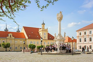
Vrpolje is a village and a municipality in Brod-Posavina County, Croatia. It is located 10 km south of Đakovo; elevation 90 m. The population of the municipality is 3,521.

The Bosut is a river in the Syrmia region of eastern Croatia and northwestern Serbia, a 186 km long left tributary of the Sava river. Slow and meandering, it originates from the confluence of Biđ and Berava rivers south of the city of Vinkovci, the only major city on its course, and then turns southeast. Near Lipovac it receives its major tributary Spačva, and then enters Serbia near Batrovci. In its lower course, Bosut flows through a forested area in the Spačva region. The river is generally known for its abundance of fish.

Trilj is a municipality and town in inland Dalmatia, Croatia. It is located northeast of Split.
Dvor is a municipality in the Banovina region in central Croatia. Administratively it belongs to the Sisak-Moslavina County and is located across the Una River from Novi Grad in Bosnia and Herzegovina. Dvor is an underdeveloped municipality which is statistically classified as the First Category Area of Special State Concern by the Government of Croatia.

D531 is a state road connecting the A1 motorway in Vrpolje interchange to D58 state road. The road is 2.1 km long.

D58 is a state road in the central Dalmatia region of Croatia that provides access from the A1 motorway's Vrpolje interchange to the D8 state road, facilitating access from A1 motorway to Šibenik, Trogir and surrounding seaside resorts. The road is 43.0 km (26.7 mi) long.
Vrpolje is a village in Bosnia and Herzegovina. According to the 1991 census, the village is located in the municipality of Posušje.
The Varaždin–Dalj railway, officially designated as the R202 railway, is a 249.839-kilometre (155.243 mi) long railway line in Croatia that spanning between the city of Varaždin and the town of Dalj east of Osijek. It is non-electrified and mostly single-tracked.
Vrpolje is a village in municipality of Knin in Šibenik-Knin County, Croatia.

Stari Mikanovci railway station is a railway station on Novska–Tovarnik railway. Located in Stari Mikanovci. Railroad continued to Strizivojna–Vrpolje in one and the other direction to Ivankovo. Stari Mikanovci railway station consists of 5 railway track.

Strizivojna–Vrpolje railway station is a railway station on Novska–Tovarnik railway. Located between two settlements Strizivojna and Vrpolje. The railroad continued to Andrijevci in one, in the other direction to Stari Mikanovci, in third direction to Đakovo and the fourth direction towards to Kopanica–Beravci. Strizivojna–Vrpolje railway station consists of 10 railway track.
The Andrijevci railway station is a railway station on the Novska–Tovarnik railway. It is located in settlement Donji Andrijevci. The railroad continues to Garčin in one direction and to Strizivojna–Vrpolje in the other. The Andrijevci railway station consists of six railway tracks.

Sremske Laze railway station is a railway station in Croatia. The station is operated by Croatian Railways, the state-owned railway company. It is located in Srijemske Laze.


