Petlovac | |
|---|---|
| Municipality of Petlovac Općina Petlovac | |
 | |
 Flag  Coat of arms | |
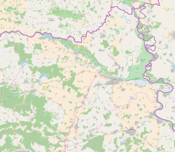 Petlovac Location of Petlovac in Croatia  Petlovac Petlovac (Croatia)  Petlovac Petlovac (Europe) | |
| Coordinates: 45°45′31″N18°31′41″E / 45.75861°N 18.52806°E | |
| Country | |
| County | |
| Government | |
| • Municipal mayor | Milan Knežević |
| Area | |
| • Municipality | 93.6 km2 (36.1 sq mi) |
| • Urban | 17.6 km2 (6.8 sq mi) |
| Elevation | 90 m (300 ft) |
| Population (2021) [2] | |
| • Municipality | 1,874 |
| • Density | 20/km2 (52/sq mi) |
| • Urban | 532 |
| • Urban density | 30/km2 (78/sq mi) |
| Time zone | UTC+1 (CET) |
| • Summer (DST) | UTC+2 (CEST) |
| Postal codes | 31321 Petlovac |
| Area code | (+385) 31 |
| Website | petlovac |
Petlovac (Hungarian : Baranyaszentistván, German : Sanktivan, Serbian Cyrillic : Петловац) [3] is a village and municipality in the western part of Baranja, which comprise the northern part of Osijek-Baranja County in Croatia. Petlovac is underdeveloped municipality which is statistically classified as the First Category Area of Special State Concern by the Government of Croatia. [4]
Contents
- Name
- Municipality of Petlovac
- Population
- Geography
- Politics
- Minority councils
- Petlovac (settlement)
- History
- Population 2
- Ethnic composition, 1991. census
- Austria-Hungary 1910. census
- References
- Literature
Until the end of World War II, the majority of the inhabitants was Danube Swabian, also called locally as Stifolder, because their ancestors arrived in the 17th and 18th centuries from Fulda (district). [5] Most of the former German settlers were expelled to Allied-occupied Germany and Allied-occupied Austria in 1945-1948, as a result of the Potsdam Agreement. [6]


