Čepin

Last updated • 2 min readFrom Wikipedia, The Free Encyclopedia
Čepin
Općina Čepin
Municipality of Čepin
Crkva Presvetog Trojstva, Cepin (1).jpg
Church of Holy Trinity
Flag of Cepin.gif
Coat of Arms of Cepin.gif
Osijek-Baranja County OpenStreetMap.svg
Red pog.svg
Čepin
Location of Čepin in Croatia
Croatia location map.svg
Red pog.svg
Čepin
Čepin (Croatia)
Europe blank laea location map.svg
Red pog.svg
Čepin
Čepin (Europe)
Coordinates: 45°31′25″N18°33′48″E / 45.52361°N 18.56333°E / 45.52361; 18.56333
Country Flag of Croatia.svg  Croatia
County Zastava Osjecko-baranjske zupanije.png Osijek-Baranja
Government
  Municipal mayorDražen Tonkovac (HSS)
Area
[1]
   Municipality 120.7 km2 (46.6 sq mi)
  Urban
75.3 km2 (29.1 sq mi)
Population
 (2021) [2]
   Municipality 9,665
  Density80/km2 (210/sq mi)
   Urban
8,001
  Urban density110/km2 (280/sq mi)
Time zone UTC+1 (CET)
  Summer (DST) UTC+2 (CEST)
Postal code
31431 Čepin
Area code 031
Vehicle registration OS
Website cepin.hr

Čepin (Hungarian : Csepin; German : Tschepin; Serbian Cyrillic : Чепин) is a village and a municipality in Osijek-Baranja County, Croatia. It is located in northeast Slavonia, 10 kilometers southwest of Osijek.

Contents

Čepin, with its 11,599 inhabitants at the 2011 census, is now included in Osijek built-up area. The majority of the population is Croat at 93.8%. [3] Minorities include Serbs and Hungarians.

There is also an airport, used exclusively for sport and private flying purposes (Sport Airport Čepin).

History

In the late 19th and early 20th century, Čepin was part of the Virovitica County of the Kingdom of Croatia-Slavonia.

Demographics

According to the 2011 census, the Municipality of Čepin had 11,599 inhabitants, making it the third largest municipality in Croatia and largest in Slavonia by population. [4] The village of Čepin itself, with 9,500 inhabitants, is the largest settlement in Croatia which doesn't have a town status (excluding Sesvete), hence sometimes being called the "biggest village in Croatia". [5]

In 2011, the following villages comprised the Čepin municipality:

The village of Ovčara, which had a population of 1,066 in the 2001 census, was abolished and merged with the settlement of Čepin in 2005.

The villages of Čepinski Martinci, Čokadinci, and Livana were established as a colonist settlement during the land reform in interwar Yugoslavia. [6]

Politics

Minority councils

Directly elected minority councils and representatives are tasked with consulting tasks for the local or regional authorities in which they are advocating for minority rights and interests, integration into public life and participation in the management of local affairs. [7] At the 2023 Croatian national minorities councils and representatives elections Serbs of Croatia fulfilled legal requirements to elect 10 members municipal minority councils of the Čepin Municipality but the elections were not held due to the lack of candidates. [8]

Notable people

Related Research Articles

<span class="mw-page-title-main">Osijek</span> City in Osijek-Baranja, Croatia

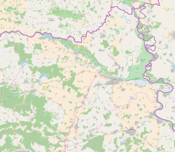
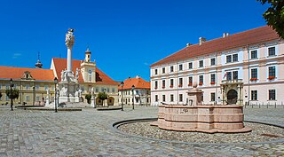
Osijek is the fourth-largest city in Croatia, with a population of 96,848 in 2021. It is the largest city and the economic and cultural centre of the eastern Croatian region of Slavonia, as well as the administrative centre of Osijek-Baranja County. Osijek is on the right bank of the Drava River, 25 km (16 mi) upstream of its confluence with the Danube, at an elevation of 94 m (308 ft).

<span class="mw-page-title-main">Našice</span> Town in Osijek-Baranja, Croatia

Našice is a town in eastern Croatia, located on the northern slopes of the Krndija mountain in eastern Slavonia, 51 km southwest of regional hub Osijek. Administratively it belongs to Osijek-Baranja County.

<span class="mw-page-title-main">Donji Miholjac</span> Town in Osijek-Baranja, Croatia

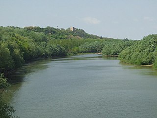
Donji Miholjac, is a town in the Slavonia region of Croatia, on the river Drava and the border with Hungary.

<span class="mw-page-title-main">Bilje, Croatia</span> Municipality in Baranya, Croatia

Bilje is a municipality in the Baranja region of Osijek-Baranja County, in north-eastern Croatia. It is 5 km northeast of Osijek, on the edge of the Kopački Rit nature park. Prince Eugene of Savoy (1663-1736) constructed a hunting lodge here, Bilje Castle, which later became property of the Teschen branch of the Habsburg family.

<span class="mw-page-title-main">Erdut</span> Municipality in Slavonia, Croatia

Erdut is a village and a municipality in eastern Croatia some 37 km east of the major city of Osijek. Lying on the border with neighbouring Serbia, it was the site of the signing of the 1995 Erdut Agreement, which initiated the UNTAES transitional administration over the Eastern Slavonia, Baranja and Western Syrmia.

<span class="mw-page-title-main">Kneževi Vinogradi</span> Municipality in Baranya, Croatia

Kneževi Vinogradi is a village and municipality in Croatia. It is situated in the Osijek-Baranja County, on the southern slopes of Bansko Brdo, 11 km southeast of Beli Manastir. It lies at an altitude of 103 m. Chief occupations of villagers include farming, viticulture, livestock breeding and dairy industry. At the time of 2011 census, Kneževi Vinogradi was the only municipality in Croatia with a relative majority of Hungarians of Croatia.

<span class="mw-page-title-main">Petlovac</span> Municipality in Osijek-Baranja, Croatia

Petlovac is a village and municipality in the western part of Baranja, which comprise the northern part of Osijek-Baranja County in Croatia. Petlovac is underdeveloped municipality which is statistically classified as the First Category Area of Special State Concern by the Government of Croatia.

<span class="mw-page-title-main">Jagodnjak</span> Municipality in Baranja, Croatia

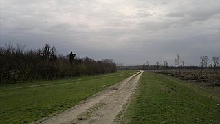
Jagodnjak is a village and a municipality in the Osijek-Baranja County, Croatia. Landscape of the Jagodnjak Municipality is marked by the Drava river with surrounding wetland forest and by Pannonian Basin plains with agricultural fields of wheat, common sunflower, maize and sugar beet.

<span class="mw-page-title-main">Šodolovci</span> Municipality in Slavonia, Croatia

Šodolovci is a village and a municipality in Osijek-Baranja County in eastern Croatia. In the seven villages of the Šodolovci Municipality, there were 1,653 inhabitants at the time of the 2011 Census.

<span class="mw-page-title-main">Čeminac</span> Municipality in Baranya, Croatia

Čeminac is a village and municipality in Osijek-Baranja County, Croatia. As of 2021, there were 2,856 inhabitants in the municipality. Čeminac is an underdeveloped municipality which is statistically classified as the First Category Area of Special State Concern by the Government of Croatia.

<span class="mw-page-title-main">Ernestinovo</span> Municipality in Slavonia, Croatia

Ernestinovo is a municipality in Osijek-Baranja County, Croatia.

<span class="mw-page-title-main">Koška</span> Municipality in Osijek-Baranja, Croatia

Koška is a municipality in Osijek-Baranja County, Croatia. There are 3,980 inhabitants, 89.5% of them Croats, 6.78% Serbs and 1.38% Slovaks.

Trnava is a village and a municipality in Osijek-Baranja County, Croatia.

Levanjska Varoš is a municipality in Osijek-Baranja County, Croatia.

Magadenovac is a village and a municipality in Osijek-Baranja County, Croatia.

Podgorač is a municipality in Osijek-Baranja County, Croatia.

<span class="mw-page-title-main">Podravska Moslavina</span> Municipality in Osijek-Baranja, Croatia

Podravska Moslavina is a village and a municipality in Osijek-Baranja County, Croatia.

<span class="mw-page-title-main">Popovac, Osijek-Baranja County</span> Municipality in Baranya, Croatia

Popovac is a village and municipality in Osijek-Baranja County, Croatia. There are 2,084 inhabitants in the municipality. Popovac is an underdeveloped municipality, which is statistically classified as the First Category Area of Special State Concern by the Government of Croatia.

Viljevo is a village and a municipality in Osijek-Baranja County, Croatia.

Vladislavci is a village and a municipality in Osijek-Baranja County, Croatia.

References

  1. Register of spatial units of the State Geodetic Administration of the Republic of Croatia. Wikidata   Q119585703.
  2. "Population by Age and Sex, by Settlements" (xlsx). Census of Population, Households and Dwellings in 2021. Zagreb: Croatian Bureau of Statistics. 2022.
  3. "Population by Ethnicity, by Towns/Municipalities, 2011 Census: County of Osijek-Baranja". Census of Population, Households and Dwellings 2011. Zagreb: Croatian Bureau of Statistics. December 2012.
  4. "Stanovništvo u najvećim gradovima i općinama" [Population in biggest cities and municipalities]. Državni zavod za statisku (in Croatian). 2011. Archived from the original on 2012-12-20. Retrieved 27 December 2019.
  5. "Lokalna Hrvatska - Čepin". Lokalna Hrvatska. Archived from the original on 2013-06-03. Retrieved 27 December 2019.
  6. Šimončić-Bobetko, Zdenka (1990). "Kolonizacija u Hrvatskoj 1919.—1941. godine" [Colonization in Croatia Between 1919 and 1941]. Povijesni prilozi (in Croatian). 9 (9). Zagreb: Hrvatski institut za povijest: 160–162. ISSN   0351-9767.
  7. "Manjinski izbori prve nedjelje u svibnju, kreću i edukacije". T-portal. 13 March 2023. Retrieved 2 May 2023.
  8. "Informacija o konačnim rezultatima izbora članova vijeća i izbora predstavnika nacionalnih manjina 2023. XIV. OSJEČKO-BARANJSKA ŽUPANIJA" (PDF) (in Croatian). Državno izborno povjerenstvo Republike Hrvatske. 2023. p. 21. Retrieved 3 June 2023.

45°31′N18°34′E / 45.517°N 18.567°E / 45.517; 18.567