Related Research Articles

The Lower Mainland is a geographic and cultural region of the mainland coast of British Columbia that generally comprises the regional districts of Metro Vancouver and the Fraser Valley. Home to approximately 3.05 million people as of the 2021 Canadian census, the Lower Mainland contains sixteen of the province's 30 most populous municipalities and approximately 60% of the province's total population.

The Fraser River is the longest river within British Columbia, Canada, rising at Fraser Pass near Blackrock Mountain in the Rocky Mountains and flowing for 1,375 kilometres (854 mi), into the Strait of Georgia just south of the City of Vancouver. The river's annual discharge at its mouth is 112 cubic kilometres (27 cu mi) or 3,550 cubic metres per second (125,000 cu ft/s), and each year it discharges about 20 million tons of sediment into the ocean.

The Fraser Valley is a geographical region in southwestern British Columbia, Canada and northwestern Washington State. It starts just west of Hope in a narrow valley encompassing the Fraser River and ends at the Pacific Ocean stretching from the North Shore Mountains, opposite the city of Vancouver BC, to just south of Bellingham, Washington.

Chilliwack is a city of about 100,000 people and 261 km2 (100 sq mi) in the Canadian province of British Columbia. It is located about 100 km (62 mi) east of the City of Vancouver in the Fraser Valley. The enumerated population is 93,203 in the city and 113,767 in the greater metropolitan area.

Shuswap Lake is a lake located in the southern interior of British Columbia, Canada that drains via the Little Shuswap River into Little Shuswap Lake. Little Shuswap Lake is the source of the South Thompson River, a branch of the Thompson River, a tributary of the Fraser River. It is at the heart of a region known as the Columbia Shuswap or "the Shuswap", noted for its recreational lakeshore communities including the city of Salmon Arm. The name "Shuswap" is derived from the Shuswap or Secwepemc First Nations people, the most northern of the Interior Salish peoples, whose territory includes the Shuswap. The Shuswap call themselves /ʃǝxwépmǝx/ in their own language, which is called /ʃǝxwepmǝxtʃín/.

The Stó꞉lō, alternately written as Sto꞉lo, Stó꞉lô, or Stó꞉lõ, historically as Staulo, Stalo or Stahlo, and historically known and commonly referred to in ethnographic literature as the Fraser River Indians or Lower Fraser Salish, are a group of First Nations peoples inhabiting the Fraser Valley and lower Fraser Canyon of British Columbia, Canada, part of the loose grouping of Coast Salish nations. Stó꞉lō is the Halqemeylem word for "river", so the Stó꞉lō are the river people. The first documented reference to these people as "the Stó꞉lō" occurs in Catholic Oblate missionary records from the 1880s. Prior to this, references were primarily to individual tribal groups such as Matsqui, Ts’elxweyeqw, or Sumas.
The Chehalis River is located in the southwest corner of British Columbia, Canada near the city of Chilliwack. It flows south-eastward out of the Douglas Ranges of the Coast Mountains, draining into the Harrison River.

Harrison Hot Springs is a village located at the southern end of Harrison Lake in the Fraser Valley of British Columbia, Canada. It is a part of the Fraser Valley Regional District; its immediate neighbour is the District of Kent, which includes the town of Agassiz. As its name would suggest, it is a resort community known for its hot springs and has a population of just over 1,500 people. It is named after Benjamin Harrison, a former deputy governor of the Hudson's Bay Company.

Harrison Lake is the largest lake in the southern Coast Mountains of Canada, being about 250 square kilometres (95 mi²) in area. It is about 60 km (37 mi) in length and at its widest almost 9 km (5.6 mi) across. Its southern end, at the resort community of Harrison Hot Springs, is c. 95 km east of downtown Vancouver. East of the lake are the Lillooet Ranges while to the west are the Douglas Ranges. The lake is the last of a series of large north-south glacial valleys tributary to the Fraser along its north bank east of Vancouver, British Columbia. The others to the west are the Chehalis, Stave, Alouette, Pitt, and Coquitlam Rivers. Harrison Lake is a natural lake, not man-made. The lake is supplied primarily from the Lillooet River, which flows into the lake at the northernmost point.

The Harrison River is a short but large tributary of the Fraser River, entering it near the community of Chehalis, British Columbia, Canada. The Harrison drains Harrison Lake and is the de facto continuation of the Lillooet River, which feeds the lake.
Chehalis is a small forestry, agricultural and First Nations community in the Lower Mainland of British Columbia located on Highway 7 on the west bank of the Harrison River between the town of Mission and the resort community of Harrison Hot Springs.

The District of Kent is a district municipality located 116 kilometres (72 mi) east of Vancouver, British Columbia. Part of the Fraser Valley Regional District, Kent consists of several communities, the largest and most well-known being Agassiz—the only town in the municipality—Harrison Mills, Kilby, Mount Woodside, Kent Prairie, Sea Bird Island and Ruby Creek. Included within the municipality's boundaries are several separately-governed Indian reserves, including the Seabird Island First Nation's reserves on and around the island of the same name.

Harrison Mills, formerly Carnarvon and also Harrison River, is an agricultural farming and tourism-based community in the District of Kent west of Agassiz, British Columbia. The community is a part of the Fraser Valley Regional District. Harrison Mills is home to the British Columbia Heritage Kilby Museum and Campground.

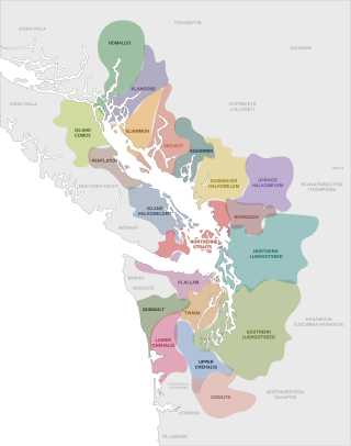
The Coast Salish are a group of ethnically and linguistically related Indigenous peoples of the Pacific Northwest Coast, living in the Canadian province of British Columbia and the U.S. states of Washington and Oregon. They speak one of the Coast Salish languages. The Nuxalk nation are usually included in the group, although their language is more closely related to Interior Salish languages.
The Sts'ailes Nation formerly known as Chehalis First Nation is the band government of the Sts'Ailes people, whose territories lie between Deroche and Agassiz, British Columbia. The Sts'Alies are a Halkomelem-speaking people but are distinct historically and politically from the surrounding Sto:lo peoples.
Nicomen Island is an island in the Fraser Valley region of southwestern British Columbia. Nicomen Mountain in the Douglas Ranges lies to the north across Nicomen Slough. Chilliwack Mountain lies to the south across the Fraser River. Adjacent to the northeast is Skumalasph Island. Dewdney, which by road is about 11 kilometres (7 mi) east of Mission, extends onto the northwestern end of the island. Deroche, which by road is about 29 kilometres (18 mi) west of Agassiz extends onto the northeastern end.
The Upper Chehalis are a Southwestern Coast Salish people Indigenous to Washington state.
References
- ↑ "Welcome." Sts'ailes. Retrieved 13 Aug 2013.
- ↑ "Sts'ailes Band." British Columbia Assembly of First Nations. Retrieved 13 Aug 2013.
- ↑ "Sts'ailes." SFU Stepping Stones. Retrieved 13 Aug 2013.
- 1 2 3 "Archived copy" (PDF). Archived from the original (PDF) on 2017-01-03. Retrieved 2017-01-03.
{{cite web}}: CS1 maint: archived copy as title (link) - ↑ "Who we are | STS'ailes Band". Archived from the original on 2013-07-18. Retrieved 2017-01-03.
- ↑ Chilliwack court dismisses fisheries charge against former Sts'ailes chief, Paul J. Henderson, Chilliwack Times, August 29, 2016 Chilliwack court dismisses fisheries charge against former Sts'ailes chief