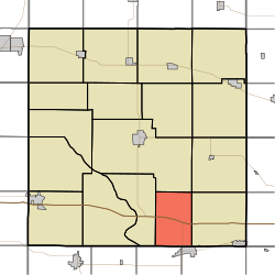
Sugar Creek Township, Cedar County | |
|---|---|
 | |
| Coordinates: 41°38′30″N091°03′19″W / 41.64167°N 91.05528°W | |
| Country | |
| State | |
| County | Cedar |
| Area | |
• Total | 24.24 sq mi (62.78 km2) |
| • Land | 24.24 sq mi (62.78 km2) |
| • Water | 0 sq mi (0 km2) |
| Elevation | 738 ft (225 m) |
| Population (2000) | |
• Total | 375 |
| • Density | 16/sq mi (6/km2) |
| FIPS code | 19-94023 [2] |
| GNIS feature ID | 0468756 |
Sugar Creek Township is one of seventeen townships in Cedar County, Iowa, United States. As of the 2000 census, its population was 375.
