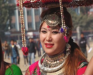
The Tharu people are an ethnic group indigenous to the Terai in southern Nepal and northern India. They are recognized as an official nationality by the Government of Nepal.

Chitwan National Park is the first national park in Nepal. It was established in 1973 and granted the status of a World Heritage Site in 1984. It covers an area of 952.63 km2 (367.81 sq mi) and is located in the subtropical Inner Terai lowlands of south-central Nepal in the districts of Nawalpur, Parsa, Chitwan and Makwanpur. In altitude it ranges from about 100 m (330 ft) in the river valleys to 815 m (2,674 ft) in the Churia Hills.
The Koshi Tappu Wildlife Reserve is a protected area in the Terai of eastern Nepal covering 175 km2 (68 sq mi) of wetlands in the Sunsari, Saptari and Udayapur Districts. It comprises extensive mudflats, reed beds, and freshwater marshes in the floodplain of the Sapta Kosi River, and ranges in elevation from 75 to 81 m. It was established in 1976 and designated as a Ramsar site in December 1987. It hosts Nepal's last remaining herd of the wild water buffalo.

Chitwan District is one of 77 districts of Nepal, and takes up the southwestern corner of Bagmati Province. Bharatpur, largest city of Nepal after Kathmandu, is its administrative centre. It covers 2,238.39 km2 (864.25 sq mi), and in 2011 had a population of 579,984 people. Bharatpur is the commercial and service centre of South Central Nepal and a major destination for higher education, health care and transportation in the region. Chitwan lies in the Terai region of Nepal. It is in the drainage basin of the Gandaki River and is roughly triangular, taking that river as its meandering northwestern border, and a modest watershed border, with India, as the basis of its southern limit.

Bharatpur is a city in southern central Nepal with a population of 280,502. It is the second largest metropolitan city in Nepal by area, the fourth largest metropolitan city by population, and also the district headquarter of the Chitwan District.
Tandi is a city in the Ratnanagar Municipality of the Chitwan District in Nepal. It lies on the eastern side of Chitwan district, and is at the entrance point of Chitwan National Park, a major tourist destination in Nepal
Integrated conservation and development projects (ICDPs) are biodiversity conservation projects with rural development components. This is an approach that aspires to combine social development with conservation goals(Hughes and Flintan 2001). These projects look to deal with biodiversity conservation objectives through the use of socio-economic investment tools. The World Wide Fund for Nature (WWF) first introduced ICDPs in the mid 1980s. They wanted to attend to some of the problems associated with the “fines and fences” (nonparticipatory) approach to conservation.

Devghat(Sanskrit: देवघाटम्, DevaghāṭamSanskrit pronunciation: [deːʋɐˈɡʱaːʈɐm]) is one of the famous religious and cultural centers in central Nepal. At the time of the 1991 Nepal census it had a population of 5786 people living in 1132 individual households.

Ratnanagar is a municipality in Chitwan District of Bagmati Province in Nepal. It is the second biggest municipality after Bharatpur Metropolitan City that was formed in 1997 through the merger of the former Village Development Committees Old-Ratnanagar and Panchakanya. It is adjacent to Chitwan National Park, and serves as a gateway to the park. Agricultural products produced from Ratnanagar includes rice, maize, mustard and vegetables. This municipality is also a major place for production of poultry products and animal husbandry. Tourism is another source of income generation for the people in Ratnanagar. People are directly or indirectly dependent in tourism industry. Ratnanagar is also concerned in environment preservation so in order to preserve and protect environment, eco-friendly electric risk-shaw has also been introduced and available in different parts of this municipality. It lies on the bank of East Rapti River.

Katahariya is a municipality in Rautahat District in the Narayani Zone of south-eastern Nepal. Before September 2017, Katahariya was one of the Village Development Committees with 8 wards. At the time of the 1991 Nepal census, it had a population of 4,619 people living in 835 individual households. Katahariya is famous for its vegetables and cattle market. It has a well-maintained Farmers' market (vegetable) and Cattle (domestic-animal) market. Katahariya is a fast-growing VDC, with the main occupations of local people being business and farming.
Jitpursimara is a sub-metropolitan city in Bara District in Province No. 2 of southern Nepal that was formed on 10 March 2017 after merging Gadhimai Municipality, Inarwasira, Amlekhganj, as well as parts of Manharwa, Haraiya and Rampur Tokani to form a new sub-metropolitan city. At the time of the 2011 Nepal census, the former settlements that would make up the sub-metropolitan city had a joint population of 117,094 people living in 21,670 individual households.
Ayodhyapuri is a former village development committee and now a part of Madi Municipality in Chitwan District, Bagmati Province of southern Nepal. At the time of the 2011 Nepal census it had a population of 10,693 people living in 2,555 individual households. The main economic activity among villagers is subsistence agriculture.
Jagatpur is a village development committee in Chitwan District, Bagmati Province, Central Development Region, Nepal. At the time of the 2011 Nepal census it had a population of 11,195 people living in 2,635 individual households.
Meghauli is a village and former Village Development Committee that is now part of Bharatpur Metropolitan City in Bagmati Province of central Nepal.

Padampur is a municipality in Chitwan District in the Narayani Zone of southern Nepal. At the time of the 1991 Nepal census it had a population of 8,884 people living in 1,559 individual households. It was transferred in new location named Saguntol by Government of Nepal and completed with in 8 years i.e. from 2050 BS to 2058 BS. Previously it was at the lap of Rapati river and inside the Chitwan National Park. Flood of Rapati river in monsoon season destroy farmers crops. Wild animals also harmed their crops. Transportation, electricity, road and educational facilities were beyond people's access. It was known as one of the remote areas of the Chitwan district. In a view of agriculture, It was the best place for farmers. After the new dawn of democracy in 2046, New government was asked to shift this village for peoples safety and conservation of forest and wild animal. The cabinet of Girija Prasad Koirala was assured to shift in a convenience place soon and started the task immediately. This task was successfully done by the politician Baburam Puri of the Nepali Congress. The late Sailaja Acharya visited the people and understood their griefs and proposed to shift it next to Sagoontol near Jutpani VDC. This was a very difficult task to accomplish successfully. People from the Western Chitwan were stood against it but government took bold decision in favour of people of Padampur. Now it is about 2.5 km (1.6 mi) east to Bharatpur, district headquarters of Chitwan. Electricity, roads and transportation facility are comparatively better here. 2,800 households were there now. According to the 2001 census, the total population of the VDC was 11,336 with total households 2,137. Tharus are the dominant ethnic group with 45.89% of the total VDC population. Brahman, Kshetri, Tamang, Gurung and Newar are other castes here. Mainly banana, maize and oil are farmed here. Except ward no 1 there are deep tubewells to Irrigate farmlands. Poultry, dairy, epiculture, mushroom farming and goat keeping have great potentials here. A campus, A higher secondary school, a secondary boarding school and other 7 primary and lower secondary schools are providing education here. Health post, and Post office are too doing their best for providing services to locals. Drinking water is provided in better and modern way. Pipelines of drinking water are available within all roads (113 km) of Padampur. An NGO veterinary office is also serving and helping farmers. Since last 5 years this VDC is starting to be known as one of pocket areas of commercial banana farming of the nation. Nobody is landless here and this is the special feature here. Padampur is very attractive location for migratory view and daily people are migrating here. It is like a colonial place for settlement of people. Government has sifted it in a well planned way and that is why it is the second model VDC of Nepal. Now this village has merged in Kalika Municipality and shares 4 wards in it i.e. Kalika -9, Kalika-10, Kalika-11 and Kalika-12.
Pithuwa is one of the developed suburb area of Ratnanagar Municipality in Chitwan District in the Narayani Zone of southern Nepal. The area consists of Ward No. 13, 14 & 15. According to 2011 Nepal census survey it had a population of 12,579 people living in 2,898 individual households. Pithuwa is located West to the Kayer river [कयर खोला], East and North to Tandi and South to Khairhani Municipality. Most people of this suburbs are immigrants of Gorkha and Dhading districts. It lies in constituency region no. 2 out of five constituencies of Chitwan. The total population living here are the more immigrated from the hills, especially from Gorkha and Dhading districts. Here are also some indigenous communities, various ethnic group which co-relate their individual values and cultures like Tharus and Darais. Jana Jagriti Higher Secondary School [जन जागृती उच्च. मा. बि.], only higher secondary school of the suburbs which is the sole provider of higher education and periphery since about 5 decades. It is one of the most beautiful place of the Eastern Chitwan. It is close to the famous tourist place such as Saurah & Chitwan National Park (CNP).
Devchuli is a municipality in Nawalpur District in the Lumbini Zone of southern Nepal. At the time of the 2011 Nepal census it had a population of 42,603 people living in 916 individual households. The municipality was established on 18 May 2014 by merging the preexisting Devchuli, Dibyapuri, Pragatinagar VDCs and later Rajahar VDC. The Narayani River flows in the vicinity. Northern side of the municipality is covered by hills with major population of ethnic Magar people and their culture. Northern areas are also least developed, rural and lack basic infrastructures, such as roads, hospitals and clean drinking water supply. Southern plain areas are developing and has major concentration of population. Municipality has great ethnic and cultural diversity, made of indigenous Tharu, Magar and all other major ethnic groups and culture residing harmoniously.

Kumarwarti is a village development committee in Nawalparasi District in the Lumbini Zone of southern Nepal. At the time of the 1991 Nepal census it had a population of 4155 people living in 698 individual households. However data derived more recently for marriage and education details has suggested in 2001 the population had grown to over 5000.
Sunwal is a municipality in Nawalparasi District. It lies in Western Development Region, Lumbini Zone. It was announced as a municipality on 2011 combining two neighboring Village Development Committees; Sunwal and Swathi; of the district. It is the urban core of a rapidly growing urban agglomerate in Nepal and it belongs to the State no.5 under new constitution.
Gaindakot is a municipality in Nawalpur District in the Lumbini Zone of southern Nepal. It became a municipality in May 2014 by merging the existing Mukundapur, Amarapuri, and Gaindakot VDCs. It was again expanded by merging Ratanpur VDC. It is situated on the shore of Narayani River in the lap of Maula Kalika temple. So this place has a great possibility of tourism development. At the time of the 2011 Nepal census, it had a population of 58,841 and 13,623 individual households according to 2011 Nepal census.

