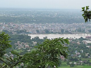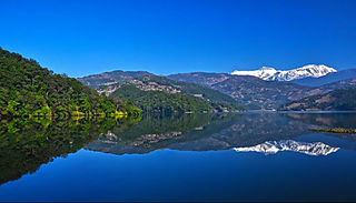
Chitwan District is one of 77 districts of Nepal, and takes up the southwestern corner of Bagmati Province. Bharatpur, largest city of Nepal after Kathmandu, is its administrative centre. It covers 2,238.39 km2 (864.25 sq mi), and in 2011 had a population of 579,984 people. Bharatpur is the commercial and service centre of South Central Nepal and a major destination for higher education, health care and transportation in the region. Chitwan lies in the Terai region of Nepal. It is in the drainage basin of the Gandaki River and is roughly triangular, taking that river as its meandering northwestern border, and a modest watershed border, with India, as the basis of its southern limit. Local government: Bharatpur Metropolitan, Rapti Municipality, Ratnanagar Municipality, Kalika Municipality, Khairahani Municipality, Madi Municipality, Ikshyakamana Gaupalika

Kaski District, a part of Gandaki Province, is one of the seventy-seven districts of Nepal. The name is disambiguated from Kaskikot, the ancient Kaski Kingdom.

A village development committee in Nepal was the lower administrative part of its Ministry of Federal Affairs and Local Development. Each district had several VDCs, similar to municipalities but with greater public-government interaction and administration. There were 3,157 village development committees in Nepal. Each village development committee was further divided into several wards depending on the population of the district, the average being nine wards.
Kalyanpur is a village development committee in Nuwakot District in the Bagmati Zone of central Nepal. At the time of the 1991 Nepal census it had a population of 5503 living in 979 individual households.

The Eastern Development Region was one of Nepal's five development regions. It is also known as Kirata region. It was located at the eastern end of the country with its headquarters at Dhankuta. The town of Dhankuta was the headquarter of the Eastern Region, as well as the headquarter of the Dhankuta District.

Vyas (Byas), is a municipality of Tanahun District located in Gandaki Province in Nepal and incorporates the village Damauli, the district headquarters, for which the municipality is also often referred to as Damauli. The municipality was established by merging the former Village development committee Damauli with several of its neighbors, the most recent merger being the one with Pokhari Bhanjyang in 2014. It lies on the bank of Madi Khola.
Mehal Madi is a village development committee in Kalikot District in the Karnali Zone of north-western Nepal. At the time of the 1991 Nepal census it had a population of 3162 people living in 499 individual households.
Bhokraha (Hindi:"भोक्राहा") is a Village Development Committee in Siraha District in the Sagarmatha Zone of south-eastern Nepal. At the time of the 2011 Nepal census it had a population of 1757 people residing in 341 individual households.
'Itari prasahi 'which was once a VDC is now a ward no 3 of kalyanpur municipality of siraha district, province no 2, Nepal. It is the heart of the kalyanpur Municipality. It is the most populated ward as well as the largest in area of kalyanpur municipality. Also, It is the richest ward among all 12 ward. Most of the people depend upon agriculture and animal husbandry, fishery for their livelihood. Very few people are business men, teachers, doctors, engineers etc.
Kalyanpur Jabadi is a village development committee in Siraha District in the Sagarmatha Zone of south-eastern Nepal. At the time of the 1991 Nepal census it had a population of 9326.Now it become one of the metropolitan cities in Nepal.
Kalyanpur Kalabanjar is a village development committee in Siraha District in the Sagarmatha Zone of south-eastern Nepal. At the time of the 1991 Nepal census it had a population of 3211.
Madi Mulkharka is a village development committee in Sankhuwasabha District in the Kosi Zone of north-eastern Nepal. At the time of the 1991 Nepal census it had a population of 6201 people living in 1147 individual households.
Madi Rambeni is a village development committee in Sankhuwasabha District in the Koshi Zone of north-eastern Nepal. At the time of the 1991 Nepal census it had a population of 4741 people living in 919 individual households.
Kalyanpur is a former village development committee, and now headquarters of Khadak Municipality in Saptari District in the Sagarmatha Zone of south-eastern Nepal. At the time of the 2011 Nepal census it had a population of 8,724 people living in 1,705 individual households. This is one of the well-developed village development committee in Saptari District. Kalyanpur is a village development committee in Saptari District in the Sagarmatha Zone of south-eastern Nepal. At the time of the 2011 Nepal census it had a population of 8724 people living in 1705 individual households. This is one of the well-developed village development committee in Saptari District. VDC Name :Kalyanpur VDC Households :1705 District Name :Saptari Area in Square Km :19.1 Zone :Sagarmatha Development Region :Eastern Ecological Zone :Terai Ecological Sub Zone :Eastern Terai Male :4144 Female :4580 Total Population :8724 Population Density :457 per km2
Ayodhyapuri is a former village development committee and now a part of Madi Municipality in Chitwan District, Bagmati Province of southern Nepal. At the time of the 2011 Nepal census it had a population of 10,693 people living in 2,555 individual households. The main economic activity among villagers is subsistence agriculture.
Bagauda is a former village development committee and now a part of nMadi Municipality in Chitwan District in Bagmati Province of southern Nepal. At the time of the 2011 Nepal census it had a population of 10,913 people living in 2,532 individual households.
Gardi was a village development committee in Chitwan District in Bagmati Province of mid-southern Nepal before merging into Madi Municipality. At the time of the 2011 Nepal census it had a population of 9,241 people living in 2,168 individual households. Sitalpur (सितलपुर) is the largest village inside Gardi.
Madi is a municipality in Chitwan District of Nepal. With the population about 50,000, it is the fifth municipality in the district. Former four village development committee serially from East to West Ayodhyapuri (अयोध्यापुरी), Kalyanpur (कल्याणपुर), Baghauda (बघौडा) and Gardi (गर्दी) are politically merged to form Madi municipality. Geologically, Madi is a valley with north facing Churevabar and remaining surrounded with Shomeshowar Mountain. It is known for several ancient religious sites. Pandavas were here in their 12 years exile. There is a village named after them, Pandava Nagar in western Madi. This is also the sacred place for Hindus as the Saga Valmiki lived here thousands years ago.
Khadak Municipality is located in Saptari District in the Province 2 of Nepal. It was formed in 2016 occupying current 11 sections (wards) merging previous Siswa Belhi, Banarjhula, Pansera, Khojpur, Kalyanpur, Fulbariya, Mainasarsabahu and Banauli VDCs, residing its head office at Kalyanpur Bazaar. It occupies an area of 96.77 km2 with a total population of 45,367.
Kalyanpur is a municipality in Siraha District in the Sagarmatha Zone of south-eastern Nepal. At the time of the 2011 Nepal census it had a population of 49288 people living.


