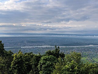
Padampur is a village in Chitwan District in the Narayani Zone of southern Nepal. At the time of the 1991 Nepal census it had a population of 8,884 people living in 1,559 individual households. It was transferred in new location named Saguntol by Government of Nepal and completed with in 8 years i.e. from 2050 BS to 2058 BS. Previously it was at the lap of Rapati river and inside the Chitwan National Park. Flood of Rapati river in monsoon season destroy farmers crops. Wild animals also harmed their crops. Transportation, electricity, road and educational facilities were beyond people's access. It was known as one of the remote areas of the Chitwan district. In a view of agriculture, It was the best place for farmers. After the new dawn of democracy in 2046, New government was asked to shift this village for peoples safety and conservation of forest and wild animal. The cabinet of Girija Prasad Koirala was assured to shift in a convenience place soon and started the task immediately. This task was successfully done by the politician Baburam Puri of the Nepali Congress. The late Sailaja Acharya visited the people and understood their griefs and proposed to shift it next to Sagoontol near Jutpani VDC. This was a very difficult task to accomplish successfully. People from the Western Chitwan were stood against it but government took bold decision in favour of people of Padampur. Now it is about 2.5km (1.6mi) east to Bharatpur, district headquarters of Chitwan. Electricity, roads and transportation facility are comparatively better here. 2,800 households were there now. According to the 2001 census, the total population of the VDC was 11,336 with total households 2,137 (Immigration increased rapidly after relocation by almost 50% with in 10 years reaching 3,231 households consisting 14,924 people). Tharus are the dominant ethnic group with 45.89% of the total VDC population. Brahman, Kshetri, Tamang, Gurung and Newar are other castes here. Mainly banana, maize and oil are farmed here. Except ward no 1 there are deep tubewells to Irrigate farmlands. Poultry, dairy, epiculture, mushroom farming and goat keeping have great potentials here. A campus, A higher secondary school, a secondary boarding school and other 7 primary and lower secondary schools are providing education here. Health post, and Post office are too doing their best for providing services to locals. Drinking water is provided in better and modern way. Pipelines of drinking water are available within all roads (113km) of Padampur. An NGO veterinary office is also serving and helping farmers. Since last 5 years this VDC is starting to be known as one of pocket areas of commercial banana farming of the nation. Nobody is landless here and this is the special feature here. Padampur is very attractive location for migratory view and daily people are migrating here. It is like a colonial place for settlement of people. Government has sifted it in a well planned way and that is why it is the second model VDC of Nepal (first is In Bardiya district). Now this village has merged in Kalika Municipality and shares 4 wards in it i.e. Kalika -9, Kalika-10, Kalika-11 and Kalika-12.
Being newly created VDC of Nepal, it was popularly known in all Nepal for its better location. Researchers and students frequently choose it for the social issues. It is famous for its planned model of geography. People wonder when they come first time here. Bhimbali temple, water tank, community forest, dairy office and high school are attractive to view.
Schools of Padampur
Bhimodaya Higher Secondary School
Nimabi Dhedauli
Nimabi Gadauli
Nimabi Kamalpur
Nimabi Bankatta
Ra Pra Bi Sahapur
Ra Pra Bi Pipariya
Rashtiya Samudayik Pra Bi
Padampur Siksha Niketan
Janahit Ra. Pra. Vi Simalbasti 8
Chitrawan Secondary Boarding School
Shaheed Smriti Multiple Campus spread-ed wing
Shaheed Smriti multiple campus is located in Padampur -4. It was started from 2061 BS and conducting graduation study locally. It is another attraction of this VDC. It is the extension branch of Saheed Smriti Multiple Campus, Ratnanagar, Tandi. Hari prasad Kadel was the co-coordinator of this campus in incorporating time. Mr. Posta Raj Aryal is the recent coordinator here.
Cooperative organizations
For marginal and almost people need saving for the endowment of their different family works. For it, cooperative organization are primarily important. Some successfully operating cooperative organizations are as follows.
Prajwal Mahila Bachat Tatha Rin Sahakari Sanstha Ltd.
Padampur Bachaht Tatha Rin Sahakari Sanstha Ltd.
Shree Bhimkali Bachat Tatha Rin Sahakari Sanstha Ltd.
Yati Bahuuddessiya Bachat Tatha Rin Sahakari Sanstha Ltd.
Nari Kalyan Bachat Tatha Rin Sahakari Sanstha Ltd.
Padampur Dugdha Utpadak Sahakari Sanstha Ltd.
Sahamati Upabhokta Sahakari Sanstha Ltd.
Political leaders
For the development of local area, local leaders are contributing us. Not less but more some leaders have played key roles to shift this VDC from the previous location i.e. Rapatipari. Still they are serving us continuously and that is why we are credited towards them. Some of our leaders are as follows:
Nanada Pd. Bhattrai
Dimbar Ram Chaudhary
Hatthuram Chaudhary
Jitbahadur Chaudhary
Jayachandra Chaudhary
Ramchandra Poudel
Bhimodaya model school
It is the only one higher secondary school of Padampur. Approximately 1200 students are currently studying here from nursery to grade 12. There are 36 staff members. Dr. Hari Prasad Kandel is the principal and Ram pd.dhakal is the vice principal of the school. The school building consists of two 3-storied buildings and one 2-storied building with program hall . It is located in the middle of the VDC. Approximately 1200 students are studying here. It has started English medium classes and fascinating more students and parents these days. Clean, green and peace is the motto of this school this time with quality education. It has aimed to stand the pioneer school in the district.
Padampur drinking water and sanitation consumers society
It is the main drinking water supply office of Padampur and was founded in 2061. It is located at Padampur-8. It is based on water resource rule of Nepal and affiliated to Khane pani division office Chitwan. It is Deep Tubewell water system and covered the whole Padampur VDC having piping more than 100km, it is one of modern and expensive project accomplished by government sector. The overhead water tank is 32 meters high and can carry 4,50,000 liters at once. It has more than 15,000 consumers. The drinking water is no more main issue in this place.
Except main underground drinking water supply system there are three other independent drinking water supply communities in ward no 1 (started since BS 2056), 2 and 8 (started since BS 2059). The water sources of these communities are located in the Mahabharat hill. The spa of the communities 2 and 8 is same where as community (Churiya ) of ward no. 1 gets from spa near Gairibaari, a village of Shaktikhor VDC. These three communities have their own overhead water tanks capable of storing 60,000L of water.
Moreover, there are several manually dug water wells for drinking water, especially in ward no 6, 5, 4, and 9 more successfully by private sector.
Society of Padampur
There are varieties of people living in Padampur. Tharu people are the main land owner then but now they are in minority in population. Tamang, Gurung, Brahmin, Newar, Darai, Chepang and other castes of people live here. The migration rate is growing day by day. It has been famous place in Nepal.
Chitwan District is one of 77 districts of Nepal, and takes up the southwestern corner of Bagmati Province. Bharatpur, largest city of Nepal after Kathmandu, is its administrative centre. It covers 2,238.39 km2 (864.25 sq mi), and in 2011 had a population of 579,984 people. Bharatpur is the commercial and service centre of South Central Nepal and a major destination for higher education, health care and transportation in the region. Chitwan lies in the Terai region of Nepal. It is in the drainage basin of the Gandaki River and is roughly triangular, taking that river as its meandering northwestern border, and a modest watershed border, with India, as the basis of its southern limit. Local government: Bharatpur Metropolitan, Rapti Municipality, Ratnanagar Municipality, Kalika Municipality, Khairahani Municipality, Madi Municipality, Ikshyakamana Gaupalika
Bharatpur is a city in southern central Nepal. It is the third most populous city of Nepal after Kathmandu and Pokhara with 369,377 inhabitants in 2021. It is also the second largest metropolitan city in Nepal by area. It is the district headquarter of the Chitwan District.
Besishahar is a municipality and the district headquarters of Lamjung District in Gandaki Province, Nepal. The Besishahar Municipality was formed by merging the existing Village Development Committees i.e. Besishahar, Gaunshahar, Udipur, Chandisthan, Baglungpani, Bajhakhet, Hiletaksar and Chiti and have 11 wards. This municipality has a sub-tropical climate with deciduous forests. Annapurna II, Machhapuchhre, Lamjung Himal can be viewed from north of Besishahar Municipality.
Jutpani is a village development committee in Chitwan District in Bagmati Province of southern Nepal. At the time of the 1991 Nepal census it had a population of 8,762 people living in 1,714 individual households.
Phulkharka was one of the village development committees in Dhading District of central Nepal. But since 2017 it lies in ward number 5 of Ganga Jamuna Gaupalika of Dhading District. This ward lies in northern part of district. In 2011, it had a population of around 4,125 with 920 households. Of 4,125 total population, women population was 2,356. Chhetree, Tamang, Gurung, Magar, Ghale, Kami, Brahmin, Damai, Sarki, Bhujel, Newar caste etc. live in this village. This village has famous Ganga Jamuna falls and Tinsure danda viewpoint. Phulkharka village is good source of freshwater which are currently used for drinking water, and irrigation. As listed below, there are 12 primary and secondary schools in this village:
Aaruchaur is a former Village Development Committee in Syangja District Nepal. At the time of the 1991 Nepal census, it had a population of 2,956 people living in 760 individual households.Aruchour is a village development committee in Syangja district of Gandaki zone of Nepal. When the local bodies were restructured, it was changed from Aruchour Village Development Committee and turned into Ward No. 4 and 5 of Arjunchoupari Village Municipality. Carcineta, Shirubari, Ghantebazar are near from here. Dahare Devi Temple is located at a very high altitude and can be seen far and wide from here. In Talpokhari School, studies are conducted up to class 12. Buses run there from Chitwan and Pokhara. Mulpani road passing Carcineta and another Pakhapani, The road reaches Aruchour through Arjunchoupari. The population has not increased much these days due to migration. As it is a hilly place, no other means are available. Some vehicles can be found in the bazaar. During the winter months, it looks like a pool of fog below the road. Even though there are small rivers, it is not difficult to walk along the river. Due to the presence of water springs, it is not difficult for rain farming. Irrigation is not possible in winter. Pipes for drinking water have arrived. Nowadays, a new road has been built towards Lower Aruchour passing through Ghopteodar. After going down from the houses of Karimle, you can rest for a while at Karimle Choupari and you can go to Kaure through that road from Nibare side.[1] After the dissolutions of VDC, it was merged with other existing VDCs to form Arjun Chaupari Rural Municipality,ward number-5.
Hariwan Municipality is one of the new municipalities declared by the Government of Nepal on May 18, 2014. It is located in Sarlahi District Janakpur zone, Nepal. It is formed by the joining of four contemporary Village development committees (VDCs) namely Atrouli, Sasapur, Ghurkauli and Harion VDCs covering an area of 88.1 km2. It has been divided into 11 wards with an administration center in Harion Bazar. According to Nepal Population Census 2011, the municipality has a total population of 42,783.
Lalbandi is a municipality in Sarlahi district in Madhesh Province of Nepal. The municipality was established on 18 May 2014 by merging the existing Parwanipur VDC, Netragunj VDC, Jabdi, Lalbandi and Pattharkot VDCs. At the time of the 2021 Nepal Census, it had a population of 66,419 living in 14,873 individual households. There are 17 wards in this municipality. It is the largest municipality in Sarlahi district. The office of this municipality is in ward no.6 Located in Lalbandi. Lalbandi Bazar, located on the East West or Mahendra highway, is one of the main trading areas within the municipality. Bordering Ishwarpur Municipality to the east and south, Haripur Municipality to the west and south, Sindhuli district to the north and Hariwan to the west, Lalbandi is the main trading site of the district.
Pipariya is a village development committee in Sarlahi District in the Janakpur Zone of south-eastern Nepal. At present it's part of Kabilasi Municipality. It includes 2 wards of Kabilasi i.e. 1&2. According to the CBS 2011 it is carrying 1,218 households and total population 6,991 including 3,581 males and 3,410 females.
Birendranagar is a village development committee (VDC) in Chitwan District in the Narayani Zone of southern Nepal. At the time of the 2011 Nepal census it had a population of 14,934 people living in 3,374 individual households.
Gunjanagar is a town in Bharatpur, Chitwan in Bagmati Province of southern Nepal. The former Gunjanagar VDC and Saradanagar VDC were merged on 18 May 2014 to form new Chitrawan Municipality, which later was merged with Bharatpur. At the time of the 1991 Nepal census it had a population of 11,076 people living in 2025 individual households.
Parbatipur is a part of Bharatpur Metropolitan City-21 in Chitwan District in Bagmati Province of southern Nepal. At the time of the 2011 Nepal census it had a population of 6506 people living in 1614 individual households. Though the status of the settlement has not been announced publicly, the official fees and taxes are applied by Metropolitan City standard/rate. Parbatipur Town is only 18 km far from its district capital Bharatpur. It is one of the fastest-growing towns of West Chitwan.
Meghauli is a village and former Village Development Committee that is now part of Bharatpur Metropolitan City in Bagmati Province of central Nepal.
Letang, "लेटाङ " is a municipality in Morang District in the Province No. 1 of south-eastern Nepal. It was formed by merging the existing Village Development Committees of Letang, Jante, Warrangi and Bhogateni. This municipality is situated in Hilly Region as well as Terai Region. Previously it was called Letang Bhogateni but now it's known as Letang.
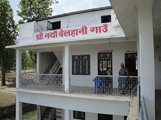
Naya Belhani is a village development committee in Nawalparasi District in the Lumbini Zone of western Nepal. At the time of the 1991 Nepal census it had a population of 9786 people living in 1795 individual households. Naya Belhani is divided into 9 wards, among which ward number 9, Arunkhola is the center of the VDC, which is considered one of an emerging business market of the Nawalparasi district. The VDC's main interesting factor is divided into two parts by Aarungkhola river and East West highway. The river is partition 6, 7 & 9 ward east region and 1,2,3,4,5,8 west region.
Kawasoti (Nepali: कावासोती) is a municipality in Nawalpur District, Gandaki Province, Nepal. It is 31 km (19 mi) west of Bharatpur and 85 km (53 mi) east of Butwal, approximately on the middle of Mahendra Highway. The Naryani River flows south of it, and the Mahabharat Range is north of it.
Gaindakot is a municipality in Nawalpur District in the Lumbini Zone of southern Nepal. It became a municipality in May 2014 by merging the existing Mukundapur, Amarapuri, and Gaindakot VDCs. It was again expanded by merging Ratanpur VDC. It is situated on the shore of Narayani River in the lap of Maula Kalika temple. So this place has a great possibility of tourism development. At the time of the 2011 Nepal census, it had a population of 58,841 and 13,623 individual households according to 2011 Nepal census. Contributed in the article by Prashant Subedi
Kalika is a municipality in Chitwan District in the Narayani Zone of southern Nepal. This municipality was established in 2015 AD by merging the existing Jutpani, Padampur, Shaktikhor and Siddhi VDCs.
Pacharauta is a municipality in Bara District in Province No. 2 of South-Eastern Nepal. It was formed in 2016 occupying current 9 sections (wards) from previous 9 former VDCs. It occupies an area of 44.01 km2 with a total population of 34,175.
Triveni is a municipality in Bajura district in the Sudurpashchim Province of Nepal. It was formed in March 2017 as decided by the Cabinet in line with the Constitution of Nepal 2015, recommended by the Local Bodies Restructuring Commission (LBRC).
This page is based on this Wikipedia article Text is available under the CC BY-SA 4.0 license; additional terms may apply. Images, videos and audio are available under their respective licenses.