Ratnanagar रत्ननगर | |
|---|---|
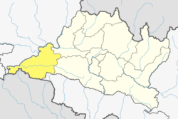
 Ratnanagar Location in Nepal  Ratnanagar Ratnanagar (Nepal) | |
| Coordinates: 27°37′N84°30′E / 27.617°N 84.500°E | |
| Country | |
| Province | Bagmati |
| District | Chitwan |
| Established | 1997 |
| Government | |
| • Mayor | Mr. Parlad Sapkota (NC) |
| • Deputy Mayor | Mr. Yadav Prasad Pathak (CPN-UML) |
| Area | |
• Total | 686 km2 (265 sq mi) |
| Elevation | 200 m (700 ft) |
| Population (2011) | |
• Total | 69,851 |
| • Density | 100/km2 (260/sq mi) |
| Time zone | UTC+5:45 (NST) |
| Postal code | 44204 [1] |
| Climate | Cwa |
| Website | www |
Ratnanagar is a municipality in Chitwan District of Bagmati Province in Nepal. It is the second biggest municipality after Bharatpur Metropolitan City that was formed in 1997 through the merger of the former Village Development Committees Old-Ratnanagar and Panchakanya. [2] It is adjacent to Chitwan National Park, and serves as a gateway to the park. Agricultural products produced from Ratnanagar includes rice, maize, mustard and vegetables. This municipality is also a major place for production of poultry products and animal husbandry. Tourism is another source of income generation for the people in Ratnanagar. People are directly or indirectly dependent in tourism industry. Ratnanagar is also concerned in environment preservation so in order to preserve and protect environment, eco-friendly electric risk-shaw has also been introduced and available in different parts of this municipality.[ citation needed ] It lies on the bank of East Rapti River.
Contents
In 2014, the former Village Development Committees Bachhayauli and Pithuwa were merged into Ratnanagar. [3]
Sauraha that lies in Ratnanagar's vicinity is a touristic hub with many hotels, resorts and shops, as it borders Chitwan National Park. There is also an Elephant Breeding Station. [4]