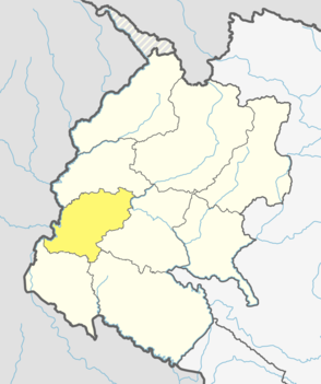
Dadeldhura district, a part of Sudurpashchim Province, is one of the seventy-seven districts of Nepal. The district, with Dadeldhura as its district headquarters, covers an area of 1,538 km2 (594 sq mi) and had a population of 126,162 in 2001 and 142,094 in 2011.

Lamjung District, a part of Gandaki Province, is one of the 77 districts of Nepal. The district, with Besisahar as its district headquarters, covers an area of 1,692 square kilometres (653 sq mi) and as of 2011 had a population of 167,724. Lamjung lies in the mid-hills of Nepal spanning tropical to trans-Himalayan geo-ecological belts, including the geographical midpoint of the country. It has mixed habitation of casts and ethnicities. It is host to probably the highest density of the Gurung ethnic population in the country.

Mahottari District, a part of Province No. 2, is one of the seventy-seven districts of Nepal. The district, with Jaleshwar as its district headquarters, covers an area of 1,002 km2 (387 sq mi) and had a population of 553,481 in 2001 and 627,580 in 2011. Its headquarters is located in Jaleshwar, a neighbouring town of the historical city of Janakpur. The name Jaleshwar means the 'God in Water'. One can find a famous temple of Lord Shiva in Water there. Jaleshwar lies at a few kilometres distance from the Nepal-India border and has a majority Maithili population. In Janakpur zone there are two districts ; mahottari and Dhanusha and both are in a distance of 1 hour.

A Village Development Committee (VDC) in Nepal was the lower administrative part of its Ministry of Federal Affairs and Local Development. Each district had several VDCs, similar to municipalities but with greater public-government interaction and administration. There were 3,157 village development committees in Nepal. Each VDC was further divided into several wards depending on the population of the district, the average being nine wards.
The 1991 Nepal census was a widespread national census conducted by the Nepal Central Bureau of Statistics.

Chaukati is a village in Sindhupalchok District in the Bagmati Zone of central Nepal. At the time of the 1991 Nepal census it had a population of 2346 and had 539 houses in the village. By 2011 the population had become 2497 in 627 households.
Maneshwara is a village in Sindhupalchok District in the Bagmati Zone of central Nepal. At the time of the 1991 Nepal census, it had a population of 3,065, and had 642 houses in the village. By 2011 the population had become 3,393 in 789 households.
Pagretar is a village development committee in Sindhupalchowk District in the Bagmati Zone of central Nepal. Kothe is a populated location within the committee area. In 1991, there were 633 houses, and at the time of the 2001 Nepal census Pagretar had a population of 3,352. By 2011, the population had become 2,952 in 762 households.
Pedku is a village in Sindhupalchok District in the Bagmati Zone of central Nepal. At the time of the 2013 Nepal census it had a population of 2284 and had 408 houses in the village. In 2011 the population was 1600 in 391 households.
Jorpati is a village and former Village Development Committee that is now part of Gokarneshwar Municipality in Kathmandu District in Province No. 3 of central Nepal. At the 2011 census it had a population of 84,567 making it one of the largest villages in the world. At the time of the 1991 Nepal census it had a population of 10,796 and had 1988 households in it.
Khadka Bhadrakali was a village in Kathmandu District in the Bagmati Zone before being incorporated into city of Budhanilkantha. At the time of the 1991 Nepal census it had a population of 5539. On recent survey in 2011, the VDC had a total population of 10,761.

Thankot is a village and former Village Development Committee that is now part of Chandragiri Municipality in Kathmandu District in Province No. 3 of central Nepal. It lies in the lap of Chandragiri Hill. According to the 2011 Nepal census it has a population of 12,047 and has 2,820 households.

Chulachuli is a rural municipality (gaunpalika) out of six rural municipality located in Ilam District of Province No. 1 of Nepal. There are a total of 10 municipalities in Ilam in which 4 are urban and 6 are rural.
Chhinnamasta is a village development committee in Saptari District in the Sagarmatha Zone of south-eastern Nepal. At the time of the 2011 Nepal census it had a population of 10,136 people living in 1,916 individual households.
Shivanagar is a town in Krishnanagar Municipality in Kapilvastu District in the Lumbini Zone of southern Nepal. The former VDC was merged to form the municipality established on 18 May 2014 Krishnanagar, Sirsihawa, Shivanagar VDCs. At the time of the 2011 Nepal census it had a population of 4,774 people living in 735 individual households.
Pathari Shanishchare (पथरी-शनिश्चरे) is a Municipality in Morang District in the Koshi Zone of south-eastern Nepal. It was formed by merging three existing village development committees i.e. Hasandaha, Pathari and Sanischare in May 2014.
Nepal conducted a widespread national census in 2011 by the Nepal Central Bureau of Statistics. Working with the 58 municipalities and the 3915 Village Development Committees at a district level, they recorded data from all the municipalities and villages of each district. The data included statistics on population size, households, sex and age distribution, place of birth, residence characteristics, literacy, marital status, religion, language spoken, caste/ethnic group, economically active population, education, number of children, employment status, and occupation.
The 2001 Nepal census was conducted by the Nepal Central Bureau of Statistics. According to the census, the population of Nepal in 2001 was 23,151,423. Working with Nepal's Village Development Committees at a district level, they recorded data from all the main towns and villages of each district of Nepal. The data included statistics on population size, households, sex and age distribution, place of birth, residence characteristics, literacy, marital status, religion, language spoken, caste/ethnic group, economically active population, education, number of children, employment status, and occupation.

Sundar Haraicha is a municipality in Morang District of Province No. 1 in Nepal that was established on 10 March 2017 by merging the former municipalities Sundar Dulari and Koshi Haraicha. At the time of the 2011 Nepal census, the localities formed had a joint population of 80,518 people living in 18,610 individual households.
Bhojpur is a neighborhood in Bhojpur Municipality which is located in Bhojpur District in Province No. 1 of Nepal. The Bhojpur Village Panchayat was established in 1962 and was renamed as Bhojpur Village development committee in 1990.

