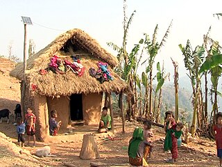
The Chepang, also known as Chewang, are an indigenous Tibeto-Burman ethnic group mainly inhabiting the rugged ridges of the Mahabharat mountain range of central Nepal.
The Gurung people, also called Tamu ("ཏམུ"), are an ethnic group from different parts of Nepal. They are one of the main Gurkha tribes. They are densely populated in Manang, Mustang, Kaski, Lamjung, Gorkha, Parbat and Syangja district. According to 2011 Census, the total population of Gurung is 522,641.

Bajura District, a part of Sudurpashchim Pradesh, is one of the seventy-seven districts of Nepal. The district, with Martadi as its district headquarters, covers an area of 2,188 km2 (845 sq mi) and had a population of 108,781 in 2001 and 134,912 in 2011. The district has nine municipalities, 9 Ilakas and 1 constituency areas. The district is situated in Longitude between 81° 10′ 20″ to 81° 48′ 27″ East and Latitude 29° 16′ 21″ to 29° 56′ 56″ North. Geographically the district is divided in three distinct regions from north to south viz. Higher Himalayan Region, Higher Mountain and mid – Mountains. The Higher Himalayan region comprises Saipal Himalayan range; High Mountain region comprises Doha Lekh and Ghori Lekh. Similarly, Mid-Mountain range comprises different ranges of mountains e.g. Badimalika Temple. The District has started from 300m to 6400m in height. The annual rainfall is about 13,433 mm and temperatures vary from 0 °C to 40 °C. The livelihood of more than 80% of the district population depends on agriculture farming, mainly small scale livestock. Due to low level of agricultural production, the majority of the households face acute food shortages for a large part of the year. According to the National Census 2011, the total population of the district is 134,912 comprising 69,106 female (51%) and 65,806 male (49%) residing in 24,908 households. Bajura district has an average population density of around 62 people per square km. The average family size is 5.4. Life expectancy of the people is 58 years. The average literacy rate is about 32%. Bajura district has a multi ethnic composition with Chhetri, Kami, Thakuri, Brahman, Damai, SarkI and Sanyashi. The common language is Nepali (96%) followed by Bhote Sherpa (0.46%) and Tamang (0.42%). Although accessibility to Bajura is very poor, this is improving rapidly. The Government strategy is mainly focused on the connection of VDC headquarters with all-weather motor able roads to SRN or District headquarters. Moreover, the DDC body of Bajura district has given higher priority on rural roads.

Chitwan District is one of 77 districts of Nepal, and takes up the southwestern corner of Bagmati Province. Bharatpur, largest city of Nepal after Kathmandu, is its administrative centre. It covers 2,238.39 km2 (864.25 sq mi), and in 2011 had a population of 579,984 people. Bharatpur is the commercial and service centre of South Central Nepal and a major destination for higher education, health care and transportation in the region. Chitwan lies in the Terai region of Nepal. It is in the drainage basin of the Gandaki River and is roughly triangular, taking that river as its meandering northwestern border, and a modest watershed border, with India, as the basis of its southern limit.

Darchula District (Nepali: दार्चुला जिल्ला pronounced [ˈdaɾt͡sula], a part of Sudurpashchim Pradesh, is one of the nine districts of province and one of seventy-seven districts of Nepal. The district, with Khalanga as its district headquarters, covers an area of 2,322 km2 and has a population of 133,274. Darchula Lies in the west-north corner of the country.

Sindhuli District, a part of Bagmati Province, is one of the seventy-Seven districts of Nepal, a landlocked country of South Asia. The district, with Sindhulimadhi Kamalamai as its district headquarters and covers an area of 2,491 km2 (962 sq mi). In 2001, it had a population of 279,821, in 2011 the population was 296,192.

Bharatpur is a city in southern central Nepal with a population of 280,502. It is the second largest city in Nepal and the district headquarters of the Chitwan District, as well as a separate metropolitan authority.

Damak, a city in eastern Nepal is one of the oldest municipalities in Jhapa District in Province No. 1 of Nepal. It is situated between the Ratuwa River in the east and the Maawa River in the west. It has Sivalik Hills in its north and ends with the intersection of Ratuwa River and Maawa River in the south. Mahendra Highway crosses this municipality nearly bisecting it. It is the largest city in Jhapa District as well as in Mechi zone with a population of 75,743 in 2011 A.D
Tandi is a city in the Ratnanagar Municipality of the Chitwan District in Nepal. It lies on the eastern side of Chitwan district, and is at the entrance point of Chitwan National Park, a major tourist destination in Nepal

Kamalamai is a municipality in Sindhuli District, in the Bagmati Pradesh of central south Nepal. At the time of the 2011 Nepal census it had a population of 39,413 people in 9,304 households. The city is located in the Sindhuli Valley of central south Nepal. The historic symbol of the valley, Sindhuli Gadhi fort, is at the peak of a hill of the Mahabharata range. The city is in the plain valley made by the Kamla River. Kamalamai Municipality is the largest municipality of Nepal according to area.
Bhiman is a town in Kamalamai Municipality Ward no. 11 in Sindhuli District in the Janakpur Zone of south-eastern Nepal. At the time of the 1991 Nepal census it had a population of 7609 people living in 1389 individual households.
Meghauli is a village and former Village Development Committee that is now part of Bharatpur Metropolitan City in Bagmati Pradesh of central Nepal.

Kawasoti (Nepali: कावासोती) is a municipality in Nawalpur District, Gandaki Pradesh, Nepal. It is 31 km west of Bharatpur and 85 km (53 mi) east of Butwal, approximately on the middle of Mahendra Highway. The Naryani River flows south of it, and the Mahabharat Range is north of it.
Jamunapur is a village in the Ratnanagar Municipality of the Chitwan District in Nepal. It lies on the eastern side of Chitwan district.
Gaindakot is a municipality in Nawalpur District in the Lumbini Zone of southern Nepal. It became a municipality in May 2014 by merging the existing Mukundapur, Amarapuri, and Gaindakot VDCs. It was again expanded by merging Ratanpur VDC. It is situated on the shore of Narayani River in the lap of Maula Kalika temple. So this place has a great possibility of tourism development. At the time of the 2011 Nepal census, it had a population of 58,841 and 13,623 individual households according to 2011 Nepal census.
Shree Chandrodaya Higher Secondary School, also known as SCHSS is an educational institute located in Benighat VDC of Dhading district in Nepal. This school also runs Chandrodaya Multiple College, also known as CMC, affiliated with Tribhuvan University offering a 4-year BBS and 4-years B.Ed. This school successfully passed it glorious 50 years in 2066 B.S. This school is around 85 km far from Kathmandu near Prithvi Highway. It is also near to Trishuli River. It is one of the oldest schools of Dhading District.

Bagmati Province is one of the seven provinces of Nepal established by the constitution of Nepal as of 20 September 2015. With Hetauda as its provincial headquarter, the province is the home to the country's capital Kathmandu, is mostly hilly and mountainous, and hosts mountain peaks including Gaurishankar, Langtang, Jugal, and Ganesh. The province covers an area of 20,300 km2 - about 13.76% of the country's total area, and has an altitude low enough to support deciduous, coniferous, and alpine forests and woodlands. Temperature varies with altitude. Rainfall takes place mainly during the summer.

Buddha Shanti Higher Secondary School is a Higher Secondary School located in Rapti Municipality, Chitwan, which was established in 2030 BS (1973) with the name Gadyauli Ma. Vi. and changed later to Buddha Shanti Higher Secondary School. Formerly it was named from the location of the school, Gadyauli, and later it has been changed into the name of Buddha and Shanti (peace). In that way Buddha Shanti Secondary School is helping the nation to get into peace from providing education for the people of the nation.

Jana Adarsha Multiple Campus is an institution of higher learning located in Rapti Municipality, Chitwan, Nepal. It was established in 2050 B. S. as non-profit seeking public campus governed and managed by local people and one of the leading community campuses in Chitwan.

