Svilaja

Last updated
Svilaja
Croatia relief map.png
Red triangle with thick white border.svg
Svilaja
The highest peak of Svilaja
Highest point
Elevation 1,508 m (4,948 ft)
Coordinates 43°48′35.12″N16°26′37.63″E / 43.8097556°N 16.4437861°E / 43.8097556; 16.4437861
Geography
Location Dalmatia, Croatia
Parent range Dinaric Alps
View from the top onto the Croatian Adriatic islands. Planina Svilaja - pogled na Jadransko more.jpg
View from the top onto the Croatian Adriatic islands.

Svilaja is a mountain range in Croatia, in the Dalmatian Hinterland.

It is part of the Dinaric Alps and stretches from the town of Sinj northwest to the Petrovo field, approximately 30 km in length. The highest peak is Svilaja or Bat at 1508 m.a.s.l. [1] Some of other northwest peaks are Jančak (1483 m), Kita (1413 m), Turjača (1340 m), and Lisina (1301 m) which closest to the town of Vrlika.

From nearest mountain cliff Veliki Kozjak (1207 m), which is northwest continuation of Svilaja, it is separated by the saddle called Lemeš (860 m) above the village of Maovice.
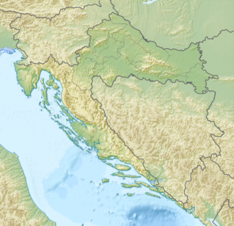
The Bat summit offers beautiful vistas of the Adriatic Sea, Peruća lake, and mountain ranges farther in Bosnia and Herzegovina. The summit is easily approachable from southeast, either by following an unpaved road from Donje Ogorje or by taking the marked trail from Orlove Stine mountain lodge. Northern parts of the mountain are deemed dangerous because of the mines left during the Croatian War of Independence. [2]


Svilaja's summit Bat (1508 m.a.s.l.). Svilaja - mountain in Croatia - towards summit Bat.jpg
Svilaja's summit Bat (1508 m.a.s.l.).


View from the top onto Peruca Lake and mountain Dinara. Svilaja mountain in Croatia - summit vista.jpg
View from the top onto Peruća Lake and mountain Dinara.

See also

Related Research Articles

<span class="mw-page-title-main">Varaždin County</span> County in northern Croatia

Varaždin County is a county in Hrvatsko Zagorje. It is named after its county seat, the city of Varaždin.

Dinara is a 100 kilometres (62 mi) long mountain range in the Dinaric Alps, located on the border of Bosnia and Herzegovina and Croatia. It has four major mountains or peaks, from north-west to south-east:

<span class="mw-page-title-main">Velebit</span>

Velebit is the largest, though not the highest, mountain range in Croatia. The range forms a part of the Dinaric Alps and is located along the Adriatic coast, separating it from Lika in the interior. Velebit begins in the northwest near Senj with the Vratnik mountain pass and ends 145 km to the southeast near the source of the Zrmanja river northwest of Knin.

<span class="mw-page-title-main">Učka</span>

The Učka is a mountain range in western Croatia. It rises behind the Opatija riviera, on the eastern side of the Istrian peninsula.

<span class="mw-page-title-main">Cetina</span> River in Croatia

Cetina is a river in southern Croatia. It has a length of 101 km (63 mi) and its basin covers an area of 1,463 km2 (565 sq mi). From its source, Cetina descends from an elevation of 385 metres (1,263 ft) above sea level to the Adriatic Sea. It is the most water-rich river in Dalmatia.

<span class="mw-page-title-main">Kamešnica (mountain)</span> Mountain in Croatia and Bosnia and Herzegovina

Kamešnica is a mountain in the Dinarides, located in the southern end of the Dinara Mountain Range on the border between Bosnia and Herzegovina and Croatia (Dalmatia). It is 1,851 metres (6,073 ft) tall and stretches from the northwest white road pass Vaganj (1173 m) to the Buško Blato artificial lake. The tallest peak is Konj (Horse) 1,855 metres (6,086 ft), which is located in Bosnia and Herzegovina and offer views of both sides of the border. In clear weather, it is possible to see the most remote areas of the Adriatic Sea and its islands. The vicinity's many trails and caves make it popular with hikers.

<span class="mw-page-title-main">Biokovo</span> Mountain range in Croatia

Biokovo is the second-highest mountain range in Croatia, located along the Dalmatian coast of the Adriatic Sea, between the rivers of Cetina and Neretva.

<span class="mw-page-title-main">Medvednica</span> Mountain in central Croatia

Medvednica is a mountain in central Croatia, just north of Zagreb, and marking the southern border of the historic region of Zagorje. The highest peak, at 1,035 m (3,396 ft) is Sljeme. Most of the area of Medvednica is a nature park, a type of preservation lesser than a national park. The area of the park is 228.26 km2 (88.1 sq mi) and about 63% is covered with forest. During Miocene and Pliocene, the mountain was an island within the Pannonian Sea.

Mala Kapela is a mountain range in Croatia, part of the Dinaric Alps. It stretches in the direction northwest–southeast, and it extends from the mountain pass called "Kapela" or "Vrh Kapele", that separates it from Velika Kapela, down to the mountain pass that connects Otočac and Plitvice and from then on to Plješevica. The highest peak is Seliški vrh at 1279 meters, located in the southern part of the mountain. The Mala Kapela Tunnel goes through the northern section of the mountain.

<span class="mw-page-title-main">Plješivica</span> Mountain of the Dinaric Alps in Croatia

Plješivica or Plješevica, also called Lička Plješevica, is a mountain in Croatia and on the border with Bosnia and Herzegovina, part of the Dinaric Alps. It stretches in the direction north–south, and it extends from the mountain pass that separates it from Mala Kapela, along the Krbava field to the west and the Una River canyon to the east, and ending near Gračac where it touches on Velebit.

<span class="mw-page-title-main">Mosor</span> Mountain range in Croatia

Mosor, or Mount Mosor, is a mountain range in Croatia located near the city of Split on the Adriatic coast. It belongs to Dinaric Alps, and it stretches from the pass of Klis in the northwest to the Cetina River in the southeast.

<span class="mw-page-title-main">Trekufiri</span> Forms a boundary between Albania, Kosovo and Montenegro

Trekufiri, is a mountain located in the Albanian Alps and the Bogićevica range. Perched at 2,366 m (7,762 ft) above sea level, its summit marks the border where Albania, Kosovo, and Montenegro intersect. The height of the three-country point varies, with Albanian maps recording the mountain's height as 2,354 m (7,723 ft) above sea level while official Yugoslavian sources state it as 2366 m.

The Petrovo Polje is a karstic field in the northern part of Dalmatian Hinterland in Croatia.

<span class="mw-page-title-main">Peruća Lake</span> Artificial lake in Split-Dalmatia County, Dalmatia

Lake Peruća or Peruča is the second largest artificial lake in Croatia, after Lake Dubrava. It is located in the Split-Dalmatia County.

<span class="mw-page-title-main">Velika Kapela</span>

The Velika Kapela is a large mountain range in the east of Gorski Kotar, Croatia.

<span class="mw-page-title-main">Risnjak</span>

Risnjak is a mountain in the Risnjak National Park, in Gorski Kotar, Croatia. It belongs to the Dinaric Alps mountain range. The name of the massif probably comes from ris, the Croatian word for lynx. Another interpretation suggests that it comes from the local word risje, which is a name for a type of grass.

<span class="mw-page-title-main">Prvić (Krk)</span>

Prvić is an uninhabited island in the Croatian part of the Adriatic Sea, located in the Kvarner Gulf. It is the largest of the so-called Senj Islands, a group of small islands and islets located off the coast of the mainland city of Senj, lying between the larger islands of Krk and Rab. Other significant islands in the Senj group are Sveti Grgur and Goli Otok, along with a number of islets and rocks, which are all uninhabited. Prvić has an area is 12.76 square kilometres (4.93 sq mi), which makes it the largest uninhabited Croatian island and 30th largest overall.

Bilogora is a low mountainous range in Central Croatia. It consists of a series of hills and small plains some 80 kilometres in length stretching in the direction northwest-southeast, along the southwest part of the Podravina region. The highest peak is called Rajčevica, located in the north of the mountain.

<span class="mw-page-title-main">Bitoraj</span>

Bitoraj is a mountain in Gorski Kotar, Croatia. It is variously defined as a standalone mountain or as group of peaks of Velika Kapela. The highest peaks on it are Burni Bitoraj at 1,386 m.a.s.l., Velika Javornica at 1374 m.a.s.l., and the eponymous Bitoraj peak at 1,140 m.a.s.l.

References

  1. Ostroški, Ljiljana, ed. (December 2015). Statistički ljetopis Republike Hrvatske 2015 [Statistical Yearbook of the Republic of Croatia 2015](PDF). Statistical Yearbook of the Republic of Croatia (in Croatian and English). Vol. 47. Zagreb: Croatian Bureau of Statistics. p. 49. ISSN   1333-3305 . Retrieved 27 December 2015.
  2. "Svilaja – vrh Svilaja". hps.hr (in Croatian). Croatian Mountaineering Association . Retrieved 2 January 2016.