
Zalaegerszeg is the administrative center of Zala county in western Hungary.

Zala is an administrative county in south-western Hungary. It is named after the Zala River. It shares borders with Croatia and Slovenia and the Hungarian counties Vas, Veszprém and Somogy. The seat of Zala County is Zalaegerszeg Its area is 3,784 square kilometres (1,461 sq mi). Lake Balaton lies partly in the county.

Transdanubia is a traditional region of Hungary. It is also referred to as Hungarian Pannonia, or Pannonian Hungary.

Zala was an administrative county (comitatus) of the Kingdom of Hungary, bordered by the river Drave to the south. The territory of the former county is now divided between Hungary, Croatia and Slovenia. The capital of the county was Zalaegerszeg.

Bocfölde is a village in Western Hungary. It has a growing commuter community that works in Zalaegerszeg, the county seat and regional industrial center that is located about 6 km (4 mi) to the North.

Hévíz is a spa town in Zala County, Hungary, about 8 kilometres from the city of Keszthely.
Pókaszepetk is a village in Zala County, Hungary.
Sand is a village in Zala County, Hungary. It is a very small agricultural town, located on gently rolling hills. There is an Evangelical church and a Catholic church near the center of town, and there are memorials to those who served in both world wars nearby. Sand is close to the towns of Csurgó, Iharosberény, and Liszó, and the largest town nearby is Nagykanizsa.

Zala is a village in Somogy County, Hungary.

Telekes is a village in Vas County, Hungary.
Őriszentpéter is a town in Vas County, Hungary.

Zalaháshágy is a village in Zala County, in Hungary.
Böde is a village in Zala County, in Hungary. In its vicinity can be found the church of Böde-Zalaszentmihályfa from the Árpád dynasty age.

Türje is a village in Zala County, Hungary. The village is located in the North-Eastern part of Zala County, near the great turn of Zala river, between the Keszthelyi Mountains and Kemeneshát Hills. The village has a railway station on the line of the Boba–Őrihodos railway which is connecting the two local centers of Zalaegerszeg and Celldömölk. It is also connected with Zalaszentgrót by bus.
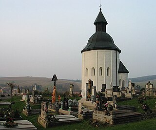
Kallósd is a village in Zala County, Hungary. The famous church of the settlement, the Saint Anne Church in Kallósd, is being one of the few round churches from the Árpád Age, and it listed among the most significant monuments of Hungary.

Várvölgy is a village in Keszthely District, in Zala County, Hungary. Its name translates to Castlevalley; Vár (castle) + völgy (valley).
Vindornyaszőlős is a village in Zala County, Hungary. It features a beautiful basalt mine nearby and a modest church. It is a village situated perfectly on the road between Keszthely and Sümeg, making it easier to access both cities. It is also quite near to Karmacs, so parents can send their children to the kindergarten there.
Vöckönd is a village in Zala County, Hungary.
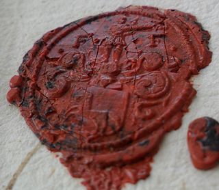
Ferenc Farkas de Boldogfa was a Hungarian nobleman, jurist, landowner, and vice-ispán of the county of Zala between 1761 and 1769.

The 2nd constituency of Zala County is one of the single member constituencies of the National Assembly, the national legislature of Hungary. The constituency standard abbreviation: Zala 02. OEVK.


