Tahoe Park, Sacramento, California

Last updated
Tahoe Park
59th Street Gateway to Tahoe Park Sacramento neighborhood.jpg
The 59th & T Street gateway to Tahoe Park
Location map Sacramento.png
Red pog.svg
Tahoe Park
Location within Sacramento
USA California location map.svg
Red pog.svg
Tahoe Park
Tahoe Park (California)
Usa edcp location map.svg
Red pog.svg
Tahoe Park
Tahoe Park (the United States)
Coordinates: 38°32′37″N121°26′07″W / 38.543611°N 121.435278°W / 38.543611; -121.435278
Country United States
State California
County Sacramento
City Sacramento
Time zone UTC−8 (Pacific)
  Summer (DST) UTC−7 (PDT)
Zip Codes
95817 and 95820

Tahoe Park is a neighborhood located within the city of Sacramento, California.

Contents

The name "Tahoe Park" is generally used to refer to several official and unofficial neighborhoods that surround Tahoe Park proper, including Tahoe Park East, Tahoe Park South, Tahoe Terrace, and West Tahoe Park.

Geography

Location

The neighborhood of Tahoe Park is centrally located in Sacramento, immediately south of U.S. Route 50 at 59th Street.

The area is less than 1-mile (1.6 km) southwest of California State University, Sacramento, less than 1-mile (1.6 km) east of the UC Davis Medical Center and approximately 4 miles (6.4 km) southeast of downtown Sacramento.

Areas

Tahoe Park

Map of Tahoe Park neighborhoods relative to the city of Sacramento and notable landmarks Map of Tahoe Park Neighborhoods Relative to Sacramento.jpg
Map of Tahoe Park neighborhoods relative to the city of Sacramento and notable landmarks

Tahoe Park is an officially recognized neighborhood in Area 3 of the City of Sacramento. It is bordered by Highway 50 and Broadway to the north, 14th Avenue to the south, 53rd and 57th Streets to the west, and 65th Street to the east. [1]

The section of Tahoe Park that is north of Broadway is informally referred to as "Tahoe Terrace"; the name has its origins in a subdivision established in 1945. [2]

Tahoe Park East

Tahoe Park East is an officially recognized neighborhood in Area 3 of the City of Sacramento. It is bordered by 65th Street to the west, Highway 50 and the Tahoe Tallac Little League Park to the north, Business Drive to the east, and 14th Avenue to the south. [1]

Tahoe Park South

Tahoe Park South is an officially recognized neighborhood in Area 3 of the City of Sacramento. It is bordered by 14th Avenue to the north, 21st Avenue to the south, 58th Street to the west, and the 65th Street Expressway to the east. [1]

Many long-time residents refer to Tahoe Park South as "Tallac Village" [ citation needed ]—most likely due to the presence of the Tallac Village Shopping Center on its northern boundary. However, Tallac Village is an officially recognized neighborhood immediately south of Tahoe Park South, between 21st Avenue and Fruitridge Road. [1] [3]

West Tahoe Park

West Tahoe Park is an officially recognized neighborhood in Area 3 of the City of Sacramento. It is bordered by Broadway to the north, 14th Avenue to the south, Stockton Boulevard to the west and 53rd Street to the east. [1]

Prior to 2005, the area west of 53rd Street was officially recognized as a part of the neighborhood of Tahoe Park proper. However, the term "West Tahoe Park" was commonly used to describe the area which, at that time, was in Sacramento's 5th district. In approximately 2005, the West Tahoe Park neighborhood was officially recognized as a separate neighborhood by the city of Sacramento. During redistricting that occurred in 2011, West Tahoe Park joined the rest of the Tahoe Park neighborhoods in District 6. By and large, this area of the Tahoe Park neighborhood is located closest to the UC Davis Medical Center.[ citation needed ]

Tahoe Terrace

Tahoe Terrace is a name used to refer to the section of Tahoe Park north of Broadway. The name comes from the 1945-era subdivision established north of Broadway, between 61st and 63rd Streets. [2]

Tahoe Terrace was a part of Sacramento's old "Area 1" that included the nearby neighborhoods of East Sacramento and Elmhurst. Tahoe Terrace can also be distinguished from the rest of Tahoe Park by its postal code, 95817; all other areas of Tahoe Park proper are located within the 95820 postal code.[ citation needed ]

Parks

Tahoe Park

Tahoe Park Tahoe Park sign at 60th Street.jpg
Tahoe Park

The area is named for the park in the heart of the neighborhood. Tahoe Park is a 19-acre (77,000 m2) recreational facility located in the Tahoe Park neighborhood of Sacramento, California. The park is largely contained between 8th Avenue to the north, 11th Avenue to the south, 59th Street to the west, and 61st Street to the east. [1]

The park contains many popular amenities, including a swimming pool, a wading pool, playgrounds for children and toddlers, several barbecue facilities, and playing fields for softball, soccer, basketball, volleyball, and horseshoes. [4]

The park has received many updates in the 1990s and 2000s, including street lights, a jogging trail, upgraded picnic areas, and fitness stations.[ citation needed ]

Mae Fong Park

Mae Fong Park is a 3.25-acre (13,200 m2) park in the Tahoe Park East neighborhood. It was officially opened in October 2010 using the temporary/working name of "Redding Avenue Park", but an effort to rename it began almost immediately, as Mae Lillian Fong, a longtime businesswoman and community leader who co-founded and operated a printing company on a nearby parcel, had recently died. [5] The City of Sacramento officially named the park after her in August 2011. [6]

History

Early years

In the early 1900s, the area southeast of the old California State Fairgrounds (now the UC Davis Medical Center campus) was sparsely populated farmland; most residential neighborhoods were west of Upper Stockton Road (now Stockton Boulevard).[ citation needed ]

In 1911, Sacramento made its first annexation. Tripling in size from its original grid area, the city expanded its city limits southward to Sutterville Road and 14th Avenue, and eastward to Elvas Avenue and 65th Street. This placed the area now known as Tahoe Park (proper) at the city's far southeastern corner just south of Folsom Boulevard. [7] [8]

By 1926, Folsom Boulevard was a part of the newly established US Route 50, a highway that continues eastward in California from Sacramento to Lake Tahoe. [9] In 1931, to serve the needs of the residents, a four-room elementary school was built at 5932 5th Avenue; it was named "Tahoe School". Seven years later, in 1938, the school address was modified to reflect the change of the street's name to "Broadway". Records from 1939 identify new tract homes under construction near the intersection of 55th Street and 8th Avenue. [10]

Post-World War II growth

With three military bases in the area (Mather Field, McClellan Field, and the Sacramento Signal Depot), Sacramento was a popular place for service men and women to live. The area experienced a housing boom during and after World War II; a large number of homes were financed by the G.I. Bill. [11]

The area grew rapidly during this time. In 1946, the City of Sacramento purchased 19 acres (77,000 m2) of land immediately south of the Tahoe Elementary School for use as a recreational facility; the park was named "Tahoe Park" after the school. [10] The same year, All Hallows Parish moved from a storefront on Stockton Boulevard to its current location at 55th Street and 14th Avenue. [11]

In 1948, Sacramento annexed a large area southeast of 14th Avenue and Stockton Boulevard, including the area now known as Tahoe Park South. [7] The same year, educational options grew in Tahoe Park to meet the needs of area families. The Tahoe Elementary School campus was expanded with new buildings, and the All Hallows Parrish Catholic School (now John Paul II Catholic School) was opened. [10]

In 1958, the neighborhood's youngest area—Tahoe Park East—was added to Sacramento when the city annexed an area northeast of 14th Avenue and 65th Street. [7]

1970s/1980s decline

The area experienced economic changes from the 1960s through the 1980s. Due to several factors—including the rerouting of Highway 99 away from Stockton Boulevard in 1962, the relocation of the state fairgrounds in 1968, and the establishment of new suburbs further away from the city's core—the area entered a state of decline in the 1970s and 1980s. [12]

1990s to present

In 1990, residents created the Tahoe Park Neighborhood Association (TPNA), a non-profit organization focused on community improvement. [13] The organization worked on behalf of many community concerns, including traffic, [14] [15] absentee landlords, [16] and crime. [17]

By 1995, the community's activism and civic participation had created a noticeable impact on the neighborhood, resulting in a resurgence for the area. [18] Beginning in the 2000s, additional organizations arose to represent the interests of area residents. [19] First-time home buyers and real estate professionals view Tahoe Park as a desirable alternative to pricier neighborhoods such as East Sacramento and Midtown. [20]

Demographics

Demographic data including population density, median household income, median rent, the number and gender of residents, median age of residents, average estimated value of detached houses, most popular occupation, and ethnicity are available for Tahoe Park and its adjoining neighborhoods.

[21] [22] Tahoe Park Demographic Stats based on 2016 data
NeighborhoodArea in square milesPopulationPopulation Density of people per square mileMedian Annual Household IncomeMedian AgeMost popular occupationEducational AttainmentEthnic make-up
MaleFemaleMaleFemaleNo HS diplomaHS diplomaHigher DegreeWhiteHispanicBlackAsianMixedOther
Tahoe Park proper0.6133,2945,370$55,80338.644.2ConstructionSales8.1%50.6%41.3%66.2%18.5%5.3%5.7%4.2%0.2%
Tahoe Park East0.3302,6247,948$61,04937.040.9SalesService Industry7.9%46.8%45.3%41.4%29.6%13.9%12.0%2.7%0.3%
Tahoe Park South0.2881,6225,627$47,03935.536.2SalesSales13.3%44.9%41.9%67.0%25.5%1.9%1.2%3.8%0.5%
West Tahoe Park0.2029754,829$50,30238.149.2-8.5%56.5%35.0%45.1%19.4%15.8%4.1%8.3%7.2%

Events

In 1994, the Folklore De Sacramento performed a traditional Mexican dance celebrating the Colonial Heights library's 5-year anniversary; the closest library to the Tahoe Park neighborhood. [10] :60

Politics

Government

Tahoe Park neighborhoods are represented by the following government districts:

Representatives past and present

In the late 1980s, Tahoe Park began to produce many of Sacramento's government officials; U.S. Federal District Judge Kim Mueller, former California State Senate President Pro Tem and current Mayor Darrell Steinberg, California Insurance Commissioner Dave Jones, Assembly Member Kevin McCarty, and Council Member Eric Guerra established their political careers on the Sacramento City Council while residents of Tahoe Park. [27] [28]

Tahoe Park Neighborhood Association

The mission of the Tahoe Park Neighborhood Association is to improve the quality of life in the Tahoe Park Neighborhood, to serve as a liaison between neighborhood and local government and to provide a non-partisan forum for discussion of neighborhood concerns of mutual interest. TPNA holds public board meetings every first Monday of the month at 7 pm at the Tahoe Community Center located at 5959 8th Avenue, Sacramento. [29]

https://www.neighborhoodscout.com/ca/sacramento/14th-stockton

http://www.city-data.com/nbmaps/neigh-Sacramento-California.html

Related Research Articles

<span class="mw-page-title-main">Sacramento, California</span> Capital city of California, United States

Sacramento is the capital city of the U.S. state of California and the seat and largest city of Sacramento County. Located at the confluence of the Sacramento and American River in Northern California's Sacramento Valley, Sacramento's 2020 population of 524,943 makes it the sixth-largest city in California and the ninth-largest capital in the United States. Sacramento is the seat of the California Legislature and the Governor of California, making it the state's political center and a hub for lobbying and think tanks. It features the California State Capitol Museum.

<span class="mw-page-title-main">California State Route 160</span> Highway in California

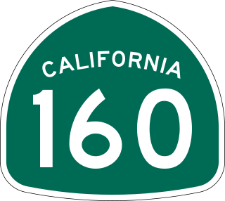
State Route 160 is a state highway in the U.S. state of California consisting of two sections. The longer, southern, section is a scenic highway through the alluvial plain of the Sacramento River, linking SR 4 in Antioch with Sacramento via the Antioch Bridge. The northern section, separated from the southern by Sacramento city streets, is the North Sacramento Freeway, running from the 16th Street Bridge over the American River to Interstate 80 Business towards Roseville.

<span class="mw-page-title-main">Pico-Union, Los Angeles</span> Neighborhood of Los Angeles in California, United States of America

Pico-Union is a neighborhood in Central Los Angeles, California. The name "Pico-Union" refers to the neighborhood that surrounds the intersection of Pico Boulevard and Union Avenue. Located immediately west of Downtown Los Angeles, it is home to over 40,000 residents.

<span class="mw-page-title-main">Central Freeway</span> Elevated freeway in San Francisco, California, United States

The Central Freeway is a roughly one-mile (1.5 km) elevated freeway in San Francisco, California, United States, connecting the Bayshore/James Lick Freeway with the Hayes Valley neighborhood. Most of the freeway is part of US 101, which exits at Mission Street on the way to the Golden Gate Bridge. The freeway once extended north to Turk Street, and was once proposed to form part of a complete loop around downtown, but was damaged in the 1989 Loma Prieta earthquake and has been replaced with the surface-level Octavia Boulevard north of Market Street.

<span class="mw-page-title-main">North University Park, Los Angeles</span> Neighborhood of Los Angeles in California, United States of America

North University Park is a neighborhood in Los Angeles, California. Located just north of the University of Southern California, North University Park contains two historic districts that are both on the National Register of Historic Places: The North University Park Historic District and the Menlo Avenue–West Twenty-ninth Street Historic District.

The Alhambra Theatre opened in 1927 and was the preeminent movie house in the greater Sacramento area for many years. It was designed in the Moorish style of the great Spanish cities and included a large courtyard and fountain. The interior was lavishly appointed with red carpet, gold trim, and large pillars. It was located directly beyond the eastern terminus of K Street at 1025 Thirty-First Street, now Alhambra Boulevard, Sacramento, California 95816, in the East Sacramento neighborhood.

Elmhurst is a historic residential neighborhood located in the eastern part of Sacramento, California. Elmhurst is known for its large elm, ash, and oak trees that provide shady canopy for the neighborhood.

<span class="mw-page-title-main">U.S. Route 50 in California</span> Highway in California

U.S. Route 50 (US 50) is a transcontinental United States Numbered Highway, stretching from West Sacramento, California, in the west to Ocean City, Maryland, in the east. The California portion of US 50 runs east from Interstate 80 (I-80) in West Sacramento to the Nevada state line in South Lake Tahoe. A portion in Sacramento also has the unsigned designation of Interstate 305. The western half of the highway in California is a four-or-more-lane divided highway, mostly built to freeway standards, and known as the El Dorado Freeway outside of downtown Sacramento. US 50 continues as an undivided highway with one eastbound lane and two westbound lanes until the route reaches the canyon of the South Fork American River at Riverton. The remainder of the highway, which climbs along and out of the canyon, then over the Sierra Nevada at Echo Summit and into the Lake Tahoe Basin, is primarily a two-lane road.

<span class="mw-page-title-main">Street system of Denver</span>

The oldest part of Denver, Colorado, now the neighborhoods of Auraria Campus, LoDo, much of downtown, and Five Points, is laid out on a grid plan that is oriented diagonal to the four cardinal directions. The rest of the city, including the eastern part of downtown, is laid out primarily on a grid oriented to the cardinal directions. In this larger grid, from east to west, there are generally 16 city blocks per mile, except between Zuni Street and Lowell Boulevard in west Denver. From north to south, there are typically eight blocks per mile, although there are many areas with more blocks per mile. Addresses follow a decimal system, with addresses advancing by one hundred at each cross street.

East Sacramento is a neighborhood in Sacramento, California, United States, that is east of downtown and midtown. East Sacramento is bounded by U.S. Route 50 to the south, Business Loop 80 to the west and north, Elvas Avenue to the northeast and east, and California State University, Sacramento and the American River to the southeast. East Sacramento residential development began in the 1890s, and the area was annexed into Sacramento in 1911. East Sacramento was also home to the Alhambra Theatre. East Sacramento also includes McKinley Park and the "Fabulous Forties" neighborhood.

<span class="mw-page-title-main">Sacramento City Council</span> City council; lawmaking body of the Sacramento City, USA

The Sacramento City Council is the governing body of the city of Sacramento, California. The council holds regular meetings at Sacramento City Hall on Tuesdays at 6:00 pm, with exceptions for holidays and other special cases.

<span class="mw-page-title-main">Oak Park, Sacramento, California</span> Neighborhood of Sacramento in California, United States

Oak Park is a neighborhood in Sacramento, California. The McGeorge School of Law, University of the Pacific Sacramento Campus, Sacramento High School, and Christian Brothers High School are located in this neighborhood.

4th Avenue/Wayne Hultgren station is an at-grade light rail station on the Blue Line of the Sacramento RT Light Rail system operated by the Sacramento Regional Transit District. The station is located in an exclusive right-of-way alongside the Union Pacific Railroad's Sacramento Subdivision at its intersection with 4th Avenue, after which the station is named, in the city of Sacramento, California.

Midtown Sacramento is a historical district and neighborhood just east of Downtown Sacramento. Officially, Midtown's borders are R Street on the South, J Street on the North, 16th Street on the West and 30th Street on the East. However, the streets in Sacramento's original "grid" that are east of 16th Street cover the area commonly called "Midtown". This more general definition covers an area bounded by Broadway on the South, C street and the Southern Pacific rail lines on the North, 16th Street on the West and Alhambra Boulevard on the East.

North Sacramento is a well-established community that is part of the city of Sacramento, California. It was a city from its incorporation in 1924 until it was merged in 1964 into the City of Sacramento. Incorporation was led by the North Sacramento Chamber of Commerce, incorporated the year before, in 1923.

Boulevard Park is a historic residential neighborhood in Sacramento, California. It is also the Boulevard Park Historic District, listed on the National Register of Historic Places.

Colonial Heights is a neighborhood in the southeast part of the City of Sacramento, California. An older neighborhood, established in 1910, it makes a fairly typical example of a turn of the century "Streetcar Suburb". Before cars and buses took over for transportation needs, it was built around the convenient and efficient electric streetcar service provided by the Central California Traction Company.

<span class="mw-page-title-main">Transportation in the Sacramento metropolitan area</span> Complex multi-modal network moving people and goods in the region of California’s state capital

Transportation in the Sacramento metropolitan area consists of a variety of different modes of travel in El Dorado County, Placer County, Sacramento County, and Yolo County, which are the four counties that comprise the Sacramento metropolitan area.

<span class="mw-page-title-main">Magnolia Square, Los Angeles</span> Neighborhood of Los Angeles in California, United States

Magnolia Square is a neighborhood in Los Angeles, California.

References

  1. 1 2 3 4 5 6 City of Sacramento: Neighborhoods (PDF) (Map) (November 2010 ed.). City of Sacramento. Archived from the original (PDF) on 2013-10-28. Retrieved 2012-02-06.
  2. 1 2 "Planners Recommend Subdivision Rezoning". Sacramento Bee. The McClatchy Company. June 7, 1945. p. 22.
  3. "Tallac Village Neighborhood Association". Neighborhood Services Division. City of Sacramento. Retrieved 2014-10-06.
  4. "Tahoe Park Master Plan" (PDF). City of Sacramento. City of Sacramento, Department of Parks and Recreation. May 24, 2005. Retrieved 2014-10-06.
  5. Naming Redding Avenue Park (Park Site FB1) "Mae Fong Park" (Report). City of Sacramento. August 23, 2011. Retrieved 2014-10-04.
  6. Sacramento City Council Resolution 2001-493 (Report). City of Sacramento. August 23, 2011. Retrieved 2014-10-04.
  7. 1 2 3 City of Sacramento: Historical Growth by Annexation (PDF) (Map). City of Sacramento. September 2007. Archived from the original (PDF) on 2008-05-08. Retrieved 2008-07-17.
  8. City of Sacramento: Historical Growth by Annexation (PDF) (Map). City of Sacramento. April 2011. Archived from the original (PDF) on 2012-02-08. Retrieved 2012-02-06.
  9. "californiahighways.org: US Highway 50" . Retrieved January 10, 2022.
  10. 1 2 3 4 Sacramento Archives and Museum Collection Center (2008). Sacramento's Elmhurst, Tahoe Park and Colonial Heights. Charleston, South Carolina: Arcadia. pp. 27–60. ISBN   978-0-7385-5590-4.
  11. 1 2 "All Hallows Roman Catholic Community: History: All Hallows". 2008. Retrieved 2014-10-06.
  12. "History of Oak Park" (PDF). City of Sacramento. pp. 14–15. Archived from the original (PDF) on 2008-05-08. Retrieved 2008-06-03.
  13. "Articles of Incorporation of Tahoe Park Neighborhood Association". Business Entities. California Secretary of State. January 15, 1991. Retrieved January 10, 2022. ...of the specific purposes of this corporation. Dated July 25, 1990
  14. "Traffic study for Tahoe Park". Sacramento Bee. The McClatchy Company. February 20, 1992. p. N3. Archived from the original on July 12, 2008. Retrieved 2014-10-02.
  15. "Complaints on traffic plans surprise UMC officials". Sacramento Bee. The McClatchy Company. December 10, 1992. p. N7. Archived from the original on July 12, 2008. Retrieved 2014-10-02.
  16. "Proposal targets remiss landlords". Sacramento Bee. The McClatchy Company. September 16, 1993. p. N3. Archived from the original on July 12, 2008. Retrieved 2014-10-02.
  17. "Drugs, gangs, thefts - Police get earful at forum". Sacramento Bee. The McClatchy Company. April 2, 1993. p. B4. Archived from the original on July 12, 2008. Retrieved 2014-10-02.
  18. "Bouncing back in Tahoe Park". Sacramento Bee. The McClatchy Company. April 16, 1995. p. B1. Archived from the original on July 12, 2008. Retrieved 2010-03-08.
  19. "Neighborhood Associations Search Results for Council District 6". City of Sacramento Neighborhood Services Division. Retrieved 2014-10-02.
  20. "Tahoe Park: Neighborhood's a hidden jewel with friendly vibe". Sacramento Bee. The McClatchy Company. Jan 8, 2013. Retrieved 2014-06-14.
  21. "Sacramento, CA Neighborhood Map - Income, House Prices, Occupations - list of neighborhoods". www.city-data.com. Retrieved 2018-07-16.
  22. "Overview of Tahoe Park East, Sacramento, California (Neighborhood) - Statistical Atlas". statisticalatlas.com. Retrieved 2018-07-16.
  23. "Council District 6, City of Sacramento". March 2016.
  24. "Sacramento County 1st Supervisor District" (PDF). Retrieved January 10, 2022.
  25. "Statewide Database". UC Regents. Retrieved February 1, 2015.
  26. "California's 6th Congressional District - Representatives & District Map". Civic Impulse, LLC. Retrieved March 8, 2013.
  27. "Two get jump in council race; The District 6 seat has been a springboard for judges, legislators". Sacramento Bee. The McClatchy Company. February 23, 2003. p. B1. Archived from the original on July 12, 2008. Retrieved 2010-03-06.
  28. "New Magistrate Judge Took Unconventional Path to Federal Bench". Sacramento County Bar Association. 2003. Retrieved 2012-02-06.
  29. "About TPNA". Tahoe Park Neighborhood Association. Retrieved 2019-05-13.