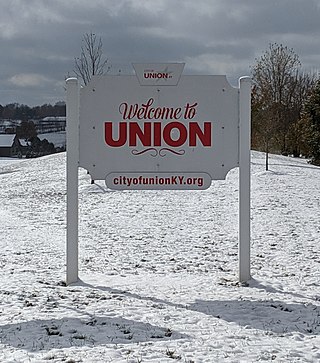
Union is a home-rule-class city in Boone County, Kentucky, United States. The population was 7,416 as of the 2020 United States Census. The area was rural until residential growth in the 1990s and 2000s. Union is located 17 miles (27 km) southwest of Cincinnati, Ohio.
A census-designated place (CDP) is a concentration of population defined by the United States Census Bureau for statistical purposes only.
Tanner is an unincorporated community in central southern Limestone County, Alabama, United States, and is included in the Huntsville-Decatur Combined Statistical Area. It lies nine miles north of the city of Decatur and the Tennessee River, and four miles south of the city of Athens.

Petersburg is a rural unincorporated community and census-designated place (CDP) in Boone County, Kentucky, United States. As of the 2020 census Petersburg, along with its surrounding areas that use the 41080 zip code, had a population of 500. It is located 25 miles away from Cincinnati, Ohio.

KXGL is a commercial radio station located in Amarillo, Texas. KXGL airs a classic hits music format branded as "The Eagle". Under ownership of Alpha Media, studios are located in southwest Amarillo, and its transmitter is north of the city in unincorporated Potter County.
The following is a set–index article, providing a list of lists, for the cities, towns and villages within the jurisdictional United States. It is divided, alphabetically, according to the state, territory, or district name in which they are located.

Mouthcard is a small unincorporated community in Pike County, Kentucky, United States near the Virginia state line. It lies on the Levisa Fork River of the Big Sandy River in the heart of the Appalachians. U.S. Route 460 runs through Mouthcard to meet U.S. Route 23 in Pikeville, the county seat.
Hamilton is an unincorporated community in Boone County, Kentucky, United States. It is situated at Latitude 38.88333, Longitude -84.78167, in the southern part of the county on the Ohio River; it is about a mile north of the mouth of Big Bone Creek. It was established in 1835, being incorporated by the Kentucky Legislature as the Town of Landing. The plat laid out by Joel Hamilton and George McGlasson. The original trustees were: William Winston Jr., George McGlasson, Joel Hamilton, Henry L. Rose, James Dukan. The same year the Legislature provided a Constable for the town.
Stone is an unincorporated community and coal town in Pike County, Kentucky, United States. It was established in 1912. Stone was a mining community named for Galen Stone, head of the Pond Creek Coal Company which was based in Stone. In 1922 the Pond Creek Coal Company was sold to Fordson Coal Company, which was a subsidiary of Ford Motor Company. In 1936 Fordson sold the mine at Stone to Eastern Coal Company.
Elkfork is an unincorporated community in Morgan County, Kentucky, United States. It lies along Route 172, northeast of the city of West Liberty, the county seat of Morgan County. Its elevation reaches up to 856 feet (261 m). Although the area is unincorporated, Elkfork contains a post office, with the ZIP code of 41421.

Rineyville is an unincorporated community and census-designated place (CDP) in Hardin County, Kentucky, United States. It is located 7 miles (11 km) northwest of Elizabethtown. The population was 3,039 as of the 2020 Census. The Paducah and Louisville Railway runs north and south through the community.
Leander is an unincorporated community in Johnson County, Kentucky, United States. It is part of the 41222 ZIP Code Tabulation Area, which includes the nearby community of Hager Hill. Leander is located at an elevation of 669 feet.
Winifred is an unincorporated community in Johnson County, Kentucky, United States. It is located at an elevation of 840 feet. Winifred is located in the ZIP Code Tabulation Area for ZIP code 41219, which includes the nearby community of Flat Gap.
Wilmer is an unincorporated community in Mobile County, Alabama, United States.
Tanner is an unincorporated community in Scott County, in the U.S. state of Missouri.
Tanner is an unincorporated community in Gilmer County, West Virginia, United States.
Tanner is an unincorporated community in Center Township, Greene County, Indiana, United States.
Stanville is an unincorporated community in Floyd County, Kentucky, United States.
Tanner Williams is an unincorporated community in Mobile County, Alabama, United States.


