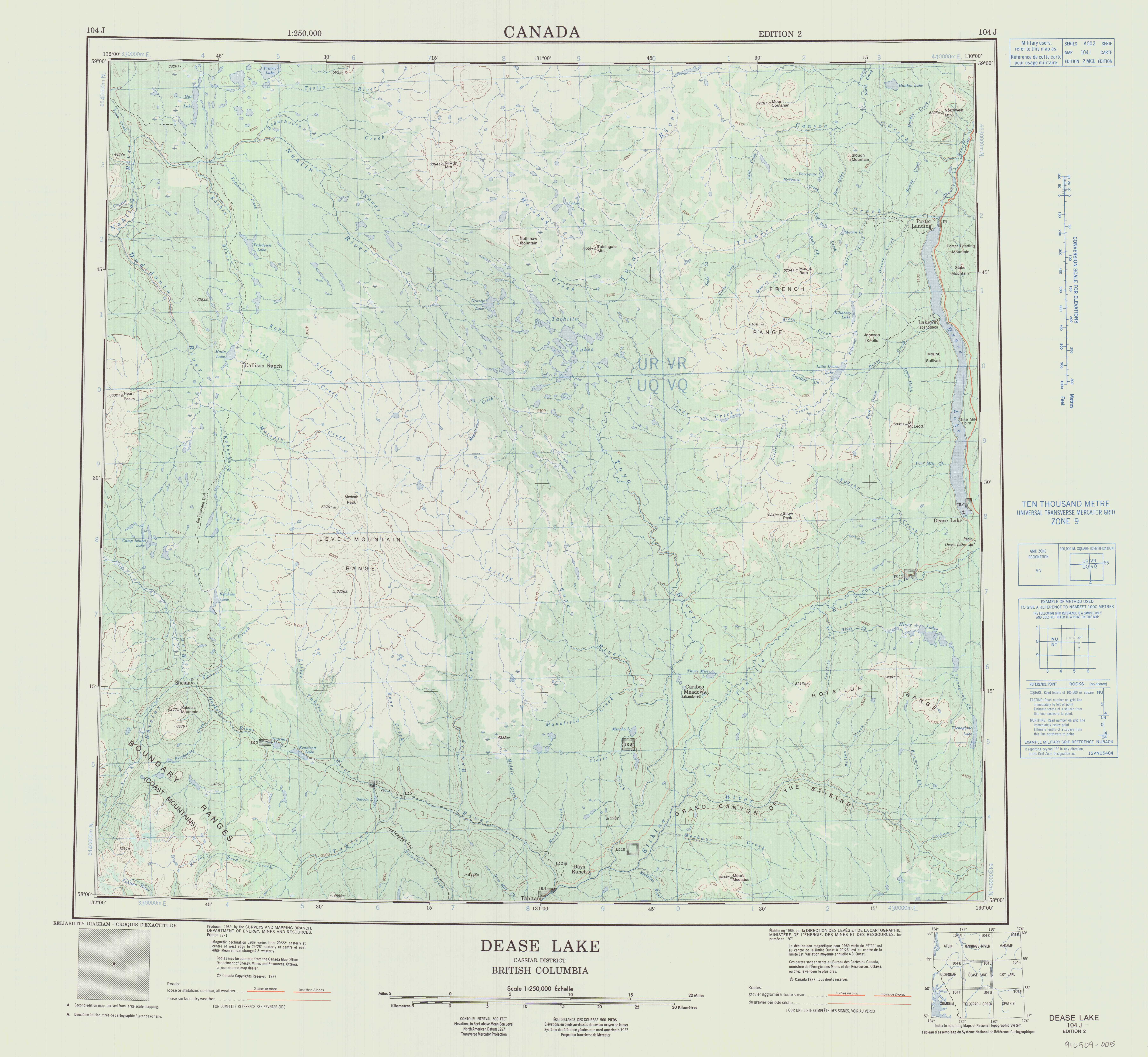
The Tuya River is a major tributary of the Stikine River in northwest part of the province of British Columbia, Canada. From its source at High Tuya Lake in Tuya Mountains Provincial Park just south of Ash Mountain, the highest peak of the Tuya Range, the Tuya River flows south about 200 km (120 mi) to meet the Stikine River in the Grand Canyon of the Stikine. The Tuya River's main tributary is the Little Tuya River. The Tuya River divides the Tanzilla Plateau on the east from the Kawdy Plateau, to the northwest, and the Nahlin Plateau, to the southwest. All three are considered sub-plateaus of the Stikine Plateau. The Tuya River's watershed covers 3,575 km2 (1,380 sq mi), and its mean annual discharge is estimated at 36.9 m3/s (1,300 cu ft/s). The mouth of the Tuya River is located about 24 km (15 mi) northeast of Telegraph Creek, British Columbia, about 67 km (42 mi) southwest of Dease Lake, British Columbia, and about 210 km (130 mi) east of Juneau, Alaska. The Tuya River's watershed's land cover is classified as 35.7% shrubland, 31.4% conifer forest, 14.0% mixed forest, 7.2% herbaceous, and small amounts of other cover.
The Little Tuya River is a tributary of the Tuya River in northwest part of the province of British Columbia, Canada. It flows generally south and east about 71 km (44 mi) to join the Tuya River near Cariboo Meadows. The Little Tuya River's watershed covers 569 km2 (220 sq mi), and its mean annual discharge is an estimated 6.69 m3/s (236 cu ft/s).
Kakuchuya Creek, historically called the Kakuchuya River, is a tributary of the Dudidontu River and part of the Taku River watershed in northwest part of the province of British Columbia, Canada.
Matsatu Creek, historically called the Matsatu River, is a tributary of Kakuchuya Creek and part of the Taku River watershed in northwest part of the province of British Columbia, Canada. It is located 40 km (25 mi) north of the abandoned settlement of Sheslay in Cassiar Land District.
Classy Creek is a tributary of the Tuya River in northwest part of the province of British Columbia, Canada. It flows generally southeast and south roughly 20 km (12 mi) to join the Tuya River about 10 km (6.2 mi) north of the Tuya River's confluence with the Stikine River in the Grand Canyon of the Stikine, near Telegraph Creek Road, unofficially called Highway 51, a spur of the Stewart–Cassiar Highway.
Hartz Creek is a tributary of the Tahltan River, part of the Stikine River watershed in northwest part of the province of British Columbia, Canada. It flows generally south and southwest for roughly 14 km (8.7 mi) to join the Tahltan River about 4.5 km (2.8 mi) north of Tahltan, British Columbia at the Tahltan River's confluence with the Stikine River. Hartz Creek's watershed covers 39.1 km2 (15.1 sq mi), and its mean annual discharge is estimated at 0.315 m3/s (11.1 cu ft/s). The mouth of Hartz Creek is located about 18 km (11 mi) northeast of Telegraph Creek, British Columbia, about 73 km (45 mi) southwest of Dease Lake, British Columbia, and about 200 km (120 mi) east of Juneau, Alaska. Hartz Creek's watershed's land cover is classified as 44.2% shrubland, 30.7% mixed forest, 20.8% conifer forest, and small amounts of other cover.
Middle Creek is a tributary of the Tahltan River, part of the Stikine River watershed in northwest part of the province of British Columbia, Canada. It flows generally south for roughly 15 km (9.3 mi) to join the Tahltan River about 10 km (6.2 mi) north of Tahltan, British Columbia at the Tahltan River's confluence with the Stikine River. Middle Creek's watershed covers 49.6 km2 (19.2 sq mi), and its mean annual discharge is estimated at 0.449 m3/s (15.9 cu ft/s). The mouth of Middle Creek is located about 20 km (12 mi) north of Telegraph Creek, British Columbia, about 75 km (47 mi) southwest of Dease Lake, British Columbia, and about 197 km (122 mi) east of Juneau, Alaska. Middle Creek's watershed's land cover is classified as 45.2% shrubland, 30.8% conifer forest, 21.4% mixed forest, and small amounts of other cover.
Riley Creek is a tributary of Middle Creek, which in turn is a tributary of the Tahltan River, part of the Stikine River watershed in northwest part of the province of British Columbia, Canada. It flows generally south for roughly 10 km (6.2 mi) to join Middle Creek about 1.5 km (0.93 mi) north of Middle Creek's confluence with the Tahltan River. Riley Creek's watershed covers 22.1 km2 (8.5 sq mi), and its mean annual discharge is estimated at 0.192 m3/s (6.8 cu ft/s). The mouth of Riley Creek is located about 22 km (14 mi) north of Telegraph Creek, British Columbia, about 74 km (46 mi) southwest of Dease Lake, British Columbia, and about 122 km (76 mi) east of Juneau, Alaska. Riley Creek's watershed's land cover is classified as 39.9% shrubland, 36.8% conifer forest, 20.3% mixed forest, and small amounts of other cover.
Mansfield Creek is a tributary of the Little Tuya River, which in turn is a tributary of the Tuya River, part of the Stikine River watershed in northwest part of the province of British Columbia, Canada. It flows generally south and east for roughly 35 km (22 mi) to join the Little Tuya River about 4.5 km (2.8 mi) west-northwest of the Little Tuya's confluence with the Tuya River. Mansfield Creek's watershed covers 143 km2 (55 sq mi), and its mean annual discharge is estimated at 1.46 m3/s (52 cu ft/s). The mouth of Mansfield Creek is located about 45 km (28 mi) northeast of Telegraph Creek, British Columbia, about 50 km (31 mi) west-southwest of Dease Lake, British Columbia, and about 210 km (130 mi) east of Juneau, Alaska. Mansfield Creek's watershed's land cover is classified as 40.5% shrubland, 35.3% conifer forest, 17.6% mixed forest, and small amounts of other cover.
The Inhini River is a tributary of the Iskut River in the northwest part of the province of British Columbia, Canada, in Cassiar Land District. From its source in the glaciers of Simma Mountain and Mount Rastus, the Inhini River flows north for about 25 km (16 mi) to the Iskut River just east of the Iskut's confluence with the Stikine River.
The Little Iskut River is a tributary of the Iskut River in the northwest part of the province of British Columbia, Canada, in Cassiar Land District. From its source at Little Ball Lake in Mount Edziza Provincial Park, the Little Iskut River flows about 45 km (28 mi), generally north to the vicinity of Mowdale Lake, then southeast and south to the Iskut River just below Cascade Falls. The Little Iskut River is part of the Stikine River drainage basin, as the Iskut River is a major tributary of the Stikine.
Flyin Creek is a tributary of Walkout Creek and part of the Stikine River watershed in northwest part of the province of British Columbia, Canada. It flows generally northwest for roughly 7.7 km (4.8 mi) to join Walkout Creek, which flows into Raspberry Creek, then Mess Creek, which flows into the Stikine River about 3 km (1.9 mi) downriver from the community of Telegraph Creek. Flyin Creek's watershed covers 16.3 km2 (6.3 sq mi), and is entirely in Mount Edziza Provincial Park. The creek's mean annual discharge is estimated at 0.423 m3/s (14.9 cu ft/s). The mouth of Flyin Creek is located about 45 km (28 mi) south of Telegraph Creek, British Columbia, about 110 km (68 mi) southeast of Dease Lake, British Columbia, and about 230 km (140 mi) southeast of Juneau, Alaska. Flyin Creek's watershed's land cover is classified as 40.3% barren, 24,2% shrubland, 19.7% conifer forest, 13.8% herbaceous, and small amounts of other cover.
Stewbomb Creek is a tributary of the Little Iskut River and part of the Stikine River watershed in northwest part of the province of British Columbia, Canada. It flows generally southeast for roughly 14 km (8.7 mi) to join the Little Iskut River, which flows into the Iskut River, the largest tributary of the Stikine River.
Artifact Creek is a tributary of Stewbomb Creek and part of the Stikine River watershed in northwest part of the province of British Columbia, Canada. It flows generally southeast for roughly 13 km (8.1 mi) to join Stewbomb Creek, which flows into the Little Iskut River.In turn the Little Iskut River flows to the Iskut River, the largest tributary of the Stikine River.
Gerlib Creek is a tributary of Bourgeaux Creek and part of the Stikine River watershed in northwest part of the province of British Columbia, Canada. It flows generally east and south for roughly 10.5 km (6.5 mi) to join the Bourgeaux Creek, a tributary of the Little Iskut River, which in turn is a tributary of the Iskut River, the largest tributary of the Stikine River.
Crayke Creek is a tributary of Mess Creek and part of the Stikine River watershed in northwest part of the province of British Columbia, Canada. It flows generally west for roughly 7 km (4.3 mi) to join Mess Creek, a tributary of the Stikine River.
Kitsu Creek is a tributary of Mess Creek and part of the Stikine River watershed in northwest part of the province of British Columbia, Canada. It flows generally northwest and north for roughly 22.5 km (14.0 mi) to join Mess Creek, a tributary of the Stikine River.
Nagha Creek is a tributary of Kitsu Creek and part of the Stikine River watershed in northwest part of the province of British Columbia, Canada. It flows generally northwest and north for roughly 15 km (9.3 mi) to join Kitsu Creek, a tributary of Mess Creek, which in turn is a tributary of the Stikine River.
Nido Creek is a tributary of Kakiddi Creek and part of the Stikine River watershed in northwest part of the province of British Columbia, Canada. It flows from Mount Edziza generally east for roughly 11 km (6.8 mi) to empty into Nuttlude Lake, an expansion of Kakiddi Creek, a tributary of the Klastline River, which in turn is a tributary of the Stikine River.
Chakima Creek is a tributary of Shaman Creek and part of the Stikine River watershed in northwest part of the province of British Columbia, Canada. From its source in the mountains south of Mount Edziza, near Cartoona Peak and Tadeda Peak, it flows generally east for roughly 19 km (12 mi) to empty into Shaman Creek, which flows to Kakiddi Creek, a tributary of the Klastline River, which in turn is a tributary of the Stikine River.
