Sydney Cove is a small bay on the southern shore of Sydney Harbour, one of several harbours in Port Jackson, on the coast of Sydney, New South Wales, Australia.
Dundas is a suburb of the Northern Suburbs District in Sydney, New South Wales, Australia. Dundas is located 21 kilometres north-west of the Sydney central business district, in the local government area of the City of Parramatta and the electoral division of Bennelong. Dundas is a leafy green suburb, notably due to its centrepiece The Ponds Walk, which follows the Ponds Subiaco Creek.
Salt Pan Creek, an urban watercourse of the Georges River catchment, is located in the Canterbury-Bankstown region of Sydney, in New South Wales, Australia.

Cottage Point is a suburb of northern Sydney, in the state of New South Wales, Australia. Cottage Point is 38 kilometres north of the Sydney central business district, in the local government area of Northern Beaches Council.
Bar Point is a suburb of the Central Coast region of New South Wales, Australia, located on the north bank of the Hawkesbury River 53 kilometres (33 mi) north of Sydney. It is part of the Central Coast Council local government area.
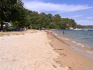
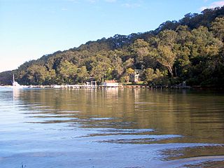
Cheero Point is a residential suburb of the Central Coast region of New South Wales, Australia, located on the west bank of the Mooney Mooney Creek 49 kilometres (30 mi) north of Sydney. It is part of the Central Coast Council local government area.

Mooney Mooney Creek is a suburb of the Central Coast region of New South Wales, Australia, located 60 kilometres (37 mi) north of Sydney along both sides of the river after which it is named. It is part of the Central Coast Council local government area.
Phegans Bay is a suburb within the local government area of the Central Coast Council on the Central Coast of New South Wales, Australia.
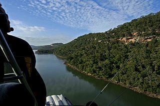
The Mooney Mooney Creek, a perennial river that is part of the Hawkesbury-Nepean catchment, is located in the Central Coast region of New South Wales, Australia.
Carey Bay is a suburb of the City of Lake Macquarie in New South Wales, Australia, and is located on a peninsula southeast of the town of Toronto on the western side of Lake Macquarie.

Huntleys Cove is a suburb in the Northern Suburbs of Sydney, in the state of New South Wales, Australia. Huntleys Cove is located 9 kilometres north-west of the Sydney central business district, in the local government area of the Municipality of Hunter's Hill. Huntleys Cove sits on the peninsula between Tarban Creek and the Parramatta River.
Morning Bay is a suburb and adjoining bay in northern Sydney, in the state of New South Wales, Australia. Morning Bay is located 40 kilometres north of the Sydney central business district, in the local government area of Northern Beaches Council.

Elvina Bay is a bay and adjacent suburb in northern Sydney, in the state of New South Wales, Australia. It is located 35 kilometres north of the Sydney central business district, in the local government area of Northern Beaches Council.

Lovett Bay is a suburb and adjacent bay in northern Sydney, in the state of New South Wales, Australia. It is 36 kilometres north of the Sydney central business district, in the local government area of Northern Beaches Council.
Kingfisher Shores is a suburb of the Central Coast region of New South Wales, Australia. It is part of the Central Coast Council local government area.

Cockburn River, a perennial river that is part of the Namoi catchment within the Murray–Darling basin, is located in the Northern Tablelands district of New South Wales, Australia.
The Wyong River is a perennial river that is located in the Central Coast region of New South Wales, Australia.

Towlers Bay is a locality in Ku-ring-gai Chase National Park, north of the city of Sydney, New South Wales, Australia, situated on the Northern Beaches. The bay located there, formerly of the same name, was renamed Morning Bay on 31 August 1984. It had been named after Bill Toler, who used to camp in the area in the 19th century.
The Mogo Creek, a perennial stream of the Hawkesbury-Nepean catchment, is located in the Blue Mountains region of New South Wales, Australia.
Gore Creek, an urban watercourse that is part of the Parramatta River catchment, is located in Northern Suburbs region of Sydney, Australia.