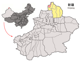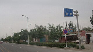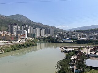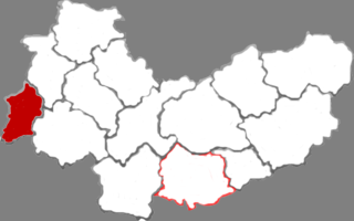
Habahe County as the official romanized name, also transliterated from Uyghur as Kaba County, is a county situated in the far north of the Xinjiang Uyghur Autonomous Region and is under the administration of the Altay Prefecture. It has an area of 8,179 km2 (3,158 sq mi) with a population of 80,000. The Postcode is 836700.

Yumin County as the official romanized name, also transliterated from Mongolian as Qagantokay County, is a county situated in the Xinjiang Uyghur Autonomous Region and is under the administration of the Tacheng Prefecture, bordering Kazakhstan's regions of East Kazakhstan and Almaty. It has an area of 6,090 km2 (2,350 sq mi) with a population of 50,000. The Postcode is 834800.

Shawan, also transliterated from Chinese to Uyghur as Savan, is a county-level city situated in the north of the Xinjiang Uyghur Autonomous Region under the administration of the Tacheng Prefecture. It has an area of 12,468 km2 (4,814 sq mi) with a population of 200,000.

Toli County is a county situated in the north of the Xinjiang Uyghur Autonomous Region and is under the administration of the Tacheng Prefecture. It has an area of 19,982 km2 (7,715 sq mi) with a population of 90,000. The Postcode is 834500.

Yuli County as the official Romanized name, also transliterated from Mongolian as Lopnur County, is a county in the Xinjiang Uyghur Autonomous Region and is under the administration of the Bayin'gholin Mongol Autonomous Prefecture. It contains an area of 59,399 km2 (22,934 sq mi). According to the 2002 census, it has a population of 100,000.

Yanqi Hui Autonomous County is an autonomous county in the Xinjiang Uyghur Autonomous Region and is under the administration of the Bayin'gholin Mongol Autonomous Prefecture. It has an area of 2,429 km2 (938 sq mi). According to the 2002 census, it has a population of 120,000. The Shikshin Buddhist Temple Ruins are located in Yanqi County, about 25–30 km (16–19 mi) southwest of the town of Yanqi.
Longxi is a county under the administration of the prefecture-level city of Dingxi in the southeast of Gansu Province, China.

Minqin County is a county of Gansu province, China. It is under the jurisdiction of Wuwei City. Its postal code is 733300, and its population in 1999 was 281,826 people.

ZhouzhiCounty is a county under the administration of Xi'an, the capital of Shaanxi province, China. It is the most spacious but least densely populated county-level division of Xi'an, and also contains the city's southernmost and westernmost points. The county borders the prefecture-level cities of Xianyang to the north, Ankang to the southeast, Hanzhong to the southwest, and Baoji to the west, as well as Xi'an's Huyi District to the east. It is famous for kiwifruit, one type of produce in which Shaanxi province excels.

Nanzheng District, formerly Nanzheng County, is a district of the city of Hanzhong, Shaanxi province, China, bordering Sichuan province to the south.

Xunyi is a county in the central part of Shaanxi province, China, bordering Gansu province to the north and northwest. It is the northernmost county-level division of Xianyang City. The county is noted for its apple orchards producing the "Malan Red", a variety of red Fuji apple named after the Malan Red Army site. Besides apples, the economy relies on coal and petroleum exploitation.
Lezhi County is a county of Sichuan Province, China. It is under the administration of Ziyang city.

Ganluo County is a county of Sichuan Province, China. It is under the administration of the Liangshan Yi Autonomous Prefecture.

Zhidoi County is a county in the west and southwest of Qinghai Province, China, bordering the autonomous regions of Tibet to the west and Xinjiang to the northwest. It is under the administration of Yushu Tibetan Autonomous Prefecture.

Wengyuan is a county in the north of Guangdong Province, China, bordering Jiangxi to the northeast. It is under the administration of Shaoguan City. It has a population of 421,756 in 2019, 99.55% of whom speak Hakka. Yao languages are spoken in some parts of the county. 0.616% of the population belongs to minority ethnic groups, most of them Yao.
Suiping County is a county in the south of Henan province, China. It is under the administration of Zhumadian City.

Baode is a county in the northwest of Shanxi province, China, bordering Shaanxi province to the west. It is under the administration of Xinzhou city, and is its westernmost county-level division.
Liangcheng County is a county of south-central Inner Mongolia, China, bounded by Shanxi province to the south. It is under the administration of Ulaan Chab city, and borders Fengzhen City to the east, Zhuozi County to the north, and the regional capital of Hohhot to the west.

Tekes County is a county within the Xinjiang Uyghur Autonomous Region and is under the administration of the Ili Kazakh Autonomous Prefecture. It contains an area of 8,067 km2. According to the 2002 census, it has a population of 150,000.

Erdaobaihe is a town in Antu County, Yanbian, Jilin, China. Erdaobaihe is subdivided into Hongfeng Village, Anbei Village, Changsheng Village, Tiebei Village, Toudaobaihe Village, Changbai Village, Baoma Village and Naitoushan Village. The town had a population of 4,791 in 2020. Erdaobaihe's economy is reliant on tourism as it is next to Changbai Mountain.


