
Abbottabad District is located in Khyber Pakhtunkhwa province of Pakistan. The district covers an area of 1,969 km2, with the city of Abbottabad being the principal town. Neighbouring districts are Mansehra to the north, Muzaffarabad to the east, Haripur to the west, and Rawalpindi to the south.
Haripur is the main city of the Haripur District in Hazara, Khyber Pukhtunkhwa in Pakistan, with Swabi and Buner to the west,some65 km (40 mi) north of Islamabad and 35 km Khanpur Road Tofkian Valley Taxila and 35 km (22 mi) south of Abbottabad. It is in a hilly plain area at an altitude of 520 m (1,706 ft).

Attock District is a district in Pothohar Plateau of the Punjab Province of Pakistan. Attock is the capital of the district.

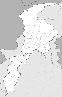
Sirikot is a village in Haripur District and Ghazi Tehsil, in Pakistan's Khyber Pakhtunkhwa Province at 34°10'60N 73°43'50E. It is the principal settlement of the Union Council.
The Karlal is a Hindko-speaking tribe in Hazara Division, Khyber-Pakhtunkhwa, Pakistan. The Karlals mostly inhabit the highlands of Dubran,Diwal,and Nara tract and the Galiyat area of the Abbottabad District, parts of the Haripur District, and parts of the Bagh District of Azad Kashmir.

Haripur is an Upazila of Thakurgaon District in the Division of Rangpur, Bangladesh.
Panian is one of the 44 union councils, administrative subdivisions, of Haripur District in the Khyber Pakhtunkhwa province of Pakistan. The majority of the population living in Panian village are Panni and follow the Pashtunwali Code of Conduct. They are Hindko speaking Pashtuns. They are descended from Gharghashti.
Sarral is a village in Haripur District in Khyber-Pakhtunkhwa province of Pakistan with a population of about 2000. It is located east of the district Haripur at 33° 52' 60N 73° 1' 60E. It is located on the right bank of Haro stream. Its mountains are covered with Pine and Myrobalan آملہ trees and rich of wildlife.

Jarral Shareef is one of the 57 Union council of Abbottabad District in the Khyber Pakhtunkhwa province of Pakistan.

Anantarampur is a village in Chanditala I community development block of Srirampore subdivision in Hooghly district in the Indian state of West Bengal.
Chak Bangla is a village in Chanditala I community development block of Srirampore subdivision in Hooghly district in the Indian state of West Bengal.
Radhaballabhpur is a village in Chanditala I community development block of Srirampore subdivision in Hooghly district in the Indian state of West Bengal.
Haripur is a village and gram panchayat in Chanditala I community development block of Srirampore subdivision in Hooghly district in the Indian state of West Bengal.
Dudhkomra is a village in Chanditala I community development block of Srirampore subdivision in Hooghly district in the Indian state of West Bengal.
Mamudpur is a village in Chanditala I community development block of Srirampore subdivision in Hooghly district in the Indian state of West Bengal.
Ban Panchbere is a village in Chanditala I community development block of Srirampore subdivision in Hooghly district in the Indian state of West Bengal.
Baghati is a village in Chanditala I community development block of Srirampore subdivision in Hooghly district in the Indian state of West Bengal.
Bade Sola is a village in Chanditala I community development block of Srirampore subdivision in Hooghly district in the Indian state of West Bengal.


