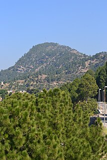
Haripur District is a district in Hazara Division of Khyber Pakhtunkhwa province in Pakistan. The town of Haripur was founded in 1822 by Hari Singh Nalwa, the Commander-in-Chief of Ranjit Singh's army. Before becoming a district in 1991, Haripur had the status of a tehsil in Abbottabad District. Its headquarters is the city of Haripur.

Mohra Noori is a town in the Rawalpindi District of Punjab province, Pakistan.
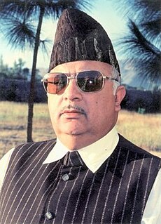
Raja Sikandar Zaman Khan was a Pakistani politician who became Chief Minister of Khyber-Pakhtunkhwa. His first political office was in the 1960s as a member of the Abbottabad District Council.
Kauntrila (Urdu:کونتريله) is the name of a village and union council of Gujar Khan Tehsil in Rawalpindi District, Punjab, Pakistan.
Beer, or Bir,(بیڑ) is one of the 44 union councils, administrative subdivisions, of Haripur District in the Khyber Pakhtunkhwa province of Pakistan.
Darwesh is a village and one of the 44 union councils, administrative subdivisions, of Haripur District in the Khyber Pakhtunkhwa province of Pakistan. It is located south of the district capital, Haripur, at 33°59'26N 72°55'5E.
Jatti Pind is one of the 44 union councils, administrative subdivisions, of Haripur District in the Khyber Pakhtunkhwa province of Pakistan. It is located to the north east of the district capital Haripur at 34°2'60N 72°57'0E.
Panian is one of the 44 union councils, administrative subdivisions, of Haripur District in the Khyber Pakhtunkhwa province of Pakistan.
Rehana is a village and one of the 44 union councils, administrative subdivisions, of Haripur District in the Khyber Pakhtunkhwa province of Pakistan.
Bait Gali is one of the 44 union councils of Haripur District in the Khyber Pakhtunkhwa Province of Pakistan.
Ghungrila is a medium-size town in Gujar Khan Tehsil Punjab, Pakistan. Gungrila is also chief town of Union Council Gungrila, which is an administrative subdivision of the Tehsil. The town is located at 33°18'0"North, 73° 15' 0" East.
Gujar Khan Tehsil, headquartered at Gujar Khan, is one of the seven Tehsils (sub-divisions) of Rawalpindi District in the Punjab province of Pakistan. It is administratively subdivided into 36 Union Councils and according to the 1998 census has a population of 42,0000. In 2017 census Gujar Khan has a population of 678,503
Haripur Tehsil is a tehsil located in Haripur District, Khyber Pakhtunkhwa, Pakistan. The tehsil is administratively subdivided into 37 Union Councils.
Pandori is a village and part of union council Ladhar in Jhelum District in the Punjab Province of Pakistan. it was itself a Union council but in the Government of Perwaiz Musharif the name of the Union Council changed to Ladhar. This Small Village got a boom in infrastructure in First Govt of Nawaz Sharif. at the same time a High School for the Boys and a High School for Girls, a hospital, water supply, veterinary hospital and the office for the agricultural help. The area is also known for spread of Shia Islam, Shia imams from Iran with funding Target the poor class street beggers ,barbers etc converted to the Shia school of thought with cash incentives.

Mohra Malkan is a village in the Dadyal Tehsil of Mirpur District of Azad Kashmir. Mohra Malkan is about 42 mi (68 km) southeast of Islamabad. Mohra Malkan is part of the Union Council of Amb. It is located approximately 2 km from Dadyal City; on the edge of Mangla Dam and next to the ruins/remains of Old Dadyal City. Other villages around Mohra Malkan are Chapman and Mehra.
Mohra Sandhu is a village situated in the Gujar Khan Tehsil of Rawalpindi District, of Punjab, Pakistan. Its geographical coordinates are 33° 21' 37 North and 73° 25' 40 East and situated in Sui Cheemian Union Council.

Saloi is a village, union council, and administrative subdivision of Chakwal District in the Punjab Province of Pakistan. It is part of Choa Saidan Shah Tehsil.

Village Mohra Heran is part of union council Choha Khalsa, and is two miles from Choha Khalsa. It is a valley in foot steps of the mountains. People originated from Mohra Nagrial in 1870 to here. Numberdar Badar-ud-Din of Mohra Nagrial discovered this beautiful valley, by profession he was a farmer and this place was much suitable for his cattle, because of the greenery, so he built a cottage and settled down in this valley. After sometime rest of his family joined him in the new village. so it became a small village at the end of 1899.
Choha Khalsa is a town and Union Council of Kallar Syedan Tehsil, District Rawalpindi, Punjab, Pakistan. Town consist of 800 houses. On 1 July 2004, Choha Khalsa became the Union Council Of Tehsil Kallar Syedan, District Rawalpindi was a Union Council of the Tehsil Kahuta.
Mohra Gujran is a village near Mandra, Tehsil Gujran Khan, in the Rawalpindi District of Pakistan. Mohra Gujran comes under union council Kuri Dolal. Its neighboring villages are Gunja Mehra, Mohra Mando, Faisal Colony and Mohra Mishran.
