
Abbottabad District is a district in the Khyber Pakhtunkhwa province of Pakistan. It is part of the Hazara Division and Hazara region covers an area of 1,969 km2, with the city of Abbottabad being the principal town. Neighbouring districts include Mansehra to the north and Haripur to the west in Khyber Pakhtunkhwa, Muzaffarabad to the east in Azad Jammu and Kashmir and Rawalpindi to the south in Punjab.
Haripur District is a district in the Hazara Division of Khyber Pakhtunkhwa, Pakistan. Before becoming a district in 1991, Haripur had the status of a tehsil in Abbottabad District. Its headquarters is the city of Haripur.

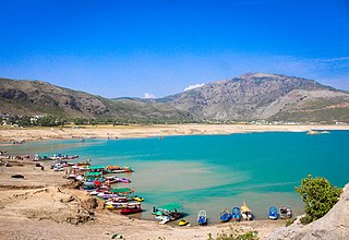
Haripur(Pashto: ہری پور, Hindko and Urdu: ) is the main City of the Haripur District in Hazara, Khyber Pakhtunkhwa in Pakistan, with Swabi and Buner to the west, some 65 km (40 mi) north of Islamabad and 35 km Khanpur Road Tofkian Valley Taxila and 35 km (22 mi) south of Abbottabad. It is in a hilly plain area at an altitude of 520 m (1,706 ft).

Nowshera is the capital city of Nowshera District in the Khyber Pakhtunkhwa province of Pakistan. It is the 78th largest city in Pakistan and ninth largest city in the province of Khyber Pakhtunkhwa.

Lakki Marwat or Lakki is the headquarters of Lakki Marwat District in Khyber Pakhtunkhwa province of Pakistan. Lakki Marwat has become one of the fastest growing cities in Khyber Pakhtunkhwa. Lakki Marwat is also the 20th most populous city in the province of Khyber Pakhtunkhwa.
Kohat Division is one of seven divisions in Pakistan's Khyber Pakhtunkhwa province. It consists of five districts: Hangu, Karak, Kohat, Kurram, and Orakzai. According to the 2017 Pakistani Census, the division had a population of 3,211,458, making it the third-least populous division in the province, and it spans 12,377 km2 (4,779 sq mi) of area, and this makes it the fourth-largest division by area in the province. Kohat is the division's largest city and namesake, with over 220,000 inhabitants. The division borders Bannu Division to the south and west, Peshawar Division to the north and east, the province of Punjab, Pakistan to its east, and the country of Afghanistan to its northwest.

Bannu Division is one of seven divisions in Pakistan's Khyber Pakhtunkhwa province. It consists of three districts: Bannu, Lakki Marwat, and North Waziristan. According to the 2017 Pakistani Census, the division had a population of 2,656,801, making it the least populous division in the province, but it spans 9,975 km2 (3,851 sq mi) of area, and this makes it the third-smallest division by area in the province. Lakki Marwat is the largest city of Bannu Division, with around 60,000 people, while the division's namesake and second-largest city is Bannu, with just under 50,000 people. The division borders Dera Ismail Khan Division to the south and west, Kohat Division to the north and east, and the province of Punjab, Pakistan to its east.
Attock Tehsil is one of the six tehsils of Attock District in the Punjab Province of Pakistan.
Fateh Jang Tehsil is an administrative subdivision (tehsil), of Attock District in the Punjab province of Pakistan lying between 33°10′ and 33°45′ North, and 72°23′ and 73°1′ East. The tehsil is administratively subdivided into 14 Union Councils.

Abbottabad Tehsil is an administrative subdivision (tehsil) of Abbottabad District in Khyber Pakhtunkhwa province of Pakistan.
Havelian Tehsil is an administrative subdivision (tehsil) of Abbottabad District in the Khyber Pakhtunkhwa province of Pakistan.

Gujar Khan Tehsil, headquartered at Gujar Khan, is one of the seven Tehsils (sub-divisions) of Rawalpindi District in the Punjab province of Pakistan. It is administratively subdivided into 36 Union Councils and according to the 1998 census has a population of 42,0000. In 2017 census Gujar Khan has a population of 678,503
Ghazi Tehsil is a tehsil located in Haripur District, Khyber Pakhtunkhwa, Pakistan. The tehsil, headquartered at the town of Ghazi, is itself subdivided into 8 Union Councils, Assistant Commissioner of Ghazi is Muhammad Shojain Vistro. The main languages spoken in the area are Hindko and Pashto.
Mansehra Tehsil is a tehsil in Mansehra District, Khyber Pakhtunkhwa, Pakistan.
Charsadda Tehsil is a tehsil located in Charsadda District, Khyber Pakhtunkhwa, Pakistan.
Tangi Tehsil is a tehsil located in Charsadda District, Khyber Pakhtunkhwa, Pakistan.
Dera Ismail Khan Tehsil is a tehsil located in Dera Ismail Khan District, Khyber Pakhtunkhwa, Pakistan.

Kulachi Tehsil is a tehsil located in Dera Ismail Khan District, Khyber Pakhtunkhwa, Pakistan.
Wazirabad Tehsil, is an administrative subdivision (tehsil) of Wazirabad District in the Punjab province of Pakistan. The tehsil is headquartered at the city of Wazirabad and is administratively subdivided into 36 Union Councils.
Mardan Tehsil is a tehsil located in Mardan District, Khyber Pakhtunkhwa, Pakistan. The city of Mardan is the capital of the tehsil.