Tenth Street Freedman's Town

Last updated

Tenth Street Historic District
Tenth Street Historic District Column Detail.jpg
Porches define the character of historic Tenth Street.
Relief map of Texas.png
Red pog.svg
Tenth Street Historic District
Usa edcp relief location map.png
Red pog.svg
Tenth Street Historic District
LocationWestern edge of William S. Beatty Survey, Northeast corner William H. Hord Survey, Southeast corner Elizabeth Robertson Survey, Dallas, Texas
Coordinates 32°44′56″N96°48′24″W / 32.74889°N 96.80667°W / 32.74889; -96.80667
AreaApproximately 84 acres (34 ha)
Built1888-1947
ArchitectAfrican American carpenters including Noah Penn, Richard J. Moore, and John Siler, among many others.
Architectural style Folk Victorian, Late 19th and 20th Century Revivals, American Craftsman, Shotgun House, Bungalow
NRHP reference No. 94000604
Significant dates
Added to NRHPJune 17, 1994
Designated DLMK1993
Designated EMEHPMay 30, 2019

The Tenth Street Freedman's Town is a historic African American community in the Oak Cliff section of Dallas, Texas. A freedmen's town is a community settled by formerly enslaved people who were emancipated during and after the American Civil War. The freedmen's town that became known as Tenth Street began near the confluence of Cedar Creek and Cedar Creek Branch, at the foot of an African American burial ground dating back to 1846. [1] The name "Tenth Street" became associated with the community in 1887, when John Scarborough Armstrong and Thomas Lafayette Marsalis platted the town of Oak Cliff.

Contents

Heritage designations

A: Total area of African American settlement comprising Greater Tenth Street and The Bottom at the zenith of pre-World War II expansion, fifty years before heritage designation. Approximately 300 acres. Historic Designations identified as Tenth Street Historic District:  B: Dallas landmark district (designated 1993). Approximately 87 acres. The Dallas landmark district includes approximately 69 acres of the 300 acres defined as Area A above, comprising 79% of the landmark district and 23% of African American district during the period of historic significance. C: National Register of Historic Places Historic District (designated 1994). Note: Hatched areas lying outside of Area A consist of age-appropriate structures not occupied by African Americans during period of historic significance but included in one or both historic district designations. These areas were off limits to African American residents of Tenth Street and The Bottom during the Jim Crow Era. Tenth Street Freedman's Town Heritage Designation Boundaries.png
A: Total area of African American settlement comprising Greater Tenth Street and The Bottom at the zenith of pre-World War II expansion, fifty years before heritage designation. Approximately 300 acres. Historic Designations identified as Tenth Street Historic District:  B: Dallas landmark district (designated 1993). Approximately 87 acres. The Dallas landmark district includes approximately 69 acres of the 300 acres defined as Area A above, comprising 79% of the landmark district and 23% of African American district during the period of historic significance. C: National Register of Historic Places Historic District (designated 1994). Note:Hatched areas lying outside of Area A consist of age-appropriate structures not occupied by African Americans during period of historic significance but included in one or both historic district designations. These areas were off limits to African American residents of Tenth Street and The Bottom during the Jim Crow Era.  

Tenth Street Historic District may identify either a Dallas Landmark District or a National Register Historic District encompassing parts of the Tenth Street Freedman's Town. Only a portion of the original nucleus and subsequent expansion of the Tenth Street Freedman's Town prior to the Second World War is protected by the local historic overlay district. Recollections of longtime residents suggest that some areas included in both the local and national designations, while appropriate to the period of historic significance, were off limits to African Americans during the period of significance and even up until the final years of Jim Crow.

Although the local and national districts were created to recognize the same historic community, the boundaries of the two designations differ slightly from each other. When Dallas adopted the city's twelfth historic district in 1993, the historic overlay was bounded by East Clarendon Drive on the south and southeast, South Fleming Avenue on the southwest, Interstate-35E on the west, East 8th Street on the north from the intersection with I-35E east to the intersection with Denley Drive, thence north along Denley Drive to the north property line of those lots facing south on East 8th Street, thence east along said property line to its intersection with Hutchins Road, thence south along the former Corsicana Interurban right of way to East Clarendon Drive, thence west a short distance along East Clarendon Drive, from which point the boundary jogged south, then west, then north to include the former site of Cuney Street before returning to East Clarendon Drive. [2] The National Register of Historic Places defines the district as roughly bounded by East Clarendon Drive on the south and southeast, South Fleming Avenue on the southwest, Interstate-35E on the west, East 8th Street on the north and the eastern ends of Church Street, East 9th Street and Plum Street on the east, where they dead-end into the old Corsicana Interurban right of way. [3]

History

The first African Americans to inhabit what is now known as Oak Cliff were likely between one and three slaves that accompanied George Lawan Leonard and his son, George S.C. Leonard, across the Trinity River from Nacogdoches County into Robertson County in December, 1843. [4] A July, 1844, report by Peters Colony agent Ralph Barksdale confirms the presence of a mere three slaves in the West Trinity zone at the time of his 1844 survey, presumably those owned by George Leonard. [5] By 1846, when William S. Beatty deeded ten acres of his 640-acre survey for a public cemetery west of the Trinity, [6] four area settlers on the west side of the Trinity owned “Negro Property” valued at $4,310, twelve slaves in all. Tax records indicate that David Cameron and William H. Hord owned four slaves each. George Lawan Leonard owned three slaves and Aaron Overton owned a single slave. [7] Of these four, George Leonard was the first to arrive. Cameron and Overton arrived in 1844, followed by Hord in 1845. [4] It stands to reason, then, that some if not all of the three slaves enumerated by Barksdale were those who came with George Leonard near the end of 1843. Conversely, it seems unlikely that Hord, being the last of the four slave holders to arrive, would have brought the first African Americans into the vicinity of William S. Beatty's Robertson County survey.

Beatty stipulated that his burial ground “remain forever open to all.” [6] Slaves were buried in the southern end along what became Tenth Street. [8] Upon Emancipation in 1865, freedmen streamed into Texas cities from across the South. Some sought family members who had been moved west as the Civil War advanced. All sought opportunity. Arch Miller, who came to Texas as William Brown Miller's slave in 1847, was among those who settled on Cedar Creek south of the "Negro Burial Ground." [9]

Sales in the planned city of Oak Cliff began in November, 1887, but not for African Americans. Lying outside of Original Oak Cliff, the land between the burial ground and the creeks was unrestricted. W.J. Betterton bought the four acre tract from William Brown Miller in October, 1887. He extended Tenth Street across the width of the cemetery. A Black urban ownership class in Oak Cliff began with the purchase of lots by Anthony Boswell in January, 1888. Among those who bought lots in Miller's Four Acres before 1890 were trustees of Elizabeth Chapel C.M.E. Church and El Bethel Missionary Baptist Church. [10]

Black ownership was largely confined to the Four Acres until the Panic of 1893. In their haste to divest, investors sold off unimproved lots to anyone with means. [11] Oak Cliff's calamity was Tenth Street's opportunity. Black Tenth Street grew west into Original Oak Cliff, bringing a vibrant mix of businesses and residences that reached a zenith during the Jazz Age. The first “colored” public school on the site of N.W. Harllee came in 1903. [12] Alumni include 1960 Olympic gold medal decathlete Rafer Johnson [13] and guitarist Aaron Thibeaux “T-Bone” Walker, who electrified the blues. [14] On September 8, 1935, jazz saxophonist James Earl Clay was born at his parents' home on Cliff Street, directly behind the Greater El Bethel Missionary Baptist Church. Clay attended N.W. Harllee before going on to graduate from Lincoln High School in South Dallas. [15] In 1937, former slave Mose Hursey told his life story to the Federal Writers Project at his home on Tenth Street. [16] His narrative is part of the Ex-Slave Narrative Collection enshrined in the Rare Book Room at the Library of Congress.

Despite the erasure of significant homes and businesses by the construction of Clarendon Drive between 1942 and 1950 and R.L. Thornton Freeway in the late 1950s, [10] the National Park Service recognized the high level of architectural integrity then present in the community by listing the Tenth Street Historic District on the National Register of Historic Places in 1994. The registration noted that “demolition, rather than new construction or major remodeling, has served as the neighborhood’s main adversary.” [3]

Transportation

Light rail

DART Blue Line, Red Line

Notable people

Related Research Articles

<span class="mw-page-title-main">Dallas County, Texas</span> County in Texas, United States

Dallas County is the second-most populous county in the U.S. state of Texas. As of the 2020 U.S. census, the population was 2,613,539, making it the ninth-most populous county in the country. Dallas County is included in the Dallas-Arlington-Fort Worth metropolitan statistical area—colloquially referred to as the Dallas–Fort Worth metroplex. Municipal expansion within Dallas County has blurred the geographic lines between cities and between neighboring counties.

<span class="mw-page-title-main">Oak Cliff</span> Neighborhood of Dallas, Texas, U.S.

Oak Cliff is an area of Dallas, Texas, United States that was formerly a separate town in Dallas County; Dallas annexed Oak Cliff on April 04, 1903. It has since retained a distinct neighborhood identity as one of Dallas' older established neighborhoods.

This article traces the history of Dallas, Texas,.

<span class="mw-page-title-main">Texas State Highway 183</span> Highway in Texas

State Highway 183 is a state highway in the Dallas–Fort Worth metroplex in Texas. Its most heavily used section is designated Airport Freeway where it serves the southern entrance of Dallas–Fort Worth International Airport.

<span class="mw-page-title-main">Texas State Highway Loop 12</span> Highway in Texas

Loop 12 is a state highway that runs mostly within the city limits of Dallas, Texas. The western segment of the loop is named after General Walton Walker, who served and died in South Korea. During the 1950s and 1960s, Loop 12 was the outer beltway in the Dallas area, having since been supplanted by Interstate 635 (I-635), which is itself being supplanted by the President George Bush Turnpike. Loop 12 is, however, the only state highway in Dallas that forms a complete loop.

Winnetka Heights is one of the oldest and largest historical districts in the Oak Cliff section of Dallas, Texas (USA). The district is bounded by Davis Street on the north, 12th Street on the south, Willomet Avenue on the east and Rosemont Avenue on the west. Established in 1910, Winnetka Heights consists of early 20th century wood-frame houses.

South Oak Cliff High School is a public secondary school located in the Oak Cliff area of Dallas, Texas, United States. South Oak Cliff High School enrolls students in grades 9-12 and is a part of the Dallas Independent School District (DISD).

<span class="mw-page-title-main">Stemmons Corridor, Dallas</span> Place in Texas, United States

The Stemmons Corridor or Lower Stemmons is a stretch of industrial and commercial property in northwest Dallas, Texas (USA). From downtown north, Interstate 35E (I-35E) is known as the Stemmons Freeway, named so for Leslie Stemmons by his son, John M. Stemmons. It lies north of downtown, west of Oak Lawn, east of the Trinity River and Irving, and south of the Elm Fork of the Trinity River. The area has a considerable amount of hotels and office towers. Property in the district accounts for 20% of Dallas' tax base. I-35E in Dallas Texas is currently the widest freeway in the DFW area with 16 total lanes, 10 lanes of high speed freeway with 6 lanes of access roads, stretching from the Woodall Rodgers Expressway in Downtown Dallas to the State Highway 183 split. I-35E is one of the most congested freeways in the country.

<span class="mw-page-title-main">Convention Center District, Dallas</span> Neighborhood in Dallas, Texas

The Convention Center District is an area in southern downtown Dallas, Texas (USA). It lies south of the Government District, north of the Cedars, west of the Farmers Market District, and east of the Reunion District. Visitdallas is contracted by the City to attract conventions, although an audit released in January 2019 cast doubts on its effectiveness.

This article is about transportation systems in and around Dallas, Texas (USA).

<span class="mw-page-title-main">Kidd Springs, Dallas</span> Neighborhood of Texas, United States

Kidd Springs is a neighborhood in the North Oak Cliff area of Dallas, Texas (USA). James Kidd purchased land in the area in the 1870s which included the spring now bearing his name.

<span class="mw-page-title-main">Kings Highway Conservation District, Dallas</span> Historic district in Texas, United States

King's Highway is located in the Oak Cliff area of Dallas, Texas (USA). The district is bounded by Stewart Drive on the north, Davis Street on the south, Tyler Street on the east and Mary Cliff Road on the west. It is in Dallas Council District 3.

<span class="mw-page-title-main">Elmwood (Dallas)</span>

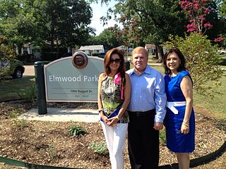
Elmwood is a residential neighborhood in central Oak Cliff, within Dallas, Texas, composed of tudor cottages, craftsman bungalows and ranch-style homes built mostly in the 1920s through the 1950s surrounding a central greenbelt along the limestone banks of Cedar Creek (Texas).

The Redbird community of Dallas is a group of neighborhoods located in the southern Oak Cliff area of Dallas, Texas. This is a middle to upper middle class Neighborhood which includes Wynnewood Hills, Elderwoods/Elderoaks/Twin Oaks, and Glen Oaks.

Thomas Lafayette Marsalis was an American developer. With John S. Armstrong, the founder of Oak Cliff, he was one of the key developers of what is now known as the Dallas area.

Wynnewood is one of the main neighborhoods of Oak Cliff, the southwestern part of Dallas, Texas, United States. Wynnewood covers 820 acres (3.3 km2). The village was once known for buildings having old decorative wood flooring.

<span class="mw-page-title-main">Uptown, Dallas</span> Place in Texas, United States

Uptown is a PID and a dense neighborhood in Dallas, Texas. Uptown is north of and adjacent to downtown Dallas, and is bordered by US 75 on the east, N Haskell Avenue on the northeast, the Katy Trail on the northwest, Bookhout Street and Cedar Springs Road on the west, N Akard Street on the southwest and Spur 366 on the south.

<span class="mw-page-title-main">Downtown Dallas</span> Central business district and residential area in Texas, United States

Downtown Dallas is the central business district (CBD) of Dallas, Texas, United States, located in the geographic center of the city. It is the second-largest business district in the state of Texas. The area termed "Downtown" has traditionally been defined as bounded by the downtown freeway loop, bounded on the east by I-345 (although known and signed as the northern terminus of I-45 and the southern terminus of US 75, on the west by I-35E, on the south by I-30, and on the north by Woodall Rodgers Freeway.

Kiest Park is a 263-acre (106 ha) park in southern Dallas, Texas, United States, established in 1931 by Edwin John Kiest, publisher of the Dallas Times Herald and a member of the Dallas Park Board in the 1930s who donated the land for the park. Named in memory of Kiest's late wife, artist Elizabeth Patterson Kiest, it is the largest City of Dallas Park in Oak Cliff and features hike-and-bike trails, tennis courts, baseball diamonds, playgrounds, picnic tables and several Works Progress Administration-era structures, including stone gates at three entrances to the park, a stone picnic shelter and a stone field house. The WPA also built a formal garden at the heart of Kiest Park. A pergola was built at the head of the garden in 1934 with WPA funds but fell into ruin and was cleared away. The nonprofit organization Friends of Oak Cliff Parks restored the historic garden and the City of Dallas rebuilt the pergola in 2014 based on the original plans, using $2 million in bond funds.

References

  1. "History | Oak Cliff Cemetery". www.oakcliffcemetery.org. Retrieved January 22, 2020.
  2. "Tenth Street". dallascityhall.com. Retrieved January 22, 2020.
  3. 1 2 Tenth Street Historic District, National Register Information System ID: 94000604, National Register of Historic Places Registration Form. Certified by Curtis Tunnell, State Historic Preservation Officer, Texas Historical Commission, May, 1994.
  4. 1 2 Brown, John Henry (1887). History of Dallas County, Texas, from 1837 to 1887. Dallas: Milligan, Cornett, and Farnham, Printers. p. 17.
  5. Minutaglio, Bill; Williams, Holly (1990). The Hidden City—Oak Cliff, Texas. Dallas, Texas: Elmwood Press and Old Oak Cliff Conservation League. p. 7.
  6. 1 2 "Oak Cliff Cemetery". Texas Historic Sites Atlas. 1985. Retrieved November 19, 2020.
  7. Minutaglio, Bill; Williams, Holly (1990). The Hidden City—Oak Cliff, Texas. Dallas, Texas: Elmwood Press and Old Oak Cliff Conservation League. p. 30.
  8. Davidson, James M. (October 1998). "The Old Dallas Burial Ground: A Forgotten Cemetery". Southwestern Historical Quarterly. 102: 170 via The Portal to Texas History.
  9. Minutaglio, Bill; Williams, Holly (1990). The Hidden City—Oak Cliff, Texas. Dallas, Texas: Elmwood Press and Old Oak Cliff Conservation League. p. 7.
  10. 1 2 Hampton, Joanna; Swann, Robert (Winter 2020). "Tenth Street Is Bleeding". AIA Dallas Columns: 15–16.
  11. Minutaglio, Bill; Williams, Holly (1990). The Hidden City—Oak Cliff, Texas. Dallas, Texas: Elmwood Press and Old Oak Cliff Conservation League. pp. 96–97.
  12. Worley's Dallas City Directory 1904.
  13. Johnson, Rafer; Goldberg, Philip (1998). The Best That I Can Be: An Autobiography. New York: Doubleday. p. 16.
  14. Dance, Helen Oakley (1987). Stormy Monday: The T-Bone Walker Story. Baton Rouge: Louisiana State University Press. p. 19.
  15. Wilonsky, Robert. "Blues for James". Dallas Observer. Retrieved August 21, 2021.
  16. Hursey, Mose (December 14, 1937). "Ex-Slave Narrative". Library of Congress.