Tettenweis

Last updated

Tettenweis
Kloster Tettenweis.jpg
Kloster Tettenweis
DEU Tettenweis COA.svg
Coat of arms
Location of Tettenweis within Passau district
Tettenweis in PA.svg
Germany adm location map.svg
Red pog.svg
Tettenweis
Bavaria location map.svg
Red pog.svg
Tettenweis
Coordinates: 48°26′N13°16′E / 48.433°N 13.267°E / 48.433; 13.267 Coordinates: 48°26′N13°16′E / 48.433°N 13.267°E / 48.433; 13.267
Country Germany
State Bavaria
Admin. region Niederbayern
District Passau
Government
   Mayor (202026) Robert Stiglmayr [1]
Area
  Total28.69 km2 (11.08 sq mi)
Elevation
335 m (1,099 ft)
Population
 (2020-12-31) [2]
  Total1,795
  Density63/km2 (160/sq mi)
Time zone UTC+01:00 (CET)
  Summer (DST) UTC+02:00 (CEST)
Postal codes
94167
Dialling codes 08534
Vehicle registration PA
Website www.tettenweis.de

Tettenweis is a municipality in the district of Passau in Bavaria, Germany.

Related Research Articles

Vilshofen an der Donau Place in Bavaria, Germany

Vilshofen an der Donau is a town in the German district of Passau.

Bruckmühl Place in Bavaria, Germany

Bruckmühl is a market town in the district of Rosenheim, in Bavaria, Germany. It is situated on the river Mangfall, 16 km west of Rosenheim.

Ergolding Place in Bavaria, Germany

Ergolding is a municipality in the district of Landshut, in Bavaria, Germany. It is situated on the left bank of the Isar, 5 km northeast of Landshut.

Straßkirchen Place in Bavaria, Germany

Straßkirchen is a municipality in the district of Straubing-Bogen in Bavaria in Germany.

Mönchsroth Place in Bavaria, Germany

Mönchsroth is a municipality in the district of Ansbach in Bavaria in Germany.

Gessertshausen Place in Bavaria, Germany

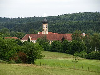
Gessertshausen is a municipality in the district of Augsburg in Bavaria in Germany. It lies on the Schmutter River.

Bischofswiesen Place in Bavaria, Germany

Bischofswiesen is a municipality in the district of Berchtesgadener Land in Bavaria in Germany.

Falkenstein, Bavaria Place in Bavaria, Germany

Falkenstein is a municipality in the district of Cham in Bavaria in Germany.

Hausen, Upper Franconia Place in Bavaria, Germany

Hausen is a municipality in the district of Forchheim in Bavaria in Germany.

Eching am Ammersee Place in Bavaria, Germany

Eching am Ammersee is a municipality in the district of Landsberg in Bavaria in Germany. It has a size of 6.15km2.

Brannenburg Place in Bavaria, Germany

Brannenburg is a municipality in the district of Rosenheim in Bavaria in Germany. There is a train station is located in Brannenburg.

Flintsbach Place in Bavaria, Germany

Flintsbach is a municipality in the district of Rosenheim in Bavaria in Germany, on the river Inn.

Altenmarkt an der Alz Place in Bavaria, Germany

Altenmarkt an der Alz is a municipality in the district of Traunstein in Bavaria, Germany.

Obing Place in Bavaria, Germany

Obing is a municipality in the district of Traunstein in Bavaria, Germany.

Güntersleben Place in Bavaria, Germany

Güntersleben is a municipality in the district of Würzburg in Bavaria in Germany.

Breitbrunn am Chiemsee Place in Bavaria, Germany

Breitbrunn am Chiemsee is a municipality in the district of Rosenheim in Bavaria in Germany.

Unterwössen Place in Bavaria, Germany

Unterwössen is a municipality in the district of Traunstein in Bavaria, Germany.

Buxheim, Swabia Place in Bavaria, Germany

Buxheim is a municipality in the district of Unterallgäu in Bavaria, Germany.

Winterhausen Place in Bavaria, Germany

Winterhausen is a municipality in the district of Würzburg in Bavaria, Germany.

Edling, Germany Place in Bavaria, Germany

Edling is a village and a municipality in the district of Rosenheim in Bavaria in Germany.

References

  1. Liste der ersten Bürgermeister/Oberbürgermeister in kreisangehörigen Gemeinden, Bayerisches Landesamt für Statistik, 15 July 2021.
  2. "Tabellenblatt "Daten 2", Statistischer Bericht A1200C 202041 Einwohnerzahlen der Gemeinden, Kreise und Regierungsbezirke". Bayerisches Landesamt für Statistik und Datenverarbeitung (in German). June 2021.