Passau is a Landkreis (district) in the southeast of Bavaria, Germany. It encloses the city of Passau geographically from two sides. Neighboring districts are Rottal-Inn, Deggendorf, Freyung-Grafenau. To the south it borders Austria.
Rottal-Inn is a Landkreis (district) in the southeastern part of Bavaria, Germany. Neighboring districts are Altötting, Mühldorf, Landshut, Dingolfing-Landau and Passau. To the southeast is the Austrian state of Upper Austria (Braunau).
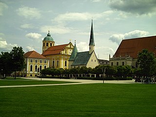
Altötting is a town in Bavaria, capital of the district Altötting of Germany. For 500 years it has been the scene of religious pilgrimages by Catholics in honor of Mary, including a visit by Pope John Paul II in 1980 and one by Pope Benedict XVI in 2006.
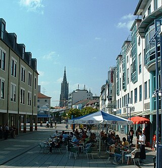
Neu-Ulm is the seat of the Neu-Ulm district and a town in Swabia, Bavaria. Neighbouring towns include Ulm, Senden, Pfaffenhofen an der Roth, Holzheim, Nersingen and Elchingen. The population is 58,978.

Bad Königshofen im Grabfeld is a small spa town in the German state of Bavaria, located in the Rhön-Grabfeld district in northeast Lower Franconia, Bavaria, Germany. According to the Bavarian State Office for Statistics and Data, Bad Königshofen had a population of 5,995 in 2017. The Franconian Saale flows through the town.

Bad Brückenau is a spa town in Bad Kissingen district in northwestern Bavaria in the Rhön Mountains.

Elchingen is a municipality about 7 km east of Ulm–Neu-Ulm in the district of Neu-Ulm in Bavaria, Germany.

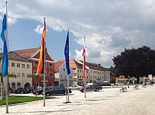
Pocking is a town in the district of Passau, in Lower Bavaria, Germany. It is situated about 30 km south-west of Passau, close to the Austrian border.
Eggenfelden is a municipality in the district of Rottal-Inn in Bavaria, Germany.

Bad Kötzting is a town in the district of Cham, in Bavaria, Germany, near the Czech border. It is situated in the Bavarian Forest, 15 km (9.3 mi) southeast of Cham.

Schlüsselfeld is a town on the southwestern edge of the Upper Franconian district (Landkreis) of Bamberg

Wörth an der Donau is a town in the district of Regensburg, in Bavaria, Germany. It is situated on the left bank of the Danube, 22 km east of Regensburg.

Nonnenhorn is one of the three Bavarian towns on Lake Constance in the Swabian district of Lindau. The air health resort and famous wine town is located between Wasserburg (Bodensee) and Kressbronn am Bodensee (Baden-Württemberg).

Großwallstadt is a community in the Miltenberg district in the Regierungsbezirk of Lower Franconia (Unterfranken) in Bavaria, Germany.

Ampfing is a municipality in the district of Mühldorf in Bavaria in Germany, and a name of a small town of the same name.

Bad Feilnbach is a municipality in the Upper Bavarian district of Rosenheim at the foot of Wendelstein Mountain in Germany. As a famous 'Moorheilbad' the municipality was awarded in 1973 the title "Bad". Since the 19th century the peat deposits were the basis for a continued expansion of the spa and health facilities. The recognized healing success of "black gold" on a variety of diseases were the basis for the development of a well-known spa and tourist community. Due to its wooded surroundings and the mild climate Feilnbach is called the "Bavarian Meran". The entire municipality is recognized as a healing spa resort except for parts of the former municipality Dettendorf.

Waging am See is a municipality in the district of Traunstein in Bavaria, Germany. The town, classified as a climatic spa, is located at the Waginger See, the warmest lake in Upper Bavaria, with temperatures up to 27 °C.

Obernzell is a municipality in the district of Passau in Bavaria in Germany.

Ortenburg is a municipality and old market town in the district of Passau in Bavaria in Germany.

Untergriesbach is a municipality in the district of Passau in Bavaria in Germany.