Springdale is an unincorporated community and census-designated place (CDP) in Gaston County, North Carolina, United States. It was first listed as a CDP in the 2020 census with a population of 1,203. It is bordered on the west and south by the City of Gastonia, on the east by the town of Ranlo, and on the north by the unincorporated community of Monterey Park.

Hamer is an unincorporated community and census-designated place (CDP) in Dillon County, South Carolina, United States. It was first listed as a CDP in the 2020 census with a population of 820.
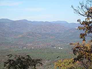
Caesars Head is an unincorporated community and census-designated place (CDP) on top of Caesars Head, a mountain in Greenville County, South Carolina, United States. It was first listed as a CDP in the 2020 census with a population of 84.
Tamassee is an unincorporated community and census-designated place (CDP) located in northwestern Oconee County, South Carolina, United States. It was first listed as a CDP in the 2020 census with a population of 60.
Dacusville is a small unincorporated community and census-designated place (CDP) in Pickens County, South Carolina, United States. It is best known for its tractor show once a year in the month of September. The community also has an elementary school and a middle school. It was first listed as a CDP in the 2020 census with a population of 399.
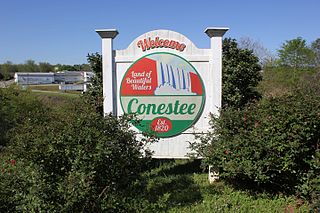
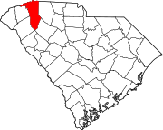
Conestee is an unincorporated community and census-designated place (CDP) in Greenville County, South Carolina, United States. It was first listed as a CDP in the 2020 census with a population of 904.
Emma is an unincorporated community and census-designated place (CDP) in Buncombe County, North Carolina, United States. It was first listed as a CDP in the 2020 census with a population of 2,174.
Brandywine Bay is a planned community and census-designated place (CDP) in Carteret County, North Carolina, United States. It was first listed as a CDP in the 2020 census with a population of 1,153.
Carolina Meadows is a planned community and census-designated place (CDP) in Chatham County, North Carolina, United States. It was first listed as a CDP in the 2020 census with a population of 727.
Governors Club is a golf course community and census-designated place (CDP) in Chatham County, North Carolina, United States. It was first listed as a CDP in the 2020 census with a population of 1,969.
Unity is an unincorporated community and census-designated place (CDP) in Lancaster County, South Carolina, United States. It was first listed as a CDP prior to the 2020 census with a population of 325.
White Knoll is an unincorporated area and census-designated place (CDP) in Lexington County, South Carolina, United States. It was first listed as a CDP prior to the 2020 census with a population of 7,858.
Keowee Key is a lakeside community and census-designated place (CDP) in Oconee County, South Carolina, United States. It is considered part of the Salem community. It was first listed as a CDP prior to the 2020 census with a population of 2,716.
Cateechee is an unincorporated community and census-designated place (CDP) in Pickens County, South Carolina, United States. It was first listed as a CDP prior to the 2020 census. The population as of 2020 was 321.
Capitol View is an unincorporated part of Richland County, South Carolina, United States, consisting of several neighborhoods that are next to the city of Columbia, the state capital. The area was first listed as a census-designated place (CDP) prior to the 2020 census. In 2020 its population was 4,653.
Arkwright is an unincorporated area and census-designated place (CDP) adjacent to the city of Spartanburg in Spartanburg County, South Carolina, United States. It was first listed as a CDP prior to the 2020 census with a population of 2,311.
Ben Avon is an unincorporated area and census-designated place (CDP) adjacent to the city of Spartanburg in Spartanburg County, South Carolina, United States. It was first listed as a CDP prior to the 2020 census. The population as of 2020 was 2,428.
Camp Croft is an unincorporated area and census-designated place (CDP) in Spartanburg County, South Carolina, United States. It was first listed as a CDP prior to the 2020 census. The 2020 census lists a population of 2,110.
Whitney is an unincorporated area and census-designated place (CDP) adjacent to the city of Spartanburg in Spartanburg County, South Carolina, United States. It was first listed as a CDP prior to the 2020 census with a population of 4,409.
Baxter Village is a planned community and census-designated place (CDP) in York County, South Carolina, United States. It was first listed as a CDP prior to the 2020 census which showed a population of 4,217.