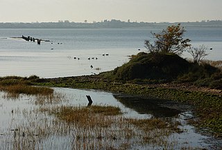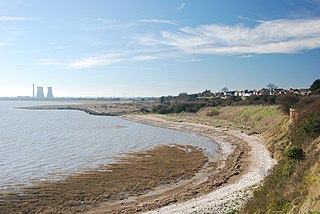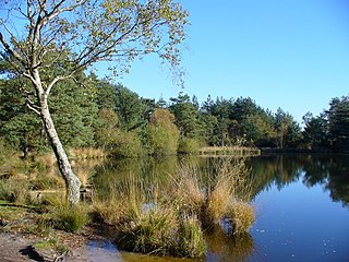
Chobham Common is a 655.7-hectare (1,620-acre) biological Site of Special Scientific Interest north of Chobham in Surrey. It is a Nature Conservation Review site, Grade I and a national nature reserve. It is part of the Thames Basin Heaths Special Protection Area and the Thursley, Ash, Pirbright and Chobham Special Area of Conservation. It contains three scheduled monuments. Most of the site is managed by the Surrey Wildlife Trust as the Chobham Common nature reserve, but the SSSI also includes a small private reserve managed by the Trust, Gracious Pond.

Surrey Wildlife Trust (SWT) was founded in 1959 as Surrey Naturalists' Trust and it is one of forty-six wildlife trusts covering Great Britain, Northern Ireland, Isle of Man and Alderney. SWT carries out conservation activities on a considerable area of Surrey County Council's large countryside estate and also manages land on behalf of the Ministry of Defence estate. As of 2022 the SWT manages more than 6,000 hectares of land for wildlife and employs more than 100 staff. It had an income of £5.1 million and expenditure of £5.7 million.

The Sussex Wildlife Trust (SWT) is a conservation charity which aims to protect natural life in Sussex. It was founded in 1961 and is one of 46 wildlife trusts across the UK and the Isle of Man and Alderney. As of 2019, it has 33,000 members and manages 2,000 hectares of land for nature. It is a registered charity and in the year to 31 March 2019 it had an income of £5.7 million and expenditure of £4 million, resulting in net income of £1.7 million.

Hankley Common is a 560-hectare (1,400-acre) nature reserve and filming location in the south-west of Elstead in Surrey. It is owned by the Ministry of Defence. The site is part of the Thursley, Hankley and Frensham Commons Special Area of Conservation, Special Protection Area and Site of Special Scientific Interest. The site has woodland and lowland heath with heather and gorse. Birds include nightjars and Dartford warblers and there are other fauna such as adders and common lizards.

Queendown Warren is a 22.2-hectare (55-acre) biological Site of Special Scientific Interest south-east of Rainham in Kent. It is a Local Nature Reserve, a Nature Conservation Review site, Grade 2, and a Special Area of Conservation. It is in the Kent Downs Area of Outstanding Natural Beauty. It is managed by the Kent Wildlife Trust, and part of it is owned by Plantlife.

Ash to Brookwood Heaths is a 1,576.3-hectare (3,895-acre) biological Site of Special Scientific Interest west of Guildford in Surrey. It is a Nature Conservation Review site, Grade I. It is part of the Thames Basin Heaths Special Protection Area and the Thursley, Ash, Pirbright and Chobham Special Area of Conservation. An area of 1,392 hectares is managed as a nature reserve by the Surrey Wildlife Trust.

Colony Bog and Bagshot Heath is a 1,130.5-hectare (2,794-acre) biological Site of Special Scientific Interest between Camberley and Woking in Surrey, England. Part of it is a Nature Conservation Review site, Grade I. It is part of the Thames Basin Heaths Special Protection Area and the Thursley, Ash, Pirbright and Chobham Special Area of Conservation. It includes Brentmoor Heath, a Local Nature Reserve which is managed by the Surrey Wildlife Trust
Thursley Common is a national nature reserve in Surrey, England, and has also been designated as a Ramsar wetland. It is also part of a Site of Special Scientific Interest called Thursley, Hankley and Frensham Commons.

The Thames Basin Heaths are a natural region in southern England in Berkshire, Hampshire and Surrey, a slightly mottled east-west belt of ecologically recognised and protected land.

Stour Estuary is a 2,523 hectare biological and geological Site of Special Scientific Interest which stretches from Manningtree to Harwich in Essex and Suffolk. It is also an internationally important wetland Ramsar site, a Special Protection Area and a Nature Conservation Review site. It is part of the Suffolk Coast and Heaths Area of Outstanding Natural Beauty, and there are Geological Conservation Review sites in Wrabness, Stutton, and Harwich Part of the site is managed by the Royal Society for the Protection of Birds, and a small area is Wrabness Nature Reserve, a Local Nature Reserve managed by the Essex Wildlife Trust.

Sandwich Bay to Hacklinge Marshes is a 1,790.1-hectare (4,423-acre) biological and geological Site of Special Scientific Interest which stretches between Deal and Sandwich in Kent. It includes two Geological Conservation Review sites, and most of it is a Nature Conservation Review site, Grade I. Part of it is a Ramsar site, a Special Area of Conservation, a Special Protection Area and a National Nature Reserve, It also includes a Kent Wildlife Trust nature reserve and a Local Nature Reserve,

Sandwich and Pegwell Bay is a 615-hectare (1,520-acre) nature reserve in Kent, managed by the Kent Wildlife Trust. It is a National Nature Reserve, and it includes a Geological Conservation Review site, Prince's Beachlands Local Nature Reserve and two Special Areas of Conservation, Sandwich Bay and Thanet Coast. It is part of Sandwich Bay and Thanet Coast Ramsar site and Special Protection Area. It is also of Sandwich Bay to Hacklinge Marshes Site of Special Scientific Interest and Sandwich/Pegwell Bay Nature Conservation Review site, Grade I.

Thursley, Hankley and Frensham Commons is a 1,878.5-hectare (4,642-acre) biological Site of Special Scientific Interest west of Godalming in Surrey. Thursley and Hankley Commons are Nature Conservation Review sites, Grade I. An area of 115.1 hectares is a local nature reserve called The Flashes and an area of 180 hectares is the Elstead Group of Commons, a nature reserve managed by the Surrey Wildlife Trust. Thursley Common is a national nature reserve. An area of 265.7 hectares is the Thursley & Ockley Bogs Ramsar site. The site is a Special Protection Area and part of the Thursley, Ash, Pirbright & Chobham Special Area of Conservation.

Bisley and West End Commons is a 37.2-hectare (92-acre) Local Nature Reserve west of Woking in Surrey. It is part of the 46-hectare (110-acre) Bisley & West End Commons and Reidon Hill nature reserve, which is owned by Surrey County Council and managed by Surrey Wildlife Trust. The site is also part of the Colony Bog and Bagshot Heath Site of Special Scientific Interest, the Thursley, Ash, Pirbright & Chobham Special Area of Conservation and the Thames Basin Heaths Special Protection Area,

Brentmoor Heath is a 28.6-hectare (71-acre) Local Nature Reserve east of Camberley in Surrey. It is part of Brentmoor Heath and Folly Bog nature reserve, the ownership of which is divided between the Ministry of Defence, Surrey County Council and Surrey Heath Borough Council, and is managed by Surrey Wildlife Trust. The site is also part of Colony Bog and Bagshot Heath site of Special Scientific Interest, Thursley, Ash, Pirbright & Chobham Special Area of Conservation and Thames Basin Heaths Special Protection Area.

Ash Ranges is a 1,392-hectare (3,440-acre) nature reserve west of Pirbright in Surrey. It is owned by the Ministry of Defence and managed by the Surrey Wildlife Trust. It is part of the Thames Basin Heaths Special Protection Area and the Ash to Brookwood Heaths Site of Special Scientific Interest

Elstead Group of Commons is a 180-hectare (440-acre) nature reserve east of Elstead in Surrey. It is composed of Royal, Elstead and Ockley Commons, which are owned by the Ministry of Defence and managed by the Surrey Wildlife Trust, and Bagmoor Common, which is owned and managed by the Trust. The site is part of Thursley, Hankley and Frensham Commons Special Protection Area and Site of Special Scientific Interest.


