Surrey is a county in South East England which borders Kent to the east, East Sussex to the southeast, West Sussex to the south, Hampshire to the west, Berkshire to the northwest, and Greater London to the northeast. With about 1.2 million people, Surrey is the 12th-most populous English county, the third-most populous home county, after Kent and Essex, and the third-most populous in the Southeast, after Hampshire and Kent.

Reigate and Banstead is a local government district with borough status in east Surrey, England. It includes the towns of Reigate, Redhill, Horley and Banstead. The borough borders the Borough of Crawley to the south, the Borough of Epsom and Ewell and District of Mole Valley to the west, Tandridge District to the east and the London Boroughs of Sutton and Croydon to the north.

Ashtead is a large village in the Mole Valley district of Surrey, England, approximately 15.5 mi (25 km) south of central London. Primarily a commuter settlement, Ashtead is on the single-carriageway A24 between Epsom and Leatherhead. The village is on the northern slopes of the North Downs and is in the catchment area of The Rye, a tributary of the River Mole.

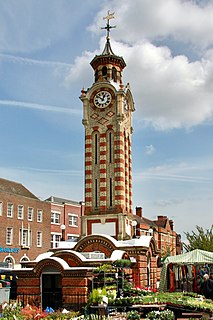
Epsom is the principal town of the Borough of Epsom and Ewell in Surrey, England, approximately 13.5 mi (21.7 km) south of central London. The town is first recorded as Ebesham in the 10th century and its name probably derives from that of a Saxon landowner. The earliest evidence of human activity is from the mid-Bronze Age, but the modern settlement probably grew up in the area surrounding St Martin's Church in the 6th or 7th centuries and the street pattern is thought to have become established in the Middle Ages. Today the High Street is dominated by the clock tower, which was erected in 1847-8.

Elmbridge is a local government district with borough status in Surrey, England. Its principal towns and villages are Esher, Cobham, Walton-on-Thames, Weybridge and Molesey. It directly borders the London Borough of Richmond upon Thames and the London Royal Borough of Kingston upon Thames. Some areas of the borough form a continuation of the Greater London Built-up Area, formerly falling into the Metropolitan Police District.

Epsom and Ewell is a local government district with borough status in Surrey, England, covering the towns of Epsom and Ewell. The borough was formed as an urban district in 1894, and was known as Epsom until 1934. It was made a municipal borough in 1937. The district was considered for inclusion in Greater London in 1965 but was left unaltered by the London Government Act 1963 and the Local Government Act 1972 in 1974. However, despite being outside modern Greater London the borough was in the Metropolitan Police District until it was transferred to Surrey Police in 2000. In the May 2019 elections, the borough was held by the Epsom and Ewell Residents Association with 32 seats, Labour with 3 seats, Liberal Democrats with 2 seats, and Conservatives with 1 seat.

The Hogsmill River in Surrey and Greater London, England is a small chalk stream tributary of the River Thames. It rises in Ewell and flows into the Thames at Kingston upon Thames on the lowest non-tidal reach, that above Teddington Lock.

Ewell is a suburban area with a village centre in the borough of Epsom and Ewell in Surrey, approximately 12 miles (19 km) south of central London and 1.5 miles (2.4 km) northeast of Epsom. In the 2011 Census, the settlement had a population of 34,872, a majority of which (73%) is in the ABC1 social class, except the Ruxley Ward that is C2DE.
Stoneleigh is a suburban area southwest of London, situated in the north of the Epsom and Ewell borough in the county of Surrey, England. It is situated approximately 11 miles (18 km) from central London. In the 2011 Census, the population was 8741.

Ashtead Common, nearly 495 acres, is a wooded area open to the public, to the north of the village of Ashtead in Surrey, England. It is owned and managed by the City of London Corporation, after being bought by the City due to concern in the 1870s that access to the open countryside around London was being threatened. 180.5 ha of the common are a National Nature Reserve. Together with Epsom Common it forms part of a larger area of open countryside called Epsom and Ashtead Commons, which is designated a Site of Special Scientific Interest (SSSI).
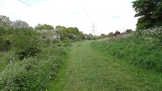
The Horton Light Railway had its origins in a contractor's line built in 1905 to transport building materials, coal and other supplies for London County Council's Epsom Cluster of psychiatric hospitals in the Horton area to the North-West of the town of Epsom. The Light Railway Order did not permit the carriage of passengers. The railway connected with the mainline network just south of Ewell West railway station.

Epsom Common is a 177.4-hectare (438-acre) Local Nature Reserve in Epsom in Surrey. It is owned and managed by Epsom and Ewell Borough Council. It is part of Epsom and Ashtead Commons, a Site of Special Scientific Interest.

The Thames Down Link is a 24 km (15 mi) official walking route linking the Thames Path and the North Downs Way. It starts in the town centre of Kingston upon Thames and finishes at Box Hill & Westhumble railway station.

Bonesgate Open Space is a public park, Local Nature Reserve (LNR) and Site of Borough Importance for Nature Conservation, Grade 1, in Chessington in the Royal Borough of Kingston upon Thames in London. It has an area of 5.07 hectares, and was designated an LNR in 1994.

Castle Hill is a 3.5 hectare scheduled monument, local nature reserve and Site of Borough Importance for Nature Conservation, Grade 1, in Chessington in the Royal Borough of Kingston upon Thames, London. It is owned by Merton College, Oxford, and leased to Kingston Council. The site is managed by the Lower Mole Countryside Management Project.

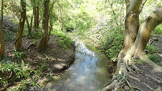
Bonesgate Stream is a brook in Chessington in Kingston upon Thames in London and Epsom and Ewell in Surrey. It is a tributary of the Hogsmill River, which is a tributary of the River Thames.

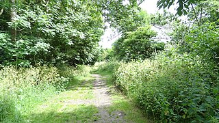
Hogsmill LNR is a 36-hectare (89-acre) Local Nature Reserve in Ewell in Surrey. It is owned by Epsom and Ewell Borough Council and Surrey County Council and managed by Epsom and Ewell Borough Council.


