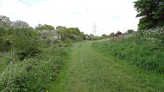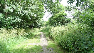
Leatherhead is a town in the Mole Valley District of Surrey, England, about 17 mi (27 km) south of Central London. The settlement grew up beside a ford on the River Mole, from which its name is thought to derive. During the late Anglo-Saxon period, Leatherhead was a royal vill and is first mentioned in the will of Alfred the Great in 880 AD. The first bridge across the Mole may have been constructed in around 1200 and this may have coincided with the expansion of the town and the enlargement of the parish church.

The River Mole is a tributary of the River Thames in southern England. It rises in West Sussex near Gatwick Airport and flows northwest through Surrey for 80 km to the Thames at Hampton Court Palace. The river gives its name to the Surrey district of Mole Valley.

Mole Valley is a local government district in Surrey, England. Its council is based in Dorking.

The River Wandle is a right-bank tributary of the River Thames in south London, England. With a total length of about 9 miles (14 km), the river passes through the London boroughs of Croydon, Sutton, Merton and Wandsworth, where it reaches the Thames. A short headwater – the Caterham Bourne – is partially in Surrey, the historic county of the river's catchment. Tributaries of the Wandle include Carshalton Ponds and Norbury Brook.

The Rye is a stream rising east of Ashtead and flowing into the River Mole near Leatherhead, Surrey.

Rowhill Nature Reserve or Rowhill Copse is a 26.6-hectare (66-acre) Local Nature Reserve (LNR) which straddles the border between Aldershot in Hampshire and Farnham in Surrey. It is owned by Rushmoor Borough Council, was declared an LNR by Waverley Borough Council and is managed by Rowhill Nature Reserve Society.

Norbury Park is a swathe of mixed wooded and agricultural land associated with its Georgian manor house near Leatherhead and Dorking, Surrey, which appears in the Domesday Book of 1086. It occupies mostly prominent land reaching into a bend in the Mole in the parish of Mickleham.

Epsom Common is a 177.4-hectare (438-acre) Local Nature Reserve in Epsom in Surrey. It is owned and managed by Epsom and Ewell Borough Council. It is part of Epsom and Ashtead Commons, a Site of Special Scientific Interest.

Mole Gap to Reigate Escarpment is a 1,016.4-hectare (2,512-acre) biological and geological Site of Special Scientific Interest west of Reigate in Surrey. It is a Geological Conservation Review site and a Special Area of Conservation. Part of it is a Nature Conservation Review site, Grade I. Two small private nature reserves in the site are managed by the Surrey Wildlife Trust, Dawcombe and Fraser Down.

Ashtead Park is a 24.2-hectare (60-acre) Local Nature Reserve in Ashtead in Surrey. It is owned by Mole Valley District Council. It contains several important listed buildings. The Park itself has remains of a Roman building, four lakes/ponds and the school's playing fields and is Grade II listed on the Register of Historic Parks and Gardens.

Bonesgate Open Space is a public park, Local Nature Reserve (LNR) and Site of Borough Importance for Nature Conservation, Grade 1, in Chessington in the Royal Borough of Kingston upon Thames in London. It has an area of 5.07 hectares, and was designated an LNR in 1994.

Southwood Open Space is a 12.9 hectare Local Nature Reserve (LNR) in Old Malden in the Royal Borough of Kingston upon Thames in London. It is a linear park along the Hogsmill River between the Kingston Bypass opposite Elmbridge Avenue and the junction between the Hogsmill and a footpath to Manor Drive North.

Masons Field is a 2.9 hectare Local Nature Reserve (LNR) in Kingsbury in the London Borough of Brent. It was declared an LNR in 2013, it is owned by London Underground Ltd and managed by Brent Council on a 125-year leasehold.

Hogsmill LNR is a 36-hectare (89-acre) Local Nature Reserve in Ewell in Surrey. It is owned by Epsom and Ewell Borough Council and Surrey County Council and managed by Epsom and Ewell Borough Council.

Weybourne LNR is a 2.4-hectare (5.9-acre) Local Nature Reserve on the southern outskirts of Weybourne in Surrey. It is owned and managed by Waverley Borough Council.

Inholms Clay Pit is a 8.4-hectare (21-acre) Local Nature Reserve south of Dorking in Surrey. It is owned by Mole Valley District Council and from 2009 - 2019 was managed by Surrey Wildlife Trust and since then by Mole Valley District Council.

Up Nately LNR is a 2.8-hectare (6.9-acre) local nature reserve in Up Nately in Hampshire. It is owned by Hampshire County Council and Surrey County Council and managed by the Basingstoke Canal Authority. It is part of Butter Wood, which is a Site of Special Scientific Interest.


