The Green Man at Inglewhite

Last updated

The Green Man at Inglewhite
South Inglewhite - geograph.org.uk - 47151.jpg
The Green Man at Inglewhite in 2005
Location map United Kingdom City of Preston.svg
Red pog.svg
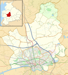
The Green Man
Location within the City of Preston district
General information
Type Public house
AddressSilk Mill Lane
Town or city Inglewhite, Lancashire
CountryEngland
Coordinates 53°51′13″N2°41′23″W / 53.853586°N 2.689769°W / 53.853586; -2.689769 Coordinates: 53°51′13″N2°41′23″W / 53.853586°N 2.689769°W / 53.853586; -2.689769
Opened1809
OwnerMikoh Inns Ltd.
LandlordMick O'Hara
Technical details
Floor count2
Website
thegreenmanatinglewhite.co.uk

The Green Man at Inglewhite is a public house in Inglewhite, Lancashire, England.

Contents

The pub, which was established in 1809, [1] [2] has been owned since January 2017 by Mikoh Inns, [1] which also owns The White Bull in Bilsborrow, Lancashire, [3] about three miles to the west.

In 1986, Inglewhite was designated a conservation area. It was appraised again a decade later. A 2011 review "re-evaluates its special architectural and historic interest in line with the requirements of the Town & Country (Listed Buildings and Conservation Areas) Act 1990 using the latest best practice guidance produced by English Heritage." [4] In 2011, Preston City Council designated The Green Man one of eight sites of special interest in the village. [4]

The building is also notable for its use of the now-rare Westmorland slate on its roof. [4]

Related Research Articles

Village green Common open area within a settlement

A village green is a common open area within a village or other settlement. Historically, a village green was common grassland with a pond for watering cattle and other stock, often at the edge of a rural settlement, used for gathering cattle to bring them later on to a common land for grazing. Later, planned greens were built into the centres of villages.

Longridge Town in Lancashire, England

Longridge is a market town and civil parish in the borough of Ribble Valley in Lancashire, England. It is situated 8 miles (13 km) north-east of the city of Preston, at the western end of Longridge Fell, a long ridge above the River Ribble. Its nearest neighbours are the village of Grimsargh, 2 miles (3 km) to the southeast, and the Roman town of Ribchester (Bremetennacum), 3.5 miles (6 km) to the southeast. The parish of Longridge had a population of 7,546 recorded in the 2001 census, increasing to 7,724 at the 2011 Census.

Goosnargh Village and parish in Lancashire, England

Goosnargh is a village and civil parish in the City of Preston district of Lancashire, England.

Clayton-le-Woods Human settlement in England

Clayton-le-Woods is a large village and civil parish of the Borough of Chorley, in Lancashire, England. According to the census of 2001, it has a population of 14,528. At the 2011 census the population of Cuerden civil parish was included within Clayton-le-Woods, giving a total of 14,532.

Rufford, Lancashire Human settlement in England

Rufford is a village in West Lancashire, England, where the Leeds and Liverpool Canal, Liverpool, Ormskirk and Preston Railway, the A59 and the River Douglas meet.

Aughton, Lancashire Village and parish in West Lancashire, England

Aughton is a village and civil parish in the Borough of West Lancashire of Lancashire, England, between Ormskirk and Maghull. It is a residential area with tree lined roads being found in all parts of the parish and an area of 1,658 hectares. The northern part is known as Aughton village, the south-west as Holt Green and the south-east as Town Green.

Fulwood, Lancashire Human settlement in England

Fulwood is an area and unparished area in Lancashire, England, forming much of the northern half of the unparished part of the City of Preston district. It had a population of 28,535 in 2011 and is made up of five wards.

Rivington Village in Lancashire, England

Rivington is a village and civil parish of the Borough of Chorley, Lancashire, England, occupying 2,538 acres. It is about 6 miles (9.7 km) southeast of Chorley and about 8+12 miles (13.7 km) northwest of Bolton. Rivington is a rural area consisting primarily of agricultural grazing land, moorland, with hill summits including Rivington Pike and Winter Hill within the West Pennine Moors. The area has a thriving tourist industry centred around reservoirs created to serve Liverpool in the Victorian era and Lever Park created as a public park by William Lever at the turn of the 20th century, with two converted barns, a replica of Liverpool Castle and open countryside. Rivington and its village had a population of 109 at the 2011 Census.

Chipping, Lancashire Human settlement in England

Chipping is a village and civil parish of the borough of Ribble Valley, Lancashire, England, within the Forest of Bowland Area of Outstanding Natural Beauty. In the 2001 census, the parish had a population of 1,046, falling slightly to 1,043 at the 2011 Census. This Lancashire village has won several best-kept village competitions over the years. The village also won the village section of the Royal Horticultural Society Britain in Bloom competition in 2009 picking up RHS Tourism and Gold achievement awards in the process.

Myerscough College is a Higher and Further Education college near Bilsborrow on the Fylde in Lancashire, England.

Whittingham, Lancashire Parish in Lancashire, England

Whittingham is a civil parish in the City of Preston, Lancashire, England. The parish measures 4 miles (6 km) east-to-west, from the outskirts of Longridge to the outskirts of Broughton, but only 1 mile (1½ km) north-to-south. Its population was 2,189 in 2001, reducing to 2,027 at the time of the 2011 Census. The village of Goosnargh is at its centre.

Inglewhite Human settlement in England

Inglewhite is a small village in the parish of Goosnargh in Lancashire, England. It lies at the intersection of the roads from Longridge to Garstang and from Broughton to Beacon Fell.

Gregson Lane Human settlement in England

Gregson Lane is a village in Lancashire, England. It is situated between Bamber Bridge, Higher Walton, Coupe Green and Brindle, and is within four miles of the city of Preston.

Garstang Human settlement in England

Garstang is an ancient market town and civil parish within the Wyre borough of Lancashire, England. It is 10 miles (16 km) north of the city of Preston and the same distance south of Lancaster.

Inskip-with-Sowerby Parish in Wyre Borough, Lancashire, England

Inskip-with-Sowerby is a civil parish in the Borough of Wyre, in Lancashire, England. A part of the Fylde, the parish includes the village of Inskip and the hamlets Crossmoor to the west and Sowerby to the east. Also Inskip Moss Side lies about a mile north-west of the village at grid reference SD452391. In 2011 it had a population of 840.

City of Preston, Lancashire City & Non-metropolitan district in England

The City of Preston is a city and non-metropolitan district in Lancashire, England. On the north bank of the River Ribble, it was granted city status in 2002, becoming England's 50th city in the 50th year of Queen Elizabeth II's reign. The City of Preston district has a population of 143,135 (mid-2019 est.), and lies at the centre of the Central Lancashire sub-region, with a population of 335,000.

Myerscough and Bilsborrow Human settlement in England

Myerscough and Bilsborrow is a civil parish in the Borough of Wyre in Lancashire, England. It was formed on 1 April 2003 as a merger of the former parishes of Bilsborrow and Myerscough, and lies on the eastern border of the Fylde plain.

St Lawrences Church, Barton Church in Lancashire, England

St Lawrence's Church is in Garstang Road, Barton, Preston, Lancashire, England. It is an active Anglican parish church in the diocese of Blackburn. The church was built in 1895–96, and was designed by R. Knill Freeman. It is constructed in sandstone, and consists of a nave, aisles, a chancel and a southwest steeple. The church holds services on Sundays and Wednesdays. It is recorded in the National Heritage List for England as a designated Grade II listed building.

Hilldale, Lancashire Human settlement in England

Hilldale is civil parish in the West Lancashire district of Lancashire, England, containing the village of Hill Dale and the neighbouring hamlet of Andertons Mill. Formerly part of Wrightington, Hilldale became a separate civil parish in 1999. As of 2011, Hilldale has a population of 581.

Inglewhite Congregational Church Church in England

Inglewhite Congregational Church is a church building located in the English village of Inglewhite, Lancashire. A Grade II listed building, it was constructed in 1826, seven years after the founding of the church.

References