
Portobello Road is a street in the Notting Hill district of the Royal Borough of Kensington and Chelsea in West London. It runs almost the length of Notting Hill from South to North, roughly parallel with Ladbroke Grove. On Saturdays it is home to Portobello Road Market, one of London's notable street markets, known for its second-hand clothes, pastries and antiques. Every August since 1996, the Portobello Film Festival has been held in locations around Portobello Road and, in 2015, Portobello Radio was founded as the area's community radio station.

Penrith is a market town and civil parish in the Westmorland and Furness district of Cumbria, England. It is less than 3 miles (5 km) outside the Lake District National Park and about 17 miles (27 km) south of Carlisle. It is between the Rivers Petteril and Eamont and just north of the River Lowther. The town had a population of 15,181 at the 2011 census. It is part of historic Cumberland.

Fitzroy is an inner-city suburb in Melbourne, Victoria, Australia, 3 km (1.9 mi) north-east of the Melbourne central business district, located within the City of Yarra local government area. Fitzroy recorded a population of 10,431 at the 2021 census.

South Yarra is an inner-city suburb in Melbourne, Victoria, Australia, 4 km south-east of Melbourne's Central Business District, located within the Cities of Melbourne and Stonnington local government areas. South Yarra recorded a population of 25,028 at the 2021 census.

Hyde Park is an inner-city residential area of north-west Leeds, West Yorkshire, England, situated between the University of Leeds and Headingley. It sits in the Headingley and Hyde Park ward of Leeds City Council.

Aspley is a suburb in the City of Brisbane, Queensland, Australia. In the 2021 census, Aspley had a population of 12,871 people.
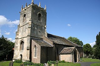
Cantley is a village and civil parish in the City of Doncaster in South Yorkshire, England. The village is adjacent to Bessacarr, separated by Bawtry Road. It has a population of 2,830, reducing slightly to 2,817 at the 2011 Census.
Hazel Grove is a village in the Metropolitan Borough of Stockport, Greater Manchester, England. Historically in Cheshire, it had a population of 14,022 at the 2021 Census.

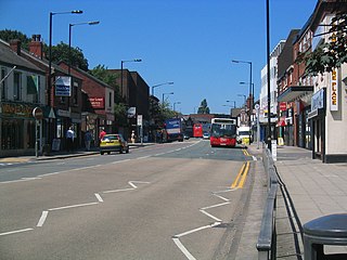
Levenshulme is an area of Manchester, in Greater Manchester, England, bordering Fallowfield, Longsight, Gorton, Burnage, Heaton Chapel and Reddish, halfway between Stockport and Manchester city centre on the A6. Levenshulme is predominantly residential with numerous fast food shops, public houses and antique stores. It has a multi-cultural and multi-ethnic population of 15,430 at the 2011 Census. The Manchester to London railway line passes through Levenshulme railway station.

Blakenhall is a suburb and ward in Wolverhampton, England. The population was 12,614 at the 2021 census.

Ashley is an electoral ward in the city of Bristol, England. It is represented by three members on Bristol City Council, which as of 2024 are Abdul Malik, Izzy Russell and Tim Wye, all members of the Green Party of England and Wales.
Cranhill is an inner city district and housing scheme in the north east of Glasgow, Scotland. Cranhill was developed from public funding in the early 1950s and was originally, chiefly composed of four-storey tenement blocks surrounding a patch of grassland, which became Cranhill Park. Later development saw the building of three tower blocks, surrounded by rows of terraced maisonettes. In more recent years, a number of semi-detached and detached homes have been built. The area also hosts some shops, two primary schools and nurseries, a community centre and the Cranhill water tower.

Campsie is a suburb in the state of New South Wales, Australia. Campsie is 11 kilometres south west of the Sydney central business district, on the southern bank of the Cooks River. Campsie is one of the administrative centres of the City of Canterbury-Bankstown.

Petrie Terrace is an inner suburb in the City of Brisbane, Queensland, Australia. In the 2021 census, Petrie Terrace had a population of 1,168 people.

Paddington is an inner suburb in the City of Brisbane, Queensland, Australia. In the 2021 census, Paddington had a population of 9,063 people.
Lisson Grove is a street and district in the City of Westminster, West London. The West End neighbourhood contains a few important cultural landmarks, including Lisson Gallery, Alfies Antique Market, Red Bus Recording Studios, the former Christ Church, now the Greenhouse Centre, Stringers of London and the Seashell of Lisson Grove.

The Avenues is an area of high status Victorian housing located in the north-west of Kingston upon Hull, England. It is formed by four main tree-lined straight avenues running west off the north-north-east/south-south-west running Princes Avenue.

Gillygate is a street in York, in England, immediately north of the city centre.

Monkgate is a street in York, North Yorkshire, running north-east from the city centre.

Bishopthorpe Road is a radial route in York, in England, connecting the city centre with the village of Bishopthorpe. It is locally known as Bishy Road.


