Aoraki / Mount Cook is the highest mountain in New Zealand. Its height, as of 2014, is listed as 3,724 metres. It is situated in the Southern Alps, the mountain range that runs the length of the South Island. A popular tourist destination, it is also a favourite challenge for mountain climbers. Aoraki / Mount Cook consists of three summits: from south to north, the Low Peak, the Middle Peak and the High Peak. The summits lie slightly south and east of the main divide of the Southern Alps, with the Tasman Glacier to the east and the Hooker Glacier to the southwest. Mount Cook is ranked 10th in the world by topographic isolation.

Mount Waddington, once known as Mystery Mountain, is the highest peak in the Coast Mountains of British Columbia, Canada. Although it is lower than Mount Fairweather and Mount Quincy Adams, which straddle the United States border between Alaska and British Columbia, Mount Waddington is the highest peak that lies entirely within British Columbia. It and the subrange which surround it, known as the Waddington Range, stand at the heart of the Pacific Ranges, a remote and extremely rugged set of mountains and river valleys.

Mount Marcy is the highest point in the U.S. state of New York, with an elevation of 5,343.1 feet (1,628.6 m). It is located in the town of Keene in Essex County. The mountain is in the heart of the High Peaks Wilderness Area in Adirondack Park. Like the surrounding Adirondack Mountains, Marcy was heavily affected by large glaciers during recent ice ages, which deposited boulders on the mountain slopes and carved valleys and depressions on the mountain. One such depression is today filled by Lake Tear of the Clouds, which is often cited as the highest source of the Hudson River. The majority of the mountain is covered by hardwood and spruce-fir forests, although the highest few hundred feet are above the tree line. The peak is dominated by rocky outcrops, lichens, and alpine plants. The mountain supports a diverse number of woodland mammals and birds.

Arthur's Pass National Park is located in the South Island of New Zealand and covers 1,185 km2 of mostly mountainous terrain. Adjacent to it lies Craigieburn Forest Park. The park is administered by the Department of Conservation.

Toubkal, also Jbel Toubkal or Jebel Toubkal, is a mountain in southwestern Morocco, located in the Toubkal National Park. At 4,167 m (13,671 ft), it is the highest peak in Morocco, the Atlas Mountains, North Africa and the Arab world. Located 63 km (39 mi) south of the city of Marrakesh, and visible from it, Toubkal is an ultra prominent peak, the highest for over 2,000 km (1,200 mi). Toubkal is ranked 27th by topographic isolation.

Mount Hayes is the highest mountain in the eastern Alaska Range, in the U.S. state of Alaska. Despite not being a fourteener, it is one of the largest peaks in the United States in terms of rise above local terrain. For example, the Northeast Face rises 8,000 feet (2,440 m) in approximately 2 miles (3.2 km). This large vertical relief contributes to Mount Hayes being the 51st most topographically prominent peak in the world.

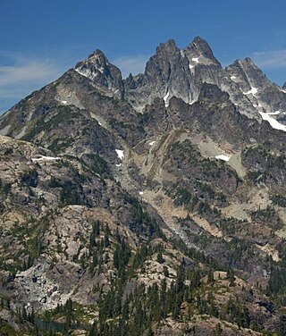
Lemah Mountain is a mountain peak in the Snoqualmie Crest, a part of the North Cascades Mountains, of the US state of Washington, most noted for its five distinct summits. It is approximately 7.7 miles (12.4 km) from Snoqualmie Pass. The name Lemah comes from the Chinook Jargon word Lemah, in turn derived from a French word, le main, meaning "hand". Lemah Mountain formed by rocks crumpled into mountains by the Cascadia subduction zone where the Juan de Fuca and North American Plates meet.

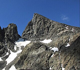
The Thumb is a 13,356-foot-elevation (4,071-meter) mountain summit located on the crest of the Sierra Nevada mountain range, in Inyo County of northern California. It is situated in the Palisades area of the John Muir Wilderness, on land managed by Inyo National Forest. It is 1.3 miles (2.1 km) east of Middle Palisade, 1.6 miles (2.6 km) west-northwest of Birch Mountain, and 1.8 miles (2.9 km) north of Mount Bolton Brown. The Thumb ranks as the 83rd-highest summit in California. Topographic relief is significant as the east aspect rises over 2,500 feet above Birch Lake in approximately one mile. The John Muir Trail traverses below the southwest aspect of the mountain, providing an optional approach access.

Disappointment Peak is a 13,917-foot-elevation summit located on the shared boundary of Fresno County and Inyo County in California, United States.

Scylla is a 12,956-foot-elevation (3,949 meter) mountain summit located west of the crest of the Sierra Nevada mountain range, in Fresno County, California, United States. This peak is situated in Kings Canyon National Park, 1.27 miles (2.04 km) southwest of Charybdis, 2.3 miles (3.7 km) southeast of Mount Goddard, and 2.57 miles (4.14 km) west of Mount McDuffie. Topographic relief is significant as the summit rises 3,150 feet above Enchanted Gorge in approximately one mile. The John Muir Trail provides one possible approach option to this remote peak. An ascent of the peak is non-technical via the northwest slope, and inclusion on the Sierra Peaks Section peakbagging list generates climbing interest in this peak.

Cerro El Plata is a 5,968 metres (19,580 ft) mountain summit in Argentina.

Alabaster Peak is an 8,065-foot-elevation (2,458-meter) mountain summit located 35 miles (56 km) east of Palmer, in the northern Chugach Mountains of Alaska. This peak of the Matanuska Valley is set midway between Anchorage and Glennallen, and can be seen from the Glenn Highway. It is situated 15 miles (24 km) west of Matanuska Glacier and 1.8 miles (2.9 km) south of Awesome Peak. Precipitation runoff from the mountain drains into Coal, Monument, and Gravel creeks, which are tributaries of the Matanuska River. Topographic relief is significant as the summit rises 3,065 feet along the west slope in one mile (1.6 km). The first ascent of the summit was made on July 4, 1970, by Robert Spurr, Bob Pelz, and Royce Purinton via the Spectrum Glacier and North Ridge. This mountain's toponym has not been officially adopted by the United States Board on Geographic Names, so it is only marked as "8065" on USGS maps.

Ice Cream Cone Mountain is an 8,675-foot-elevation (2,644-meter) mountain summit located 22 miles (35 km) east of Palmer, in the northern Chugach Mountains of Alaska. This peak is visible from the Glenn Highway near Mile 70 west of Kings Mountain. Precipitation runoff from the mountain's north slope drains into Carpenter Creek, a tributary of the Matanuska River, whereas the south slope drains into Metal Creek, a tributary of the Knik River. Topographic relief is significant as the summit rises 5,200 feet above Metal Creek in 1.5 mile (2.4 km) and 5,675 feet above Carpenter Creek in 1.9 mile (3 km). The first ascent of the summit was made on July 3, 1967, by David P. Johnston, John Samuelson, and Hans Van der Laan via the Northeast Ridge. This mountain's local descriptive toponym has not been officially adopted by the United States Board on Geographic Names, so it is only marked as "8675" on USGS maps. Some climbers in Anchorage call this peak the "Sky Buster" which was the name applied by mountaineer Vin Hoeman.

Troublemint Peak is a 6,801-foot-elevation (2,073-meter) summit in Alaska, United States.

Castle Hill Peak is a 1,998-metre-elevation (6,555-foot) mountain in the Canterbury Region of New Zealand.

Alma is a 2,510-metre-elevation (8,235-foot) mountain in the Canterbury Region of New Zealand.

Achilles Peak is a 2,540-metre-elevation (8,333-foot) mountain in the Canterbury Region of New Zealand.

Mount D'Archiac is a 2,875-metre-elevation (9,432-foot) mountain in the Canterbury Region of New Zealand.

Cloudy Peak is a 2,403-metre-elevation (7,884-foot) mountain in the Canterbury Region of New Zealand.

Mount Alba is a 2,360-metre-elevation (7,743-foot) mountain in New Zealand.


