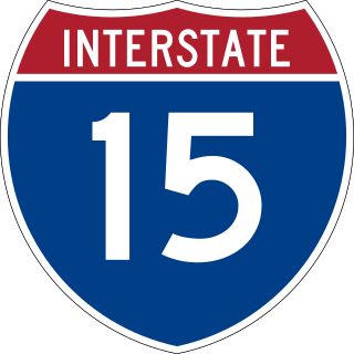
Interstate 15 (I-15) is a major Interstate Highway in the Western United States, running through Southern California and the Intermountain West. I-15 begins near the Mexican border in San Diego County and stretches north to Alberta, Canada, passing through the states of California, Nevada, Arizona, Utah, Idaho, and Montana. The Interstate serves the cities of San Diego, San Bernardino, Las Vegas, Salt Lake City, Idaho Falls, and Great Falls. It also passes close to the urban areas of Los Angeles, Orange, and Riverside counties, California. The stretches of I-15 in Idaho, Utah, and Arizona have been designated as the "Veterans Memorial Highway". The southern end is at a junction with I-8 and State Route 15 (SR 15) in San Diego, and the northern end is at a connection with Alberta Highway 4 at the Sweetgrass–Coutts Border Crossing.

Interstate 94 (I-94) is an east–west Interstate Highway connecting the Great Lakes and northern Great Plains regions of the United States. Its western terminus is just east of Billings, Montana, at a junction with I-90; its eastern terminus is in Port Huron, Michigan, where it meets with I-69 and crosses the Blue Water Bridge into Sarnia, Ontario, Canada, where the route becomes Ontario Highway 402. It thus lies along the primary overland route from Seattle to Toronto and is the only east–west Interstate Highway to have a direct connection to Canada.
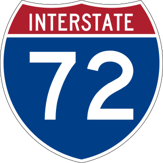
Interstate 72 (I-72) is an Interstate Highway in the midwestern United States. Its western terminus is in Hannibal, Missouri, at an intersection with U.S. Route 61 (US 61); its eastern terminus is at Country Fair Drive in Champaign, Illinois. The route runs through the major cities of Decatur, Illinois, and Springfield, Illinois. In 2006, the Illinois General Assembly dedicated all of I-72 as Purple Heart Memorial Highway. The stretch between Springfield and Decatur is also called Penny Severns Memorial Expressway, and the section between mile 35 and the Mississippi River is known as the Free Frank McWorter Historic Highway.

U.S. Route 12 or U.S. Highway 12 (US 12) is an east–west United States Numbered Highway, running from Aberdeen, Washington, to Detroit, Michigan, for almost 2,500 miles (4,000 km). The highway has mostly been superseded by Interstate 90 (I-90) and I-94, but, unlike most U.S. Highways that have been superseded by an Interstate, US 12 remains intact as an important link for local and regional destinations. The highway's western terminus in Aberdeen is at an intersection with US 101, while the highway's eastern terminus in Downtown Detroit is at the corner of Michigan and Cass avenues, near Campus Martius Park.

U.S. Route 2 or U.S. Highway 2 (US 2) is an east–west United States Numbered Highway spanning 2,571 miles (4,138 km) across the northern continental United States. US 2 consists of two segments connected by various roadways in southern Canada. Unlike some routes, which are disconnected into segments because of encroaching Interstate Highways, the two portions of US 2 were designed to be separate in the original 1926 highway plan.

U.S. Route 85 (US 85) is a 1,479-mile-long (2,380 km) north–south United States Highway that travels in the Mountain and Northern Plains states of the United States. The southern terminus of the highway is at the Mexican border in El Paso, Texas, connecting with Mexican Federal Highway 45. The northern terminus is at the Canadian border in Fortuna, North Dakota, where the route continues north as Saskatchewan Highway 35. The highway route is part of the CanAm Highway. Sections of US 85 are designated as the Theodore Roosevelt Expressway.
The Bismarck Expressway is a state highway in Mandan and Bismarck, North Dakota, in the United States. It carries two unsigned highways: Interstate 194 (I-194) from its west end at exit 156 of I-94 to I-94 Business in Mandan, and North Dakota Highway 810 (ND 810) from I-94 Bus. in Mandan, around the south side of Bismarck back to I-94 Bus. in Bismarck. I-94 Bus. takes the designation from the end of ND 810 to the designation's eastern terminus at I-94 and US Highway 83 (US 83). The portion in Mandan, even where it is ND 810, is a freeway; once it crosses the Missouri River into Bismarck, it becomes a four-lane surface road.
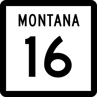
Montana Highway 16 is a 152.371-mile-long (245.217 km) state highway in the U.S. state of Montana. It begins in West Glendive at a Business Loop of Interstate 94 (I-94), and ends at the Port of Raymond on the Saskatchewan border. The northern portion from U.S. Route 2 at Culbertson to the Canada–United States border is proposed as part of the Theodore Roosevelt Expressway.
U.S. Route 2 (US 2) is a part of the United States Numbered Highway System that is split into two segments. Its eastern segment runs from Rouses Point, New York, to Houlton, Maine. In Vermont, US 2 extends 150.518 miles (242.235 km) from the New York state line in Alburgh to the New Hampshire state line in Guildhall. West of Vermont, US 2 continues into New York for another 0.87 miles (1.40 km) to an intersection with US 11 in Rouses Point. US 2 passes through the cities of Burlington and Montpelier as it traverses the state. The highway parallels Interstate 89 (I-89) between these two cities. The Burlington to Montpelier route was first laid out as a toll road in the early 19th century. It was later incorporated into the transcontinental auto trail known as the Theodore Roosevelt International Highway in 1919 before being designated as part of US 2 in 1926.

Louisiana Highway 28 (LA 28) is a state highway located in central Louisiana. It runs 86.97 miles (139.96 km) in an east–west direction from the junction of U.S. Highway 171 (US 171) and LA 8 in Leesville to US 84 west of Jonesville.

U.S. Route 51 (US 51) in the U.S. state of Illinois, is a main north–south artery that runs from the Ohio River north to the Wisconsin border, a distance of 415.95 miles (669.41 km).
Interstate 94 (I-94) runs east–west for 352.4 miles (567.1 km) through the southern half of the US state of North Dakota, from the Montana state line east to the Red River at Fargo. The route generally follows the route of the Northern Pacific Railway.
U.S. Highway 2 (US 2) is an east–west United States Numbered Highway in the state of Montana. It extends approximately 666.645 miles (1,072.861 km) from the Idaho state line east to the North Dakota state line.
U.S. Highway 2 (US 2) is a 358.090-mile-long (576.290 km) United States Numbered Highway in North Dakota, which runs from the Montana state line east to the Red River at Grand Forks. The route connects the cities of Williston, Minot, and Grand Forks. Of the 358 miles (576 km) of US 2 in North Dakota, all but the westernmost 12 miles (19 km) have four lanes.
U.S. Route 85 (US 85) is a part of the U.S. Highway System that travels from the Mexican border in El Paso, Texas, north to the Canadian border in Fortuna, North Dakota. In the state of North Dakota, US 85 travels from the South Dakota state line north to the Canadian border.

There are 19 business routes of Interstate 94 (I-94) in the United States. These business routes connect the downtown business districts of cities to the freeway along I-94.

North Dakota Highway 1804 is a state highway in the U.S. state of North Dakota. ND 1804 and ND 1806 were named to reflect the years of Lewis and Clark's travels through the area, and together constitute the portion of the Lewis and Clark Trail that runs through North Dakota along the northeast and southwest sides of Lake Sakakawea and the Missouri River, respectively.

U.S. Route 385 (US 385) is a part of the United States Numbered Highway System that travels from Big Bend National Park in Texas to US 85 in Deadwood, South Dakota. Within the state of Nebraska, the highway is known as the Gold Rush Byway, one of nine scenic byways across the state. The highway follows along the old Sidney-Black Hills trail which played a crucial role during the Black Hills Gold Rush in the late 1870s. It served as the primary route to transport gold and mining gear between Sidney, Nebraska and the Black Hills to the north. Today, the highway enters Nebraska in the southeastern portion of the Nebraska Panhandle on the state line with Colorado northeast of Julesburg and continues in a northerly direction to the South Dakota state line north of Chadron.
U.S. Route 85 (US 85) is a part of the U.S. Highway System that travels from the Mexican border in El Paso, Texas, north to the Canadian border in Fortuna, North Dakota. In the state of Colorado, US 85 begins at the New Mexico state line south of Starkville and ends at the Wyoming state line south of Cheyenne, Wyoming.
The Heartland Expressway is a federally-designated High Priority Corridor between Limon, Colorado, and Rapid City, South Dakota in the US. The proposed four-lane corridor is currently under construction, and when completed, will function as the central third of the Ports-to-Plains Alliance, connecting the Ports to Plains Corridor and Theodore Roosevelt Expressway via the Nebraska Panhandle. When completed, the highway will provide multi-lane, divided-highway access to cities including Alliance, Nebraska; Scottsbluff, Nebraska; and Brush, Colorado, bringing long-term economic development and reducing travel times in the region.
