Thomaston (CDP), Maine

Last updated

Thomaston, Maine
Knox County Maine incorporated and unincorporated areas Thomaston (CDP) highlighted.svg
Location in Knox County and the state of Maine
Coordinates: 44°4′42″N69°10′53″W / 44.07833°N 69.18139°W / 44.07833; -69.18139
CountryUnited States
State Maine
County Knox
Town Thomaston
Area
[1]
  Total2.16 sq mi (5.60 km2)
  Land2.12 sq mi (5.48 km2)
  Water0.04 sq mi (0.11 km2)
Elevation
118 ft (36 m)
Population
 (2020)
  Total1,836
  Density867.67/sq mi (335.00/km2)
Time zone UTC-5 (Eastern (EST))
  Summer (DST) UTC-4 (EDT)
ZIP code
04861
Area code 207
FIPS code 23-76330
GNIS feature ID0576993

Thomaston is a census-designated place (CDP) comprising the main village in the town of Thomaston in Knox County, Maine, United States. The population was 1,875 at the 2010 census, [2] out of 2,781 in the town of Thomaston as a whole.

Contents

Geography

The Thomaston CDP is located at 44°4′42″N69°10′52″W / 44.07833°N 69.18111°W / 44.07833; -69.18111 (44.078388, −69.18133) [3] in the southern part of the town of Thomaston, on the north side of the Saint George River where it reaches tidewater. U.S. Route 1 comprises Main Street through the village, leading northeast (northbound) 4 miles (6 km) to Rockland and northwest (southbound) 5 miles (8 km) to Warren. Maine State Route 131 follows Route 1 along Main Street but leads northwest up Oyster River Road to the eastern part of Warren and south out High Street five miles to St. George.

According to the United States Census Bureau, the Thomaston CDP has a total area of 2.2 square miles (5.6 km2), of which 2.1 square miles (5.5 km2) are land and 0.04 square miles (0.1 km2), or 1.98%, are water. [2]

Demographics

Historical population
CensusPop.Note
2020 1,836
U.S. Decennial Census [4]

As of the census [5] of 2000, there were 2,714 people, 1,013 households, and 583 families residing in the CDP. The population density was 1,379.0 inhabitants per square mile (532.4/km2). There were 1,100 housing units at an average density of 558.9 per square mile (215.8/km2). The racial makeup of the CDP was 97.13% White, 0.81% Black or African American, 0.29% Native American, 0.66% Asian, 0.04% Pacific Islander, 0.07% from other races, and 0.99% from two or more races. Hispanic or Latino of any race were 0.55% of the population.

There were 1,013 households, out of which 25.5% had children under the age of 18 living with them, 43.3% were married couples living together, 10.2% had a female householder with no husband present, and 42.4% were non-families. 35.7% of all households were made up of individuals, and 18.8% had someone living alone who was 65 years of age or older. The average household size was 2.25 and the average family size was 2.90.

In the CDP, the population was spread out, with 18.6% under the age of 18, 9.0% from 18 to 24, 31.9% from 25 to 44, 24.7% from 45 to 64, and 15.8% who were 65 years of age or older. The median age was 39 years. For every 100 females, there were 121.7 males. For every 100 females age 18 and over, there were 127.6 males.

The median income for a household in the CDP was $30,549, and the median income for a family was $41,058. Males had a median income of $29,375 versus $22,067 for females. The per capita income for the CDP was $16,564. About 8.1% of families and 14.6% of the population were below the poverty line, including 13.5% of those under age 18 and 17.9% of those age 65 or over.

Related Research Articles

<span class="mw-page-title-main">Knox County, Maine</span> County in Maine, United States

Knox County is a county located in the state of Maine, United States. As of the 2020 census, the population was 40,607. Its county seat is Rockland. The county is named for Revolutionary War general and Secretary of War Henry Knox, who lived in the county from 1795 until his death in 1806. The county was established on April 1, 1860, and is the most recent county to be created in Maine. It was carved from parts of Waldo and Lincoln counties. The Union Fair, started in 1868, began as the efforts of the North Knox Agricultural and Horticultural Society.

<span class="mw-page-title-main">Brunswick Station, Maine</span> Census-designated place in Maine, United States

Brunswick Station was a census-designated place (CDP) within the town of Brunswick in Cumberland County, Maine, United States. The population was 578 at the 2010 census. It consists of an area that was part of the former Naval Air Station Brunswick and was part of the Portland–South Portland–Biddeford, Maine Metropolitan Statistical Area. The 2020 census shows it as part of the Brunswick CDP.

Chisholm is a census-designated place (CDP) in the town of Jay in Franklin County, Maine, United States. The population was 1,380 at the 2010 census. It is an industrial village named for Hugh J. Chisholm, who built the Otis Falls Pulp & Paper Company here in 1888 to use Androscoggin River water power.

<span class="mw-page-title-main">South Thomaston, Maine</span> Town in the state of Maine, United States

South Thomaston is a town in Knox County, Maine, United States. The population was 1,511 at the 2020 census. A fishing and resort area, the town includes the village of Spruce Head.

<span class="mw-page-title-main">Farmington (CDP), Maine</span> Census-designated place in Maine, United States

Farmington is a census-designated place (CDP) comprising the center of the town of Farmington, which is the county seat of Franklin County in Maine, United States. The population of the CDP was 4,288 at the 2010 census, out of 7,760 people in the town as a whole. The University of Maine at Farmington is located within the CDP.

<span class="mw-page-title-main">Farmingdale (CDP), Maine</span> Census-designated place in Maine, United States

Farmingdale is a census-designated place (CDP) in the town of Farmingdale in Kennebec County, Maine, United States. The population was 1,970 at the 2010 census, out of 2,956 in the entire town.

<span class="mw-page-title-main">Oakland (CDP), Maine</span> Census-designated place in Maine, United States

Oakland is a census-designated place (CDP) comprising the main population center in the town of Oakland in Kennebec County, Maine, United States. The population was 2,602 at the 2010 census, out of 6,240 in the entire town of Oakland.

<span class="mw-page-title-main">Winthrop (CDP), Maine</span> Census-designated place in Maine, United States

Winthrop is a census-designated place (CDP) comprising the primary settlement in the town of Winthrop in Kennebec County, Maine, United States. The population was 2,650 at the 2010 census, out of 6,092 in the town of Winthrop as a whole.

<span class="mw-page-title-main">Camden (CDP), Maine</span> Census-designated place in Maine, United States

Camden is a census-designated place (CDP) comprising the main village in the town of Camden in Knox County, Maine, United States. The population was 3,570 at the 2010 census, out of 4,850 in the entire town of Camden.

<span class="mw-page-title-main">Waldoboro (CDP), Maine</span> Census-designated place in Maine, United States

Waldoboro is a census-designated place (CDP) comprising the central village in the town of Waldoboro in Lincoln County, Maine, United States. The population was 1,233 at the 2010 census, out of 5,075 people in the entire town of Waldoboro.

<span class="mw-page-title-main">Wiscasset (CDP), Maine</span> Census-designated place in Maine, United States

Wiscasset is a census-designated place (CDP) comprising the primary settlement in the town of Wiscasset in Lincoln County, Maine, United States. The population was 1,097 at the 2010 census, out of 3,732 people in the entire town. Wiscasset is the county seat of Lincoln County.

Dexter is a census-designated place (CDP) comprising the main settlement within the town of Dexter in Penobscot County, Maine, United States. The population of the CDP was 2,158 at the 2010 census.

Newport is a census-designated place (CDP) consisting of the main area of settlement within the town of Newport in Penobscot County, Maine, United States. The population of the CDP was 1,776 at the 2010 census.

Anson is a census-designated place (CDP) in the town of Anson in Somerset County, Maine, United States. The population was 818 at the 2000 census.

<span class="mw-page-title-main">Fairfield (CDP), Maine</span> CDP in Maine, United States

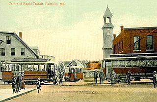
Fairfield is a census-designated place (CDP) in the town of Fairfield in Somerset County, Maine, United States. The population was 2,569 at the 2000 census.

Hartland is a census-designated place (CDP) in the town of Hartland in Somerset County, Maine, United States. The population was 756 at the 2020 census.

Madison is a census-designated place (CDP) in the town of Madison in Somerset County, Maine, United States. The population was 2,533 at the 2020 census.

Norridgewock is a census-designated place (CDP) in the town of Norridgewock in Somerset County, Maine, United States. The population was 1,351 at the 2020 census.

<span class="mw-page-title-main">Skowhegan (CDP), Maine</span> CDP in Maine, United States

Skowhegan is a census-designated place (CDP) in the town of Skowhegan in Somerset County, Maine, United States. The population was 6,404 at the 2020 census.

<span class="mw-page-title-main">Thomaston (CDP), Connecticut</span> Census-designated place in Connecticut, United States

Thomaston is a census-designated place (CDP) in Litchfield County, Connecticut, United States. It comprises the downtown portion of the town of Thomaston. As of the 2010 census, the population of the CDP was 1,910, out of 7,887 in the entire town.

References

  1. "2020 U.S. Gazetteer Files". United States Census Bureau. Retrieved April 8, 2022.
  2. 1 2 "Geographic Identifiers: 2010 Census Summary File 1 (G001), Thomaston CDP, Maine". American FactFinder. U.S. Census Bureau. Archived from the original on February 13, 2020. Retrieved March 11, 2019.
  3. "US Gazetteer files: 2010, 2000, and 1990". United States Census Bureau. February 12, 2011. Retrieved April 23, 2011.
  4. "Census of Population and Housing". Census.gov. Retrieved June 4, 2016.
  5. "U.S. Census website". United States Census Bureau . Retrieved January 31, 2008.