| Thomazeau Volcano | |
|---|---|
 Thomazeau Volcano Thomazeau, Ouest, Haiti | |
| Highest point | |
| Coordinates | 18°41′N72°05′W / 18.68°N 72.08°W |
| Geography | |
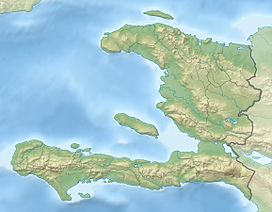
| Location | Thomazeau, Ouest, Haiti |
| Geology | |
| Rock age | 1.5 MYA |
| Mountain type | Cinder cones |
| Last eruption | Pleistocene |
Thomazeau Volcano or the Thomazeau cinder cones, is a group of extinct cinder cones outside of Thomazeau, Haiti, it was active from 1.5 million years ago to the Pleistocene. [1]
It was discovered in 1982 by the Haitian Bureau of Mines and Energy, [2] who discovered materials such as Nepheline, pyroclastic flows and basalt rock. Only a very well-preserved cone remains where its lava flow is distinctly visible.