Thongsbridge

Last updated

Thongsbridge
View from Thongsbridge looking towards Castle Hill.JPG
View from Thongsbridge towards Castle Hill
West Yorkshire UK location map.svg
Red pog.svg
Thongsbridge
Location within West Yorkshire
Population1,220  [1]
OS grid reference SE150098
Metropolitan borough
Metropolitan county
Region
Country England
Sovereign state United Kingdom
Post town Holmfirth
Postcode district HD9
Dialling code 01484
Police West Yorkshire
Fire West Yorkshire
Ambulance Yorkshire
UK Parliament
List of places
UK
England
Yorkshire
53°35′04″N1°46′24″W / 53.5844°N 1.7733°W / 53.5844; -1.7733

Thongsbridge is a small village in the Kirklees district of West Yorkshire, England. It is in the semi-rural Holme Valley and the village boundaries merge into the neighbouring communities of Holmfirth, New Mill and Wooldale. According to the 2001 Census, it covers an area of 124.7 hectares (308 acres).

Contents

History

The name of the village is derived from the old Viking word ‘thong’ meaning a strip of land.

One of the first records of Thongsbridge is from the early 13th century when the area was owned by the Bisset family. The village expanded in the early days of the industrial revolution, its location, within the steep-sided valley, being ideal for the water powered textile mills.

The homes and businesses located in the valley bottom were affected by a number of floods that affected the Holme Valley. The Holmfirth Flood of 1852 being amongst the most severe, with a number of houses and parts of the local textile mill being swept away.

The village originally had a station on the railway branch line going from Brockholes and terminating in Holmfirth built by Lancashire and Yorkshire Railway company in 1850. The railway partially closed in 1959 with passenger services being stopped and then finally shut down to freight trains as well in 1965. The goods yard and railway trackbed have now mostly been built on but can still be seen in places.

On 6 July 2014, Stage 2 of the 2014 Tour de France from York to Sheffield, passed through the village. [2]

Sport and leisure facilities

Leisure facilities in the village include fitness centres located at the nearby Holmfirth High School Sports Centre and Thongsbridge tennis club, which is located in the valley bottom, adjacent to the Cricket club and bowling club.

Thongsbridge Cricket Club was formed in 1860 and was one of the founding members of the Huddersfield and District Alliance League in 1893. The team currently plays in the Huddersfield Cricket League. [3]

Thongsbridge Tennis Club is one of the most progressive and dynamic tennis clubs in Britain.Thongsbridge Tennis Club Website

Thongsbridge Athletic FC competed in the Huddersfield District League until they folded in the 2000's.

Since 2008, Holme Valley Black Belt Academy has been set up in the old Thongsbridge mills (previously at the Holmfirth Civic Hall).

Politics

Thongsbridge is part of the Colne Valley constituency, which has been represented by Jason McCartney (Conservative) since 2019; he also represented the area between 2010 and 2017. The constituency was previously represented by Thelma Walker (Labour) from 2017 to 2019 and by Kali Mountford (Labour) from 1997 to 2010.

At a local level, the village is part of the Holme Valley South Ward which has 3 councillors who represent the area at Kirklees Council. The Metropolitan District Council is responsible for all aspects of local services and policy, including planning, transport, roads (except trunk roads and motorways), public rights of way, education, social services and libraries. The three Holme Valley South Councillors are currently Donald Firth (Conservative), Moses Crook (Labour & Co-operative) and Paul Davies (Labour). [4]

Surrounding villages

Thongsbridge is adjacent to the town of Holmfirth and is also surrounded by several villages, including: Netherthong, Honley, Brockholes, New Mill and Wooldale.

Related Research Articles

<span class="mw-page-title-main">Holmfirth</span> Town in West Yorkshire, England

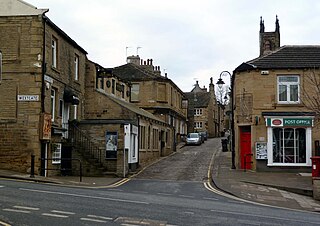
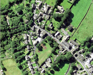
Holmfirth is a town in the Metropolitan Borough of Kirklees, West Yorkshire, England. It is located 6 miles (9.7 km) south of Huddersfield and 14 miles (23 km) west of Barnsley; the boundary of the Peak District National Park is 2 miles (3.2 km) to the south-west. The town is sited on the A635 and A6024 roads in the Holme Valley, at the confluence of the River Holme and Ribble. It mostly consists of stone-built cottages nestled on the eastern slopes of the Pennine hills.

<span class="mw-page-title-main">Mirfield</span> Town and civil parish in West Yorkshire, England

Mirfield is a town and civil parish in the Metropolitan Borough of Kirklees, West Yorkshire, England. Historically part of the West Riding of Yorkshire, it is on the A644 road between Brighouse and Dewsbury. At the 2011 census it had a population of 19,563. Mirfield forms part of the Heavy Woollen District.

<span class="mw-page-title-main">Cleckheaton</span> Town in West Yorkshire, England

Cleckheaton is a town in the Metropolitan Borough of Kirklees, West Yorkshire, England. Historically part of the West Riding of Yorkshire, it is situated south of Bradford, east of Brighouse, west of Batley and south-west of Leeds. It is at the centre of the Spen Valley and was the major town in the former borough of Spenborough. Cleckheaton has a history as a mill town and forms part of the Heavy Woollen District.

<span class="mw-page-title-main">Kirklees</span> Metropolitan borough in England

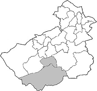
Kirklees is a metropolitan borough of West Yorkshire, England. The borough comprises the ten towns of Batley, Birstall, Cleckheaton, Dewsbury, Heckmondwike, Holmfirth, Huddersfield, Meltham, Mirfield and Slaithwaite. It is governed by Kirklees Council. Kirklees had a population of 422,500 in 2011; it is the third-largest metropolitan district in England by area, behind Doncaster and Leeds.

<span class="mw-page-title-main">Meltham</span> Town and civil parish in West Yorkshire, England

Meltham is a town and civil parish within the Metropolitan Borough of Kirklees, in West Yorkshire, England. It lies in the Holme Valley, below Wessenden Moor, 5 miles south-west of Huddersfield on the edge of the Peak District National Park. It had a population of 8,089 at the 2001 census, which was estimated to have increased to 8,600 by 2005. The population assessed at the 2011 Census was 8,534. It has 12 elected council members who meet up around every 6 weeks.

<span class="mw-page-title-main">Tong (ward)</span> Ward in the City of Bradford, West Yorkshire, England

Tong is a ward within the City of Bradford Metropolitan District Council, West Yorkshire, England, named after Tong village which is its oldest settlement. The population at the 2011 Census was 20,608.

<span class="mw-page-title-main">Huddersfield</span> Town in West Yorkshire, England

Huddersfield is a market town in the Metropolitan Borough of Kirklees in West Yorkshire, England. It is the administrative centre and largest settlement in the Kirklees district. The town is in the foothills of the Pennines. The River Holme's confluence into the similar-sized Colne is to the south of the town centre which then flows into the Calder in the north eastern outskirts of the town.

<span class="mw-page-title-main">Honley</span> Village in West Yorkshire, England

Honley is a village in the Holme Valley civil parish in Kirklees, West Yorkshire, England. Historically part of the West Riding of Yorkshire, it is situated near to Holmfirth and Huddersfield, and on the banks of the River Holme. According to the 2011 Census it had a population of 6,474, a growth of 577 from the 2001 Census

<span class="mw-page-title-main">Colne Valley</span> Valley in West Yorkshire, England

The Colne Valley is a steep sided valley on the east flank of the Pennine Hills in the English county of West Yorkshire. It takes its name from the River Colne which rises above the town of Marsden and flows eastward towards Huddersfield.

<span class="mw-page-title-main">Upperthong</span> Village in West Yorkshire, England

Upperthong is a village approximately 807 feet (246 m) above sea level, near the town of Holmfirth in Holme Valley, approximately 7 miles (11 km) south of Huddersfield, West Yorkshire, England.

<span class="mw-page-title-main">Colne Valley (UK Parliament constituency)</span> Parliamentary constituency in the United Kingdom

Colne Valley is a constituency represented in the House of Commons of the UK Parliament since 2019 by Jason McCartney of the Conservative Party.

<span class="mw-page-title-main">New Mill, West Yorkshire</span> Village in West Yorkshire, England

New Mill, West Yorkshire, England, is a small, semi-rural village near the town of Holmfirth. It is in the metropolitan borough of Kirklees and the civil parish of Holme Valley. The village had a population of 1,259 in the 2001 census. The village is 2 miles (3.2 km) east of Holmfirth and 6 miles (9.7 km) south of Huddersfield.

<span class="mw-page-title-main">Holme Valley</span> Civil parish in West Yorkshire, England

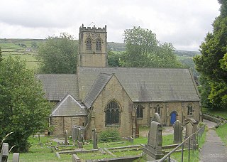
Holme Valley, formerly Holmfirth is a large civil parish in the metropolitan borough of Kirklees in West Yorkshire, England. It has a population of 25,049, increasing to 34,680 for the two wards in the 2011 Census. Its administrative centre is in Holmfirth. Other sizeable settlements in the parish include, Brockholes, Honley and New Mill. It is named from the River Holme that runs through the parish.

<span class="mw-page-title-main">River Holme</span> River in Yorkshire, England

The Holme of the Holme Valley, West Yorkshire, England is a tributary of the River Colne, West Yorkshire. The source is via Digley Reservoir, fed firstly by the run-off from Brownhill Reservoir, then by Dobbs Dike. Banks along the upper valley are mostly urbanised and are in the Holme Valley civil parish.

<span class="mw-page-title-main">Scholes, Holme Valley</span> Village in West Yorkshire, England

Scholes is a village and former civil parish, now in the parish of Holme Valley, in Kirklees, West Yorkshire, England. It is situated 1 mile (2 km) to the south-east and above Holmfirth, 7 miles (11 km) south-west of Huddersfield, in the Holme Valley. It has a population of 1,990. The name Scholes may have originated from the Scandinavian language meaning 'the temporary huts or sheds'.

<span class="mw-page-title-main">Brockholes</span> Village in West Yorkshire, England

Brockholes is a small village in West Yorkshire, England, in the administrative area of Kirklees Metropolitan Council and Holme Valley Parish Council. The village of Honley borders to the immediate north of the village and Holmfirth lies to the south. Brockholes is within the Postal district of Holmfirth.

<span class="mw-page-title-main">Thurstonland</span> Village in West Yorkshire, England

Thurstonland is a village in the civil parish of Kirkburton, in Kirklees, West Yorkshire, England. It has a population of almost 400.

<span class="mw-page-title-main">Jackson Bridge</span> Human settlement in England

Jackson Bridge is a small village in the civil parish of Holme Valley in the Metropolitan Borough of Kirklees in West Yorkshire, England and within the postal district of Holmfirth. It is situated next to the A616, Huddersfield to Penistone, road.

<span class="mw-page-title-main">Wooldale</span> Village in West Yorkshire, England

Wooldale is a small village nestled on a hill, overlooking the Kirkroyds area of New Mill, Holmfirth in West Yorkshire, England. It has a population of 2,420.

<span class="mw-page-title-main">Holmfirth branch line</span> Disused railway line in West Yorkshire, England

The Holmfirth branch line is a disused railway line that ran for 2 miles (3.2 km) from Brockholes to Holmfirth, in West Yorkshire, England. The line was built as double track as there were plans to extend the line up the Holme Valley.

References

  1. Area Profile 2008, Kirklees Metropolitan Council. Kirklees Ward Profile Thongsbridge 2008 Archived 28 September 2003 at the Wayback Machine
  2. "Tour de France Stage 1". Archived from the original on 25 July 2014. Retrieved 15 July 2014.
  3. "The Cricket History of Calderdale and Kirklees - Thongsbridge CC". web.archive.org. 6 August 2007. Archived from the original on 6 August 2007. Retrieved 10 April 2024.
  4. "Councillors by Ward" . Retrieved 4 April 2024.