Thorpe Hesley

Last updated

Thorpe Hesley
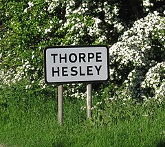
Thorpe Hesley Sign.jpg
Entering from Jumble Lane
South Yorkshire UK location map.svg
Red pog.svg
Thorpe Hesley
Location within South Yorkshire
Population4,439 (2015 est.)
Metropolitan borough
Metropolitan county
Region
Country England
Sovereign state United Kingdom
Post town ROTHERHAM
Postcode district S61
Dialling code 0114
Police South Yorkshire
Fire South Yorkshire
Ambulance Yorkshire
UK Parliament
List of places
UK
England
Yorkshire
53°27′N1°26′W / 53.45°N 1.44°W / 53.45; -1.44

Thorpe Hesley is a village in the Metropolitan Borough of Rotherham, South Yorkshire, England, lying east of the M1 motorway at junction 35. The village has been included within the boundaries of Rotherham town since 1894, having previously been divided between the townships of Kimberworth and Wentworth. [1] Historically the village was known for coal mining and nail making. [2] It has an Anglican church, Holy Trinity, built in 1839 chiefly at the cost of Earl Fitzwilliam and the Earl of Effingham. [3]

Contents

There is one post office, which is located within a convenience store, one petrol station and four public houses. At the 2021 Census, it had a population of 4,150. [4]

Horse and Tiger pub, Brook Hill Horse and Tiger Thorpe Hesley.jpg
Horse and Tiger pub, Brook Hill

Claims to fame

John Wesley spent some time in the village where he preached. He lodged at Barley Hall (now demolished).

In 1975, there was filming in the village for the Walt Disney film Escape from the Dark .[ citation needed ] The film was re-titled The Littlest Horse Thieves for its release in the USA.

The BBC TV Series Play for Today had a two part story titled The Price of Coal filmed at the colliery on Wentworth Road; this mine has now been closed and the colliery demolished.

Coal mines

Coal has been mined in and around the area of Thorpe Hesley for at least 800 years. Monks from the Cistercian Abbey of Kirkstead, in Lincolnshire, had forges and other property in this part of the country and mined coal and ironstone locally. Thorpe Hesley had the distinction of having three modern-day coal mines. Which were closed in the 1970s and 1980s and have been completely demolished. The land surrounding the area of the Barley Hall site has been landscaped and is now a small nature reserve.

In January 2013 permission was given for the Hesley Wood colliery spoil heap to be processed to recover fuel, and to restore woodland on the site. [5]

See also

Related Research Articles

<span class="mw-page-title-main">Barnsley</span> Town in South Yorkshire, England

Barnsley is a market town in South Yorkshire, England. It is the main settlement of the Metropolitan Borough of Barnsley and the fourth largest settlement in South Yorkshire. The town's population was 96,888 in 2021, while the wider borough had a population of 244,600 in the 2021 census.

<span class="mw-page-title-main">Dinnington, South Yorkshire</span> Town in South Yorkshire, England

Dinnington is a town in the civil parish of Dinnington St John's, in the Metropolitan Borough of Rotherham, in South Yorkshire, England. It is near to the towns of Worksop and Rotherham and cities of Sheffield and Doncaster.

<span class="mw-page-title-main">Metropolitan Borough of Rotherham</span> Metropolitan borough in South Yorkshire, England

The Metropolitan Borough of Rotherham is a metropolitan borough of South Yorkshire, England. It is named after its main settlement of Rotherham. The wider borough spans a larger area and covers the outlying towns of Maltby, Swinton, Wath-upon-Dearne, Dinnington. As well as the villages of Rawmarsh and Laughton. A large valley spans the entire borough and is referred to as the "Rother Valley".

<span class="mw-page-title-main">Maltby, South Yorkshire</span> Town and civil parish in South Yorkshire, England

Maltby is a former mining town and civil parish in the Metropolitan Borough of Rotherham, South Yorkshire, England. It was historically in the West Riding of Yorkshire. It is located 6 miles (10 km) east of Rotherham and 10 miles (16 km) north-east of Sheffield. It forms a continuous urban area with Hellaby, separated from the rest of Rotherham by the M18 motorway. It had a population of 16,688 at the 2011 Census.

<span class="mw-page-title-main">Featherstone</span> Town and civil parish in West Yorkshire, England

Featherstone is a town and civil parish in the City of Wakefield, West Yorkshire, England, two miles south-west of Pontefract. Historically part of the West Riding of Yorkshire, in 2011 it had a population of 15,244. Featherstone railway station is on the Pontefract Line.

<span class="mw-page-title-main">Elsecar</span> Village in South Yorkshire, England

Elsecar is a village in the Metropolitan Borough of Barnsley in South Yorkshire, England. It is near to Jump and Wentworth, it is also 2 miles (3.2 km) south of Hoyland, 6 miles (9.7 km) south of Barnsley and 8 miles (13 km) north-east of Sheffield. Elsecar falls within the Barnsley Metropolitan Borough Ward of Hoyland Milton.

<span class="mw-page-title-main">Thurnscoe</span> Village in South Yorkshire, England

Thurnscoe is a village in the Metropolitan Borough of Barnsley in South Yorkshire, England. The village falls within the Dearne North ward of the Barnsley Metropolitan Borough Council. Historically within the West Riding of Yorkshire, the village is approximately 9 miles (14 km) from Barnsley and 8 miles (13 km) from Doncaster. It is served by Thurnscoe railway station with bus links provided by Stagecoach. In 2011, it had a population of 8,687.

<span class="mw-page-title-main">Rossington</span> Civil parish and former mining village in South Yorkshire, England

Rossington is a civil parish and former mining village in the Metropolitan Borough of Doncaster in South Yorkshire, England and is surrounded by countryside and the market towns of Bawtry and Tickhill.

<i>The Price of Coal</i> 1977 British TV series or programme

The Price of Coal is a two-part television drama written by Barry Hines and directed by Ken Loach first broadcast as part of the Play for Today series in 1977. Set at the fictional Milton Colliery, near Barnsley in South Yorkshire, the episodes contrast "efforts made to cosmetically improve the pit in preparation for a royal visit and the target-conscious safety shortcuts that precipitate a fatal accident ".

<span class="mw-page-title-main">Cortonwood</span> Colliery in South Yorkshire, England

Cortonwood was a colliery near Rotherham, South Yorkshire, England. The colliery's proposed closure was a tipping point in the 1984–1985 miners' strike. The site is now a shopping and leisure centre.

<span class="mw-page-title-main">Greasbrough Canal</span>

The Greasbrough Canal was a private canal built by the Marquess of Rockingham to serve his coal mining interests in and around the village of Greasbrough, near Rotherham, South Yorkshire, England. It opened in 1780, and the Newbiggin branch was built some time later. The main line to Greasbrough closed in 1840 with the coming of the Sheffield and Rotherham Railway, and the canal ceased to carry commercial traffic during the First World War. Most of it has been filled in, but a small section near the River Don Navigation remains in water.

Silverwood Colliery was a colliery situated between Thrybergh and Ravenfield in Yorkshire, England. Originally called Dalton Main, it was renamed after a local woodland. It was owned by Dalton Main Collieries Ltd.

<span class="mw-page-title-main">Orgreave Colliery</span> Former coal mine in South Yorkshire, England

Orgreave Colliery was a coal mine situated adjacent to the main line of the Manchester, Sheffield & Lincolnshire Railway about 5 miles (8 km) east of Sheffield and 3.5 miles (6 km) south west of Rotherham. The colliery is within the parish of Orgreave, from which it takes its name.

<span class="mw-page-title-main">Maltby Main Colliery</span> Former coal mine in South Yorkshire, England

The Maltby Main Colliery was a coal mine located 7 miles (11 km) east of Rotherham on the eastern edge of Maltby, South Yorkshire, England. The mine was closed in 2013.

New Stubbin Colliery was a coal mine situated in the township of Rawmarsh near Rotherham, South Yorkshire, England. The colliery was situated in a deep valley. Along one side at the top of the valley runs Haugh Road, Rawmarsh and on the other a lane known locally as “Greasbrough Tops”.

<span class="mw-page-title-main">Robin Hood, West Yorkshire</span> Village in West Yorkshire, England

Robin Hood is a village in the City of Leeds in West Yorkshire, England. It is close to the City of Wakefield boundary and is situated between Leeds and Wakefield as well as being close to Rothwell and Lofthouse.

The Elsecar Collieries were the coal mines sunk in and around Elsecar, a small village to the south of Barnsley in what is now South Yorkshire, but was traditionally in the West Riding of Yorkshire.

The South Yorkshire Coalfield is so named from its position within Yorkshire. It covers most of South Yorkshire, West Yorkshire and a small part of North Yorkshire. The exposed coalfield outcrops in the Pennine foothills and dips under Permian rocks in the east. Its most famous coal seam is the Barnsley Bed. Coal has been mined from shallow seams and outcrops since medieval times and possibly earlier.

Dinnington Main Colliery was a coal mine situated in the village of Dinnington, near Rotherham, South Yorkshire, England.

<span class="mw-page-title-main">Manvers Main Colliery</span> Former coal mine in South Yorkshire, England

Manvers Main Colliery was a coal mine, sunk on land belonging to the Earl Manvers on the northern edge of Wath-upon-Dearne, between that town and Mexborough in the Dearne Valley, in the West Riding of Yorkshire, England. The regional headquarters and laboratories of British Coal were situated in the complex.

References

  1. "History of Thorpe Hesley, in Rotherham and West Riding - Historical administrative units and statistics". www.visionofbritain.org.uk. Retrieved 10 July 2017.
  2. "History of Thorpe Hesley, in Rotherham and West Riding - Map and description". www.visionofbritain.org.uk. Retrieved 10 July 2017.
  3. Jones, Mel & Joan (28 February 2012). Thorpe Hesley, Scholes & Wentworth Through Time. Amberley Publishing Limited. ISBN   9781445631714 . Retrieved 10 July 2017 via Google Books.
  4. "Thorpe Hesley (South Yorkshire, Yorkshire and the Humber, United Kingdom) - Population Statistics and Location in Maps and Charts". www.citypopulation.de. Retrieved 12 September 2023.
  5. "Thorpe Hesley coal reclamation plan approved". BBC News. 9 January 2013. Retrieved 8 June 2013.