
Dartmouth Dam is a large rock-fill embankment dam with an uncontrolled chute spillway across the Mitta Mitta, Gibbo and Dart rivers, the Morass Creek and a number of small tributaries. The dam is located near Mount Bogong in the north-east of the Australian state of Victoria. The dam's purpose includes irrigation, the generation of hydro-electric power, water supply and conservation. The impounded reservoir is called Dartmouth Reservoir, sometimes called Lake Dartmouth. The Dartmouth Power Station, a hydro-electric power station that generates power to the national grid, is located near the dam wall.

Wyangala Dam is a major gated rock fill with clay core embankment and gravity dam with eight radial gates and a concrete chute spillway across the Lachlan River, located in the south-western slopes region of New South Wales, Australia. The dam's purpose includes flood mitigation, hydro-power, irrigation, water supply and conservation. The impounded reservoir is called Lake Wyangala.

The Stephens Creek Dam is an earth-filled embankment dam built on a rock foundation with an uncontrolled spillway across the Stephens Creek, located in the Far West region of New South Wales, Australia. The principal purpose of the dam is to supply potable water for the town of Broken Hill. The impounded 2,000-megalitre reservoir is called Stephens Creek Reservoir.
The Pejar Dam is an earth and rock-filled embankment dam with an uncontrolled spillway across the Wollondilly River, located in the Southern Tablelands region of New South Wales, Australia. The principal purpose of the dam is to supply potable water for the city of Goulburn. The impounded 9,000-megalitre reservoir is also called Pejar Dam.

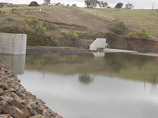
Googong Dam is a minor ungated earth and rock fill with clay core embankment dam with concrete chute spillway plus a nearby 13 metres (43 ft) high earthfill saddle embankment across the Queanbeyan River upstream of Queanbeyan in the Capital Country region of New South Wales, Australia. The dam's purpose includes water supply for Canberra and Queanbeyan. The impounded reservoir is called Googong Reservoir.

The Robert-Bourassa generating station, formerly known as La Grande-2 (LG-2), is a hydroelectric power station on the La Grande River that is part of Hydro-Québec's James Bay Project in Canada. The station can generate 5,616 MW and its 16 units were gradually commissioned between 1979 and 1981. Annual generation is in the vicinity of 26500 GWh.
The William Hovell Dam is a rock and earth-fill embankment dam with a flip bucket chute spillway across the King River, operated by Pacific Blue and located in the Hume region of Victoria, Australia. The purposes of the dam are for irrigation and the generation of hydroelectricity. The impounded reservoir is called Lake William Hovell.

Banasura Sagar Dam, which impounds the Karamanathodu tributary of the Kabini River, is part of the Indian Banasurasagar Project consisting of a dam and a canal project started in 1979. The goal of the project is to support the Kakkayam Hydro electric power project and satisfy the demand for irrigation and drinking water in a region known to have water shortages in seasonal dry periods. The dam is also known as Kuttiyadi Augmentation Main Earthen Dam. The dam has a height of 38.5 metres (126 ft) and length of 685 metres (2,247 ft).

Folsom Dam is a concrete gravity dam on the American River of Northern California in the United States, about 25 mi (40 km) northeast of Sacramento. The dam is 340 ft (100 m) high and 1,400 ft (430 m) long, flanked by earthen wing dams. It was completed in 1955, and officially opened the following year.

Ujjani Dam, also known as Bhima Dam or Bhima Irrigation Project, on the Bhima River, a tributary of the Krishna River, is an earthfill cum Masonry gravity dam located near Ujjani village of Madha Taluk in Solapur district of the state of Maharashtra in India.

The Six Mile Creek Dam is a rock and earth-fill embankment dam with an un-gated spillway across the Six Mile Creek that is located in the South East region of Queensland, Australia. The main purposes of the dam are for potable water supply of the Sunshine Coast region and for recreation. The impounded reservoir is called Lake Macdonald, named in memory of former Noosa Shire Council Chairman Ian MacDonald.

The Rio Grande Project is a United States Bureau of Reclamation irrigation, hydroelectricity, flood control, and interbasin water transfer project serving the upper Rio Grande basin in the southwestern United States. The project irrigates 193,000 acres (780 km2) along the river in the states of New Mexico and Texas. Approximately 60 percent of this land is in New Mexico. Some water is also allotted to Mexico to irrigate some 25,000 acres (100 km2) on the south side of the river. The project was authorized in 1905, but its final features were not implemented until the early 1950s.
The Badush Dam is an unfinished multi-purpose dam on the Tigris River, located near Badush, 16 kilometres (9.9 mi) northwest of Mosul in the Ninawa Governorate, northern Iraq.

Pantabangan Dam is an earth-fill embankment dam on the Pampanga River located in Pantabangan in Nueva Ecija province of the Philippines. The multi-purpose dam provides water for irrigation and hydroelectric power generation while its reservoir, Pantabangan Lake, affords flood control. The reservoir is considered one of the largest in Southeast Asia and also one of the cleanest in the Philippines. Construction on the dam began in 1971 and it was completed in 1974.

Deriner Dam is a concrete double-curved arch dam on the Çoruh River 5 km (3.1 mi) east of Artvin in Artvin Province, Turkey. The main purpose of the dam is hydroelectric power production and additionally flood control. Construction on the dam began in 1998, the reservoir began to fill in February 2012 and the power station was completed by February 2013. It will have a 670 MW power house and is the tallest dam in Turkey. The dam is being implemented by Turkey's State Hydraulic Works and constructed by a consortium of Turkish, Russian and Swiss companies.
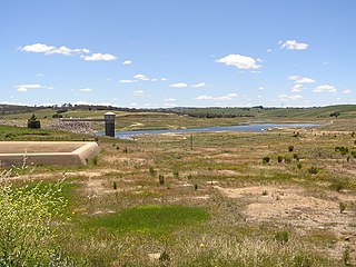
Ben Chifley Dam, or Chifley Dam, is a rock and earth-fill embankment dam across the Campbells River in the central west region of New South Wales, Australia. The main purpose of the dam is to supply potable water to the city of Bathurst.
Outardes-4 is a hydroelectric power station and dam on the Outardes River 70 km (43.5 mi) northwest of Baie-Comeau, Quebec, Canada. The power station was commissioned in 1969 and is supplied by the Outardes-4 Reservoir which is created by seven additional dams.

The Xingó Dam is a concrete face rock-fill dam on the São Francisco River on the border of Alagoas and Sergipe, near Piranhas, Brazil. The dam was built for navigation, water supply and hydroelectric power generation as it supports a 3,162 megawatts (4,240,000 hp) power station. It was constructed between 1987 and 1994 and the last of its generators was commissioned in 1997. In Portuguese, the dam is called the Usina Hidrelétrica de Xingó.

The Itá Hydroelectric Power Plant is a dam and hydroelectric power plant on the Uruguay River near Itá on the border of Santa Catarina and Rio Grande do Sul, Brazil. The power station has a 1,450-megawatt (1,940,000 hp) capacity and is supplied with water by a concrete face rock-fill embankment dam. It is owned and operated by Tractebel Energia and produces the equivalent of 60% of the energy consumed in Santa Catarina.

The Ramganga Dam, also known as the Kalagarh Dam, is an embankment dam on the Ramganga River 3 km (2 mi) upstream of Kalagarh in Pauri Garhwal district, Uttarakhand, India. It is located within the Jim Corbett National Park.

