
Garrison Dam is an earth-fill embankment dam on the Missouri River in central North Dakota, U.S. Constructed by the U.S. Army Corps of Engineers from 1947 to 1953, at over 2 miles (3.2 km) in length, the dam is the fifth-largest earthen dam in the world. The reservoir impounded by the dam is Lake Sakakawea, which extends to Williston and the confluence with the Yellowstone River, near the Montana border.

Fort Randall Dam is a 2.03-mile-long (3 km) earthen dam which spans the Missouri River and impounds Lake Francis Case, the 11th-largest reservoir in the U.S. The dam joins Gregory and Charles Mix counties, South Dakota a distance of 880 river miles (1,416 km) upstream of St. Louis, Missouri, where the river joins the Mississippi River. The dam and hydroelectric power plant were constructed by and are currently operated by the U.S. Army Corps of Engineers.

The Fort Peck Dam is the highest of six major dams along the Missouri River, located in northeast Montana in the United States, near Glasgow, and adjacent to the community of Fort Peck. At 21,026 feet (6,409 m) in length and over 250 feet (76 m) in height, it is the largest hydraulically filled dam in the United States, and creates Fort Peck Lake, the fifth largest artificial lake in the U.S., more than 130 miles (210 km) long, 200 feet (61 m) deep, and it has a 1,520-mile (2,450 km) shoreline which is longer than the state of California's coastline. It lies within the Charles M. Russell National Wildlife Refuge. The dam and the 134-mile-long (216 km) lake are owned and operated by the U.S. Army Corps of Engineers and exist for the purposes of hydroelectric power generation, flood control, and water quality management.

Fort Peck Lake, or Lake Fort Peck, is a major reservoir in Montana, formed by the Fort Peck Dam on the Missouri River. The lake lies in the eastern prairie region of Montana approximately 140 miles (230 km) east of Great Falls and 120 miles (190 km) north of Billings, reaching into portions of six counties.

Big Bend Dam is a major embankment rolled-earth dam on the Missouri River in Central South Dakota, United States, creating Lake Sharpe. The dam was constructed by the U.S. Army Corps of Engineers as part of the Pick-Sloan Plan for Missouri watershed development authorized by the Flood Control Act of 1944. Construction began in 1959 and the embankment was completed in July 1963. Power generation began at the facility in 1964 and the entire complex was completed in 1966 at a total cost of $107 million. The hydroelectric plant generates 493,300 kilowatts of electricity at maximum capacity, with an annual production of 969 million kilowatt hours, and meets peak-hour demand for power within the Missouri River Basin.

The Oahe Dam is a large earthen dam on the Missouri River, just north of Pierre, South Dakota, United States. The dam creates Lake Oahe, the fourth-largest man-made reservoir in the United States. The reservoir stretches 231 miles (372 km) up the course of the Missouri to Bismarck, North Dakota. The dam's power plant provides electricity for much of the north-central United States. It is named for the Oahe Indian Mission established among the Lakota Sioux in 1874.

Lake Oahe is a large reservoir behind Oahe Dam on the Missouri River; it begins in central South Dakota and continues north into North Dakota in the United States. The lake has an area of 370,000 acres (1,500 km2) and a maximum depth of 205 ft (62 m). By volume, it is the fourth-largest reservoir in the US. Lake Oahe has a length of approximately 231 mi (372 km) and has a shoreline of 2,250 mi (3,620 km). 51 recreation areas are located along Lake Oahe, and 1.5 million people visit the reservoir every year. The lake is named for the 1874 Oahe Indian Mission.

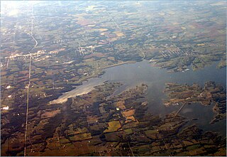
Lewis and Clark Lake is a 31,400 acre (130 km²) reservoir located on the border of the U.S. states of Nebraska and South Dakota on the Missouri River. The lake is approximately 25 miles (40 km) in length with over 90 miles (140 km) of shoreline and a maximum water depth of 45 feet (14 m). The lake is impounded by Gavins Point Dam and is managed by the U.S. Army Corps of Engineers, Omaha District.

Lake Ouachita is a reservoir created by the damming of the Ouachita River by Blakely Mountain Dam.

Perry Lake is a US Army Corps of Engineers operated reservoir in northeast Kansas. Its primary purposes are flood control, water reserve for nearby areas and regional recreation. The lake is approximately 11,150 acres (45 km²) in size, with over 160 miles (260 km) of shoreline. Perry Lake's full multi-purpose pool elevation is 891.5 feet (271.7 m) above sea level. Perry Lake is located about 40 miles (64 km) west of Kansas City, just northwest of Lawrence, Kansas. Its close proximity to Kansas City, Lawrence, and the state capitol, Topeka, make it a very popular destination, with the nickname "Paradise on the Plains".
Smithville Lake is a 7,190-acre (29 km2) reservoir on the Little Platte branch of the Platte River in Clay County, Missouri near Smithville. It provides the water supply for Smithville, Missouri and Plattsburg, Missouri. Kansas City, Missouri has reserved a portion for its water supply.

Kanopolis Lake is a reservoir in Ellsworth County in the Smoky Hills of central Kansas, about 31 miles southwest of Salina and a few miles southeast of the town of Kanopolis. The lake is formed by Kanopolis Dam. Completed in 1948 as a flood control and water conservation project of the United States Army Corps of Engineers, the dam impounds the Smoky Hill River.

Heart Butte Dam is a dam in Grant County of southwestern North Dakota. The dam was a project of the United States Bureau of Reclamation completed in 1949, primarily for irrigation and flood control. The earthen dam is 142 feet in height and impounds the Heart River.

Baldhill Dam is a dam in Barnes County, North Dakota, about 10 miles north-northwest of Valley City in the eastern part of the state.

Cold Brook Dam is an earthen dam located near Hot Springs, South Dakota in Fall River County in the southwestern part of the state, in the southern Black Hills.
Cottonwood Springs Dam is a dam in Fall River County, South Dakota in the southwestern part of the state, south of the Black Hills.

Shadehill Dam is a dam on the Grand River in Perkins County in northwestern South Dakota in the United States, about 10 miles (16 km) south of Lemmon. The dam and its impoundment, Shadehill Reservoir, serve mainly for flood and silt control, wildlife conservation and recreation. Located directly below the confluence of the North and South Forks of the Grand River, the dam is operated by the U.S. Bureau of Reclamation, and is part of the Shadehill Unit of the Pick-Sloan Missouri Basin Program.

