Pipestem Dam

Last updated
Pipestem Dam & Reservoir
USACE Pipestem dam and reservoir.jpg
Pipestem Dam and Reservoir
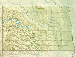
USA North Dakota relief location map.jpg
Red pog.svg
Location of Pipestem Dam & Reservoir in North Dakota
Country United States
Location Stutsman County,
North Dakota,
United States. Located near Jamestown.
Coordinates 46°57′41″N98°45′6″W / 46.96139°N 98.75167°W / 46.96139; -98.75167 Coordinates: 46°57′41″N98°45′6″W / 46.96139°N 98.75167°W / 46.96139; -98.75167
StatusOperational
Construction began1971
Opening date1973
Owner(s) United States Army Corps of Engineers logo.svg U.S. Army Corps of Engineers, Omaha District
Dam and spillways
Type of dam Embankment
Impounds Pipestem River
Height (thalweg)107.5 ft (33 m)
Length4,000 ft (1,219 m)
Reservoir
CreatesPipestem Reservoir
Total capacity8,944 acre⋅ft (11,032,262 m3)
Catchment area 594 mi (956 km)
Maximum length5.5 mi (9 km)
Maximum water depth30 ft (9 m)
Website
U.S. Army Corps of Engineers, Omaha District

Pipestem Dam is an embankment dam located in Stutsman County, North Dakota, U.S.. The dam was constructed by the U.S. Army Corps of Engineers for flood damage reduction, fish and wildlife enhancement, and recreation. The dam impounds the Pipestem River to create the Pipestem Reservoir, also known as Pipestem Lake. Construction of the dam began in June 1971, and was completed in 1973. The dam is located 4 mi (6 km) north of Jamestown, North Dakota. The dam measures approximately 4,000 feet in length, with a maximum height of 107.5 feet from the stream bed to the top of the dam. [1] The dam and reservoir are managed by the U.S. Army Corps of Engineers, with fish and wildlife resources managed by the North Dakota Game and Fish Department.

Contents

See also

Related Research Articles

Lake Sakakawea Man-made reservoir in North Dakota, United States

Lake Sakakawea is a large reservoir in the north central United States, impounded in 1953 by Garrison Dam, a U.S. Army Corps of Engineers dam located in the Missouri River basin in central North Dakota. Named for the Shoshone-Hidatsa woman Sakakawea, it is the largest man-made lake located entirely within the State of North Dakota, the second largest in the United States by area after Lake Oahe, and the third largest in the United States by volume, after Lake Mead and Lake Powell.

Garrison Dam Dam in McLean/Mercer Counties, North Dakota

Garrison Dam is an earth-fill embankment dam on the Missouri River in central North Dakota, U.S.. Constructed by the U.S. Army Corps of Engineers from 1947 to 1953, at over 2 miles (3.2 km) in length, the dam is the fifth-largest earthen dam in the world. The reservoir impounded by the dam is Lake Sakakawea, which extends to Williston and the confluence with the Yellowstone River, near the Montana border.

Fort Randall Dam Dam in Gregory County and Charles Mix County, South Dakota.

Fort Randall Dam is a 2.03 mi (3 km) long earthen dam which spans the Missouri River and impounds Lake Francis Case, the 11th largest reservoir in the U.S. The dam joins Gregory and Charles Mix County, South Dakota a distance of 880 river miles (1,416 km) upstream of St. Louis, Missouri, where the river joins the Mississippi River. The dam and Hydroelectric power plant were constructed by and are currently operated by the U.S. Army Corps of Engineers.

Fort Peck Lake

Fort Peck Lake, or Lake Fort Peck, is a major reservoir in Montana, formed by the Fort Peck Dam on the Missouri River. The lake lies in the eastern prairie region of Montana approximately 140 miles (230 km) east of Great Falls and 120 miles (190 km) north of Billings, reaching into portions of six counties.

Lake Sharpe

Lake Sharpe is a large reservoir impounded by Big Bend Dam on the Missouri River in central South Dakota, United States. The lake has an area of 56,884 acres (230.20 km2) and a maximum depth of 78 ft (24 m). Lake Sharpe is approximately 80 mi (130 km) long, with a shoreline of 200 mi (320 km). Lake Sharpe is the 54th largest reservoir in the United States. The lake starts near Ft. Thompson and stretches upstream to Oahe Dam, near Pierre. The lake is located within the following counties: Buffalo, Lyman, Hyde, Hughes, and Stanley. The Big Bend of the Missouri is about 7 miles (11 km) north of the dam.

Lewis and Clark Lake Man-made lake in Nebraska and South Dakota, United States

Lewis and Clark Lake is a 31,400 acre (130 km²) reservoir located on the border of the U.S. states of Nebraska and South Dakota on the Missouri River. The lake is approximately 25 miles (40 km) in length with over 90 miles (140 km) of shoreline and a maximum water depth of 45 feet (14 m). The lake is impounded by Gavins Point Dam and is managed by the U.S. Army Corps of Engineers, Omaha District.

Pine Flat Lake

Pine Flat Lake is an artificial lake or reservoir in the Sierra Nevada foothills of eastern Fresno County, California on the western north-south border to the Sierra- and Sequoia National Forests, about 30 mi (48 km) east of Fresno. The lake is managed by the U.S. Army Corps of Engineers (USACE) and is open to boaters, campers & hikers.

Wilson Lake (Kansas)

Wilson Lake is a reservoir in the U.S. state of Kansas, on the border of Russell County and Lincoln County. Built and managed by the U.S. Army Corps of Engineers for flood control, it is also used for wildlife management and recreation. Several parks are located along its shoreline, including Wilson State Park.

El Dorado Lake

El Dorado Lake is a reservoir on the Walnut River 0.5 miles (0.80 km) northeast of El Dorado in the Flint Hills region of Kansas. Built and managed by the U.S. Army Corps of Engineers, it is used for flood control, recreation, and water supply. El Dorado State Park is located on its shore.

Lake Francis Case

Lake Francis Case is a large reservoir impounded by Fort Randall Dam on the Missouri River in south-central South Dakota, United States. The lake has an area of 102,000 acres (410 km2) and a maximum depth of 140 ft (43 m). Lake Francis Case has a length of approximately 107 mi (172 km) and has a shoreline of 540 mi (870 km). The lake is the eleventh-largest reservoir in the United States and is located within the counties of: Charles Mix, Gregory, Lyman, Brule, and Buffalo. The lake stretches from Pickstown, South Dakota upstream to Big Bend Dam.

Jamestown Dam Dam in Stutsman County, North Dakota, United States. Located near Jamestown.

The Jamestown Dam is a rolled-earth dam spanning the James River in Stutsman County in the U.S. state of North Dakota, serving the primary purpose of flood control. It is north of the city of Jamestown, North Dakota. Built from April 1952 to September 1953, the dam measures 1,418 feet (432 m) long at the crest and 85 feet (26 m) high. It impounds the James River to form the Jamestown Reservoir. A small islet lies shortly upstream of the dam, where the James River previously split into two channels.

John Redmond Reservoir

John Redmond Reservoir is a reservoir on the Neosho River in eastern Kansas. Built and managed by the U.S. Army Corps of Engineers, it is used for flood control, recreation, water supply, and wildlife management. It borders the Flint Hills National Wildlife Refuge to the northwest.

Lake Darling Dam Dam in Ward County, northwest of Minot

Lake Darling Dam is an earthen embankment dam on the Souris River located 20 mi (32 km) northwest of Minot, in Ward County, North Dakota. The dam began impounding water in April 1936 and was completed July of that year. It was created for the purposes of water storage and conservation. It is part of the Upper Souris National Wildlife Refuge and is owned by the United States Fish and Wildlife Service. The dam and lake are named after Jay N. "Ding" Darling, the first director of the Bureau of Biological Survey. Although the dam is located in Ward County, Lake Darling is almost entirely located in Renville County, to its north.

Kanopolis Lake

Kanopolis Lake is a reservoir in Ellsworth County in the Smoky Hills of central Kansas, about 31 miles southwest of Salina and a few miles southeast of the town of Kanopolis. The lake is formed by Kanopolis Dam. Completed in 1948 as a flood control and water conservation project of the United States Army Corps of Engineers, the dam impounds the Smoky Hill River.

Bowman-Haley Dam Dam in Bowman County, North Dakota

Bowman-Haley Dam is an embankment dam located in Bowman County, North Dakota, in the southwestern part of the state. The dam is just over 2 miles north of the South Dakota border.

Council Grove Lake

Council Grove Lake is a reservoir on the Neosho River in east-central Kansas. Built and managed by the U.S. Army Corps of Engineers, it is used for flood control, recreation, and water supply.

Cold Brook Dam Dam in Fall River County, South Dakota

Cold Brook Dam is an earthen dam located near Hot Springs, South Dakota in Fall River County in the southwestern part of the state, in the southern Black Hills.

Lake Yankton (South Dakota)

Lake Yankton, also called Cottonwood Lake, is an artificial lake that was originally part of the main channel of the Missouri River on the border of the U.S. States of Nebraska and South Dakota, near Yankton, South Dakota. The lake has an approximate surface area of 250 acres (100 ha) and has a maximum depth of 18 feet (5.5 m). The lake is located immediately downstream (east) of Gavins Point Dam and Lewis and Clark Lake, located just north of the current location of the main channel of the Missouri River.

The Salt Creek Dams, are a U.S. Army Corps of Engineers water resource development project located in southeastern Nebraska near Lincoln, Nebraska, the state capitol. The project was authorized by the Federal Flood Control Act of 1958 to provide flood damage reduction, water quality, recreation, and fish and wildlife enhancement. The basin drains a 1645 square mile area of southeastern Nebraska, encompassing the City of Lincoln. Salt Creek enters the Platte River from the right bank 25 miles southwest of Omaha, Nebraska and drains the southern and western part of the basin, while Wahoo Creek drains the northeastern portion. The lakes are a part of the Missouri River basin.

References

  1. "Omaha District > Missions > Dam and Lake Projects > Additional Dams & Lakes".