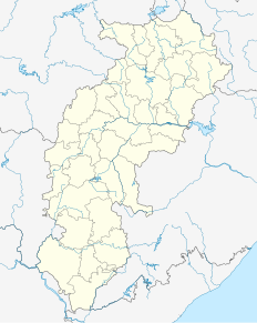
Chhattisgarh is a state located in the region of Central India. Formerly part of Madhya Pradesh, it was granted statehood on November 1, 2000. It is the 9th-largest state in India, with an area of 135,192 km2 (52,198 sq mi). As of 2020, it has a population of roughly 29.4 million, making it the 17th most populated state in the country.

Raipur is the capital city of the Indian state of Chhattisgarh. Raipur is also the administrative headquarters of Raipur district and Raipur division, and the largest city of the state. It was a part of Madhya Pradesh before the state of Chhattisgarh was formed on 1 November 2000. It has exponential industrial growth, and has become a major business hub in central India. Raipur is ranked 7th in Ease of Living Index 2019 and 7th in Municipal Performance Index 2020 by Union Ministry of Housing and Urban Affairs (MoHUA).

Rajnandgaon is a city in Rajnandgaon District, in the state of Chhattisgarh, India. As of the 2011 census the population of the city was 163,122. Rajnandgaon district came into existence on 26 January 1973, as a result of the division of Durg district.

Garhwa is a town and a municipality in, and headquarters of, Garhwa district in the state of Jharkhand, India. Uttar Pradesh, Chhattisgarh and Bihar are nearby states. Garhwa Road (Rehla) is a major Railway Junction where thousands of passengers find this station most convenient to catch their train for Delhi and Kolkata. You can find bus services for Ranchi, Ambikapur, Gaya etc.

Khairagarh is a town in Rajnandgaon District in the Indian state of Chhattisgarh.

Durg is a city in the Indian state of Chhattisgarh, east of the Shivnath River and is part of the Durg-Bhilai urban agglomeration. With an urban population of 1,064,077, Durg-Bhilai is the second largest urban area in Chhattisgarh after Raipur. It is the headquarters of Durg District.

Bagbahara is a town and a Municipality in Mahasamund district in the state of Chhattisgarh, India. It is situated on National Highway No. 353 and Raipur-Vishakhapattanam Rail Route.

Bhatapara is a city and a Nagar Palika (municipality) in the Baloda Bazar-Bhatapara district of the state of Chhattisgarh, India.

Bhilai Charoda is a municipal corporation and a part of Bhilai city in the state of Chhattisgarh, India. Charoda is an industrial area of Bhilai city. Asia's longest railway marshaling yard is present in Charoda, Bhilai.

Gogaon is a census town in Raipur district in the Indian state of Chhattisgarh.

Kanker city is a municipality in and the headquarters of Kanker District, in the Indian state of Chhattisgarh. It is the second largest city of Bastar division after Jagdalpur.

Katghora is a town and a nagar palika in Korba district in the Indian state of Chhattisgarh connecting various states in india through road connectivity.

Khariar Road is a town and a Notified Area Council in Nuapada district in the Indian state of Odisha. Khariar Road is connected to Mahasamund - Raipur through National Highway 353 as well as the Indian Railways East Coast Railway

Kharsia in Chhattisgarh State, India

Pithora is a town and a nagar panchayat in Mahasamund district in the Indian state of Chhattisgarh.

Ramanujganj is a town in the Balrampur-Ramanujganj district of the Indian state of Chhattisgarh. Ramanujganj is the border town of Chhattishgarh-Jharkhand State. The nearest airports are Ranchi(250 km) and Raipur(350 km). The nearest railway stations are Garhwa(50km) and Ambikapur(110 km). District sessions court and district jail is situated here as well as district polytechnic College. A CRPF battalion is based here for training and protection of district if need arises.

Titilagarh is a town and Municipality in Balangir district in the Indian state of Odisha.

Urla is a census town in Raipur District in the Indian state of Chhattisgarh.

Bhilai is a city in the Indian state of Chhattisgarh, in eastern central India. With a population of 1,064,077, Bhilai–Durg is the second largest urban area in Chhattisgarh after Raipur. Bhilai is a major industrial city in India as well as an education hub of central India.

Tilda-Neora railway station is a main railway station in Raipur district, Chhattisgarh. Its code is TLD. It serves Tilda-Neora Urban area. The station consists of four platforms. The station lies on the Raipur–Bilaspur branch line of Bilaspur–Nagpur section.


