Vasant Vihar is a diplomatic and residential sub-division of the New Delhi district of Delhi, India. It is located near the diplomatic area of Chanakyapuri, and houses over 50 diplomatic missions of foreign countries, including the High Commission of South Africa, and embassy of Argentina.
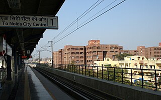
Mayur Vihar is an upmarket residential area on the periphery of Delhi, located in East Delhi, close to the city's Noida-Delhi border, situated just across the Yamuna River, and is divided into three distinct phases (sectors). As the name suggests, it has been the dwelling (vihar) of peacocks (mayur). Even today, the area has a closed sanctuary dedicated to the conservation of peacocks.

Saket is a residential colony and the administrative headquarters of the South Delhi district of Delhi in India. The neighborhood is named after the city of Ayodhya, also known as Saket, an ancient, religiously significant city in Uttar Pradesh.
Rajouri Garden is a market and residential neighbourhood in South-West Delhi, India. The Main Market and Nehru Market are the key markets of the area. The population is largely Punjabi who migrated to Delhi, following the Partition of India, from Pakistan in 1947. The postal code of Rajouri Garden is 110027.
Gulabi Bagh is one of the oldest and planned residential areas that lies north of central Delhi, India, adjacent to Ashok Vihar, Shakti Nagar, Kamla Nagar, Karol Bagh. Famous for its greenery and fresh air, it is often characterized by its famous (monkey) park that is adjacent to it.

Basanta Kumar Biswas was an Indian pro-independence activist involved in the Jugantar group who, in December 1912, played a role in the bombing of the Viceroy's parade in what came to be known as the Delhi-Lahore Conspiracy.

Chittaranjan Park is an upscale neighborhood in South East Delhi and home to a large Bengali community. It was established on a rocky terrain in the early 1960s under the name EPDP Colony and later renamed after the deshbandhu (patriot) Chittaranjan Das in the 1980s. Nowadays it is considered among the posh localities in South Delhi due to a rise in the market price of its plots. Despite its growing cosmopolitan nature, it remains home to a large Bengali community and is home to Kolkata-style street-food stalls, Bengali cuisine, fish markets, temples, and cultural centers. It hosts many festivities and cultural events. Durga Puja is the most celebrated festival here which boasts magnificent marquee.

East Delhi is an administrative district of Delhi in India. It is bounded by the Yamuna River on the west, North East Delhi to the north, Ghaziabad District of Uttar Pradesh state to the east, and Gautam Buddha Nagar District of Uttar Pradesh to the south. Administratively, the district is divided into three subdivisions: Gandhi Nagar, Preet Vihar, and Mayur Vihar.
The Civil Lines is a residential area and one of the 3 subdivisions of the Central Delhi district of Delhi in India. It is one of the 12 zones under the Municipal Corporation of Delhi. It was the hub of European-style hotels in the city until New Delhi came into being in 1911. The official residence of the Lieutenant Governor of Delhi is also located at Raj Niwas Marg, Civil Lines.
Sriniwaspuri is a small Colony located in the southern part of Delhi, India. It is the only place in Delhi where Emperor Ashoka’s Rock Edict was discovered. The in-situ Bahapur rock edict was discovered in Delhi is a minor edict that is in an engraved form on a small patch of rock exposure in Sriniwaspuri.
INA colony is a residential colony in South Delhi, New Delhi, India.
Laxmi Bai Nagar is a VIP residential colony in New Delhi, India. Laxmi Bai, meaning "city of Lakshmibai", is named for the Rani (queen) of the Maratha-ruled Jhansi State in India, which is now a province of modern Uttar Pradesh state. She fought for independence from the British Raj during the Indian Rebellion of 1857 and died in combat.

Moti Bagh, a residential locality in South Delhi, was developed in 1950s to house Government employees. This locality, with many trees and parks, is divided into South Moti Bagh and North Moti Bagh.
Sarita Vihar is a residential colony situated in South East Delhi, National Capital Territory of Delhi, India. It is near the Kalindi Kunj- Noida Toll bridge or GD Birla Marg-Road 13A which connects the district to Noida.The area is situated close to Uttar pradesh border. It is believed that the site was primarily chosen as the construction site for the Games Village of the 1982 Asian Games, however on the insistence of the late Prime Minister Rajiv Gandhi, the plan was changed to convert it into an upscale residential housing locality. In 2013, it was awarded the "Greenest Colony in Delhi" tag by the then Chief Minister of Delhi Sheila Dikshit, credited to the efforts of its RWA members who have aggressively worked towards improving the state of parks and green spots in the locality.
Saibaba colony is an area located in Coimbatore, India. The Saibaba Temple is located there, and the name of the area is derived from the temple. The locality is mostly occupied by upper-middle-class people living in Coimbatore. One side is bordered by Thadagam road and the other side by Mettupalayam Road. NSR road in Sai Baba colony is fully occupied by commercial centers.
Nowgong is a city of Chhatarpur district of Madhya Pradesh. The town had a population of 11,507 in 1952. Vindhya Pradesh was merged into Madhya Pradesh on 1 November 1956. Nowgaon was declared capital of Madhya Pradesh, but after six months Bhopal became the capital of Madhya Pradesh.
Ashok Vihar is a neighbourhood in the North West Delhi district of Delhi, India. Situated along the Ring Road, Delhi, it is divided into four phases.
JJ Colony is a resettlement colony on the Gram Sabha Land of Madanpur Khadar Village in the south-eastern region of Delhi. It is located in close proximity to Sarita Vihar and Kalindi Kunj, about 1 kilometers from the Uttar Pradesh border. It was created in 2004 when the slum dwellers from across Delhi were forcefully evicted and relocated to the urban peripheries. Since its formation, the community has undergone massive structural, political, economic, and social changes affecting the lives of the community. The transformation of JJ Colony in Khadar is underscored by several challenges ranging from the provision of basic amenities, mobility, and the condition of women's safety. From then to now JJ colony in khadar has changed much from the lanes of agriculture canal to road channels has come far bit.

Madanpur Khadar is an urban village in South East district of Delhi. It is located on Delhi-UP Border and is named after Thakur Madan Singh Chauhan. The term Khadar is attached to the village’s name because it is situated on the banks of Yamuna river. It was declared as an urban village by the administrative authorities under Delhi Metropolitan Council in 1966.


