
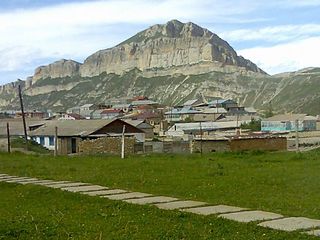
Agulsky District is an administrative and municipal district (raion), one of the forty-one in the Republic of Dagestan, Russia. It is located in the south of the republic. The area of the district is 793.5 square kilometers (306.4 sq mi). Its administrative center is the rural locality of Tpig. As of the 2010 Census, the total population of the district was 11,204, with the population of Tpig accounting for 24.4% of that number.
Akushinsky District is an administrative and municipal district (raion), one of the forty-one in the Republic of Dagestan, Russia. It is located in the southern central part of the republic. The area of the district is 622.8 square kilometers (240.5 sq mi). Its administrative center is the rural locality of Akusha. As of the 2010 Census, the total population of the district was 52,558, with the population of Akusha accounting for 8.8% of that number.

Babayurtovsky District is an administrative and municipal district (raion), one of the forty-one in the Republic of Dagestan, Russia. It is located in the northern central part of the republic. The area of the district is 3,262.3 square kilometers (1,259.6 sq mi). Its administrative center is the rural locality of Babayurt. As of the 2010 Census, the total population of the district was 45,701, with the population of Babayurt accounting for 33.3% of that number.

Botlikhsky District is an administrative and municipal district (raion), one of the forty-one in the Republic of Dagestan, Russia. It is located in the west of the republic. The area of the district is 500 square kilometers (190 sq mi). Its administrative center is the rural locality of Botlikh. As of the 2010 Census, the total population of the district was 54,322, with the population of Botlikh accounting for 22.4% of that number.

Dakhadayevsky District is an administrative and municipal district (raion), one of the forty-one in the Republic of Dagestan, Russia. It is located in the southern central part of the republic. The area of the district is 1,450 square kilometers (560 sq mi). Its administrative center is the rural locality of Urkarakh. As of the 2010 Census, the total population of the district was 36,709, with the population of Urkarakh accounting for 12.0% of that number.
Kayakentsky District is an administrative and municipal district (raion), one of the forty-one in the Republic of Dagestan, Russia. It is located in the east of the republic. The area of the district is 640 square kilometers (250 sq mi). Its administrative center is the rural locality of Novokayakent. As of the 2010 Census, the total population of the district was 54,089, with the population of Novokayakent accounting for 9.5% of that number.

Kaytagsky District is an administrative and municipal district (raion), one of the forty-one in the Republic of Dagestan, Russia. It is located in the southeast of the republic. The area of the district is 678.24 square kilometers (261.87 sq mi). Its administrative center is the rural locality of Madzhalis. As of the 2010 Census, the total population of the district was 31,368, with the population of Madzhalis accounting for 21.7% of that number.
Kizlyarsky District is an administrative and municipal district (raion), one of the forty-one in the Republic of Dagestan, Russia. It is located in the north of the republic. The area of the district is 3,047 kilometers (1,893 mi). Its administrative center is the town of Kizlyar. As of the 2010 Census, the total population of the district was 67,287.

Kulinsky District is an administrative and municipal district (raion), one of the forty-one in the Republic of Dagestan, Russia. It is located in the south of the republic. The area of the district is 649 square kilometers (251 sq mi). Its administrative center is the rural locality of Vachi. As of the 2010 Census, the total population of the district was 11,174, with the population of Vachi accounting for 7.3% of that number.

Kurakhsky District is an administrative and municipal district (raion), one of the forty-one in the Republic of Dagestan, Russia. It is located in the south of the republic. The area of the district is 740 square kilometers (290 sq mi). Its administrative center is the rural locality of Kurakh. As of the 2010 Census, the total population of the district was 15,434, with the population of Kurakh accounting for 21.0% of that number.

Laksky District is an administrative and municipal district (raion), one of the forty-one in the Republic of Dagestan, Russia. It is located in the southern central part of the republic. The area of the district is 750 square kilometers (290 sq mi). Its administrative center is the rural locality of Kumukh. As of the 2010 Census, the total population of the district was 12,161, with the population of Kumukh accounting for 15.9% of that number.

Rutulsky District is an administrative and municipal district (raion), one of the forty-one in the Republic of Dagestan, Russia. It is located in the south of the republic. The area of the district is 2,170 square kilometers (840 sq mi). Its administrative center is the rural locality of Rutul. As of the 2010 Census, the total population of the district was 22,926, with the population of Rutul accounting for 18.0% of that number.

Shamilsky District is an administrative and municipal district (raion), one of the forty-one in the Republic of Dagestan, Russia. It is located in the western central part of the republic. The area of the district is 920 square kilometers (360 sq mi). Its administrative center is the rural locality of Khebda. As of the 2010 Census, the total population of the district was 28,122, with the population of Khebda accounting for 9.1% of that number.
Tabasaransky District is an administrative and municipal district (raion), one of the forty-one in the Republic of Dagestan, Russia. It is located in the southeast of the republic. The area of the district is 801 square kilometers (309 sq mi). Its administrative center is the rural locality of Khuchni. As of the 2010 Census, the total population of the district was 52,886, with the population of Khuchni accounting for 6.1% of that number.
Tsumadinsky District is an administrative and municipal district (raion), one of the forty-one in the Republic of Dagestan, Russia. It is located in the west of the republic. The area of the district is 1,100 square kilometers (420 sq mi). Its administrative center is the rural locality of Agvali. As of the 2010 Census, the total population of the district was 23,345, with the population of Agvali accounting for 10.5% of that number.

Untsukulsky District is an administrative and municipal district (raion), one of the forty-one in the Republic of Dagestan, Russia. It is located in the center of the republic. The area of the district is 560 square kilometers (220 sq mi). Its administrative center is the rural locality of Untsukul. As of the 2010 Census, the total population of the district was 29,547, with the population of Untsukul accounting for 21.2% of that number.
Belidzhi is an urban locality in Derbentsky District of the Republic of Dagestan, Russia. As of the 2010 Census, its population was 12,236.

Mamedkala is an urban locality in Derbentsky District of the Republic of Dagestan, Russia. As of the 2010 Census, its population was 11,029.
Achi-Su, also known as Achisu (Ачису), is an urban locality in Karabudakhkentsky District of the Republic of Dagestan, Russia. As of the 2010 Census, its population was 1,679.
Dubki is an urban locality in Kazbekovsky District of the Republic of Dagestan, Russia. As of the 2010 Census, its population was 5,202.


